This geocache is one of twenty Historical Geo-Passport geocaches within the South Nation Jurisdiction. For more information on this series of geocaches, please visit South_Nation. Parking is available at the posted parking coordinates. Follow the scenic trail until you get to the reference point, and then walk along the water’s edge to approach the posted coordinates.
Près du cours supérieur de la rivière Nation Sud se trouve le canal Galop, le prédécesseur historique à la Voie maritime du Saint-Laurent.
Ouvert en 1846, le canal Galop s’étend sur 12 kilomètres à partir d’Iroquois jusqu’à Cardinal. Il permettait aux navires de contourner une série de rapides dans les environs de la Pointe aux Iroquois, Cardinal et l'Île Galop.
De nouvelles écluses ont été construites le long du canal en 1897 et l'écluse de Cardinal (écluse 26) mesurait 60 mètres de longueur. Les autres parties du canal sont devenues à cette époque les plus longues écluses du Canada, atteignant près de 243 mètres.
L'utilisation du canal Galop changea dans les années 1950 lorsque la construction de la Voie maritime du Saint-Laurent débuta. La nature de la vie le long des rives du Saint-Laurent a commencé à changer et de plus récentes et de plus grandes écluses ont été construites afin d’expédier d’importantes quantités de marchandises en provenance des Grands Lacs.
En outre, de nouvelles centrales hydroélectriques ont été construites et ont finalement abouti à la submersion de 10 villages le long de la rivière et à la relocalisation d'autres villages. Le canal est aussi le lieu de repos final de l'épave du Conestoga.
********************
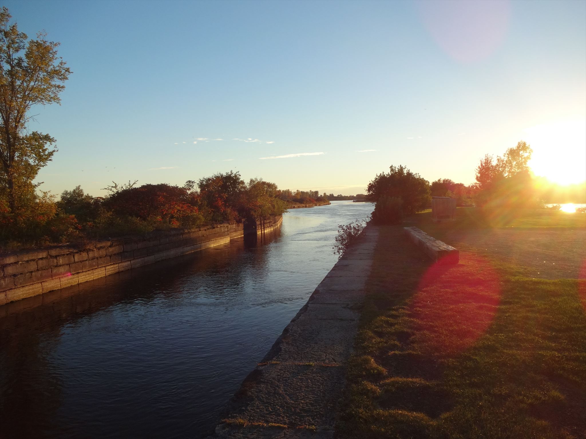
Near the headwaters of the South Nation River, is the historic predecessor to the St Lawrence Seaway, the Galop Canal. Opened in 1846, the Galop Canal ran 12 kilometres from Iroquois to Cardinal. The canal allowed ships to bypass three sets of rapids located in Point Iroquois, Cardinal and Galop Island. New locks were built along the canal in 1897. Lock 26 was located at Cardinal and was 60 metres in length. However, other parts of the canal reached almost 243 metres in length and were the longest locks in Canada at the time.
Usage of the Galop Canal shifted when in the 1950s, the construction of the St. Lawrence Seaway began and with it changed the nature of life on the banks of the St. Lawrence all together. Newer, larger locks were built which ensured larger amounts of cargo could be shipped to and from the Great Lakes. In addition to these new locks, new hydroelectric power stations were constructed and ultimately led to the flooding of 10 villages along the river and the relocation of others.
The canal is the final resting place of the Conestoga and the location of another geocache GC2CXQN- Diver Down: The Wreck of the Conestoga which highlights some of the history of the canal.