St Jean de Chevelu et ses lacs !!!
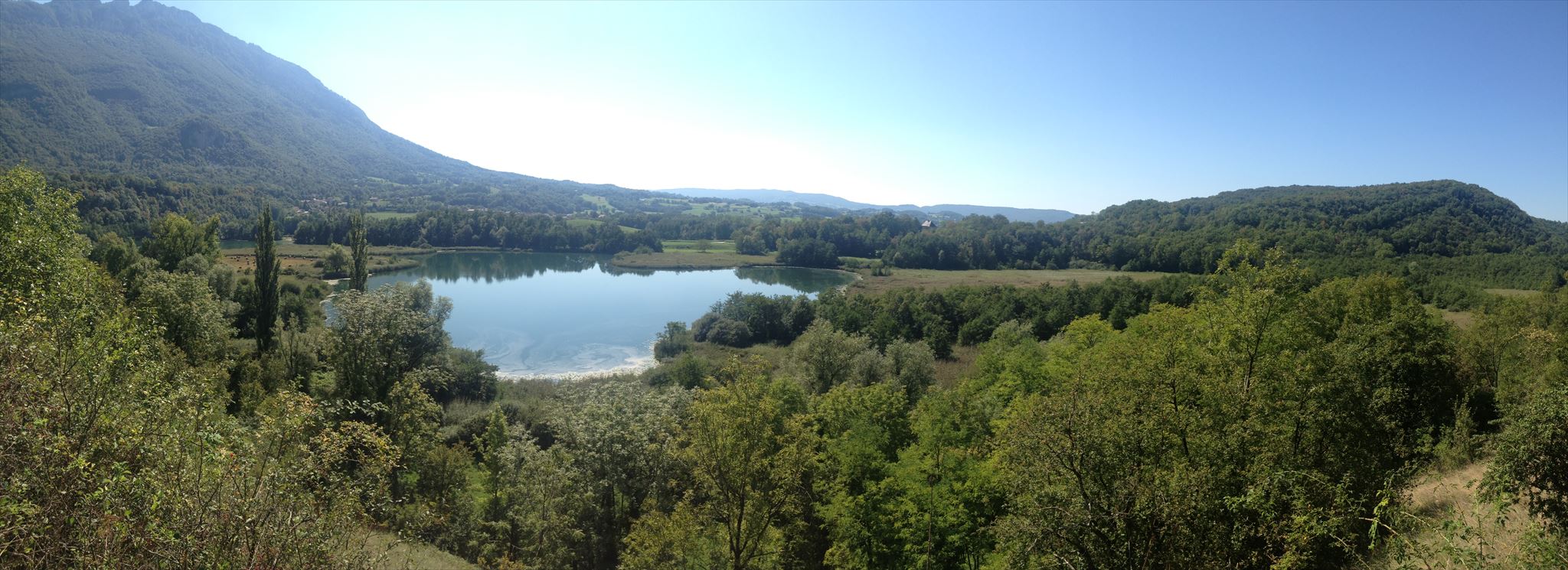
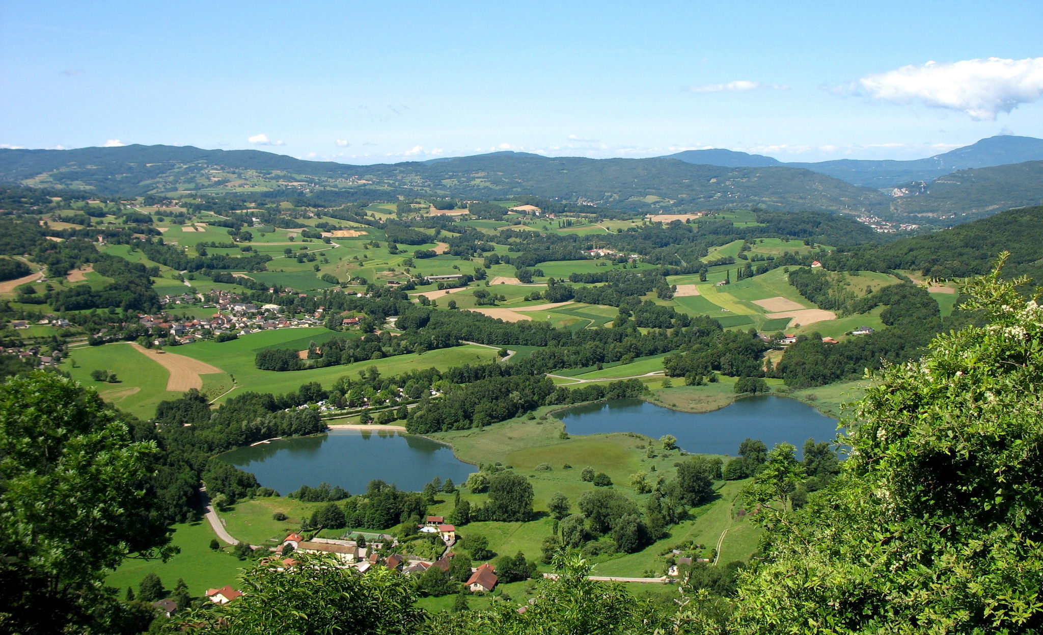
 Les lacs et marais de st jean de chevelu
D’origine glaciaire, ces lacs sont nés de l’affaissement d’une partie de la montagne de la Dent du Chat, survenu après le retrait des derniers glaciers.
D’abord unique, la cuvette s’est peu à peu comblée donnant naissance à deux petits lacs. Leur profondeur n’excède pas aujourd’hui 8 m.
Le marais qui les entoure possède une forte valeur patrimoniale.
Depuis 1990, les lacs et marais sont protégés par un arrêté préfectoral. Certaines activités humaines, pouvant porter atteinte à l’équilibre du milieu y sont interdites. Les marais font l’objet d’une gestion confiée au Conservatoire du Patrimoine Naturel de la Savoie.
Pour valider cette earth cache :
Rendez-vous aux coordonnées de la cache où vous trouverez un panneau explicatif.
"Loguez cette cache "Found it" et envoyez-moi vos propositions de réponses soit via mon profil, soit via la messagerie geocaching (Message Center), et je vous contacterai en cas de problème."
1: De quoi est constitué le fond de la cuvette ?
2: Par quoi sont délimités ces lacs ?
3: Comment se forme la tourbe ?
4: Quelle est l'altitude des lacs ?
5: Sur l'image du panneau, a quoi correspond le n°18 ?
6: Une photo des lacs depuis le panneau.(Facultatif)
 The lakes and marshes of st jean de chevelu
Of glacial origin, these lakes were born from the collapse of part of the mountain of the Dent du Chat, occurred after the last glacial retreat.
On the first one, the bowl was filled gradually giving rise to two small lakes. Their depth does not exceed 8 m today.
The marshes around them has a strong heritage value.
Since 1990, lakes and marshes are protected by prefectural decree. Some human activities, which would impair the middle of balance are prohibited. The marshes are the subject of a management entrusted to the Natural Heritage Conservatory of Savoy.
To validate this earth cache:
Go to the cache coordinates, where you will find an explanatory panel.
" Found it "and send me your answers proposals or via my profile or via email geocaching (Message Center), and I will contact you in case of problems."
1: What constitutes the bottom of the bowl?
2: What are delimited by these lakes?
3: How to form peat?
4: What is the altitude lakes?
5: On the image of the panel, has What does the No. 18?
6: A photo of the lakes from the panel (Optional).