 |
 |
 |
| This EarthCache intends to show a geological curiosity that in Portugal is given the name of Pias. These can be found in the Holy Hill next to the Castle of Guimarães, due to this location the local legends and myths refer that they were caused by the cannon balls that were fired at the castle. |
|
Esta Earthcache pretende dar a conhecer umas curiosidades geológicas a que em Portugal é dado o nome de Pias. Estas podem ser encontradas na Colina Sagrada junto ao Castelo de Guimarães, devido a esta localização as lendas e mitos locais referem que as mesmas foram provocadas pelas bolas e canhão que eram disparadas contra o castelo. |
| |
|
|
| Guimarães Castle |
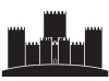 |
Castelo de Guimarães |
|
The Castle of Guimarães was built under the orders of Mumadona Dias in the 10th century. It's an emblematic castle associated with the origins of the Portuguese nation.
The Castle is a military fortification grounded primarily in the late Romanesque period, and elaborated during the early Gothic epoch of Portuguese architecture. Its area is delineated by walls forming a pentagram, similar to a shield, that includes eight rectangular towers, military square and central keep. Originating in the foundations of a Roman structure, it was later elaborated on the French model, in its current the form of a shield, with reduced central yard and difficult accesses. It includes several Gothic characteristics, owing to its remodelling at the end of the 13th century, when the keep and residences were constructed (possibly over pre-existing structures).
The Castle and the Holy Hill are part of the historic center of Guimarães that is listed as UNESCO World Heritage Site since 2001.
|
|
O Castelo de Guimarães foi construído sob as ordens de Mumadona Dias no século X. É um castelo emblemático associado às origens da nação portuguesa.
O castelo é uma fortificação militar fundamentada principalmente no período românico tardio, e elaborado durante oinício da época gótica da arquitetura portuguesa. A sua área é delineada por paredes formando um pentagrama, semelhante a um escudo, que inclui oito torres retangulares, praça militar torre central. Originando-se nos alicerces de uma estrutura romana, foi posteriormente elaborado sobre o modelo francês, na sua actual forma de escudo, com pátio central reduzido e acessos difíceis. Ele inclui várias características góticas, devido à sua remodelação no final do século XIII, aquando da construção de residências que foram construídas possivelmente sobre estruturas pré-existentes.
O Castelo e a Colina Sagrada são parte do centro histórico de Guimarães que è Património Mundial da UNESCO desde 2001. |
| |
|
|
| |
|
|
| The geology of the Municipality of Guimarães |
 |
A geológia do Município de Guimarães
|
|
The Guimarães municipality integrates, in geological terms, the large structural unit called the Hesperian Massif, which is the oldest structural unit of the Iberian Peninsula and where the oldest rocks of this geographical surface can be found (granite, schists, quartzites and rocks various metamorphic).
Regarding the geological nature, Guimarães municipality is essentially occupied by granitic rocks, with small outcrops of schist rocks in northwest and southeast of the municipality; along the Ave, Vizela and Selho Rivers are found recent surface deposits made by fluvial gravels and clays.
|
|
O concelho de Guimarães integra-se, em termos geológicos, na grande unidade estrutural designada de Maciço Hespérico, que representa a mais velha unidade estrutural da Península Ibérica e onde se encontram as rochas mais antigas desta superfície geográfica (granitos, xistos, quartzitos e rochas metamórficas diversas).
Quanto à natureza geológica, o concelho de Guimarães é essencialmente ocupado por rochas graníticas, com pequenos afloramentos de rochas xistentas a noroeste e sudeste do concelho; ao longo dos Rios Ave, Vizela e Selho encontram-se depósitos superficiais recentes constituídos por cascalhos fluviais e por argilas pouco espessas.
|
| |
|
|
| Gnammas |
|
Pias |
|
The Gnammas (in Portuguese these are called pias) are dug depressions in the bedrock. In usually have a circular, oval or elliptical shape. These are forms in which there is temporal water retention that usually disappears by evaporation.
Water is the main responsible for the initial formation and development of the Gnammas. It is sometimes visible the association between the Gnammas and the cracks in the rock, areas where the rock breakdown is naturally more propitious. Other times it is difficult to explain why the Gnammas are in a given location. The frequent presence of inhomogeneities in the rock, for example, irregular distribution or concentration of more susceptible minerals to change, such as biotite and feldspar in the case of granites, leads to the existence of areas where weathering is preferred and where it can form depressions which later evolve into Gnammas.
|
|
As pias são depressões escavadas no substrato rochoso. Em planta têm uma forma normalmente circular, oval ou elíptica. São formas onde há retenção temporal de água que habitualmente desaparece por evaporação.
A água é o principal responsável pela formação inicial e desenvolvimento das pias. Por vezes é visível a associação entre as pias e as fracturas ou fissuras na rocha, zonas onde a desagregação da rocha é naturalmente mais propícia. Outras vezes é difícil explicar porque razão as pias se encontram em determinado local. A frequente existência de heterogeneidades na rocha, por exemplo, a distribuição irregular ou concentração de minerais mais susceptíveis à alteração, como biotite e feldspatos no caso das rochas graníticas, leva à existência de zonas onde a meteorização é preferencial e onde se podem formar concavidades que evoluem posteriormente para pias.
|
| |
|
|
| The EarthCache |
 |
A EarthCache |
|
In order to make the Found of this Erathcache you have to visit the rock outcrop on the coordinates of the cache and we send us an e-mail via our profile with the following:
- By what rock is formed the rock outcrop where are the Gnammas?
- We can see more or less than ten (10) Gnammas in this rock outcrop?
Identifie which is the largest Gnamma and tells us:
- What is its diameter?
- What is its depth?
- Its shape is circular or oval?
Photos in the log are always welcome, but please do not post photos that show the answers of the Earthache!
DO NOT PLACE PHOTOS OF ROCKY WHERE PIAS ARE FOUND.
After sending the answers by e-mail you can log the Earthcache. If there is any doubt regarding the answers you will be contacted to clarify it.
|
|
Para poder fazer o Found desta Eearthcache terá de visitar o afloramento rochoso nas coordenadas da cache e de mos enviar um mail através do nosso perfil com o seguinte:
- Por que rocha é formado o afloramento rochoso onde se encontram as Pias?
- Podes observar mais ou menos de dez (10) Pias neste afloramento rochoso?
Identifica qual é a maior Pia e diz-nos:
- Qual o seu diâmetro?
- Qual a sua profundidade?
- A sua forma é circular ou oval?
Fotos no log serão sempre bem vindas, mas por favor não coloquem fotos que revelem as respostas da Earthcache!
NÃO COLOQUE FOTOS DO AFLORAMENTO ROCHOSO ONDE SE ENCONTRAM AS PIAS.
Depois de enviar as respostas pode fazer o log, caso exita alguma duvida em relação ás respostas dadas serão contactados para a esclarecer.
|
| |