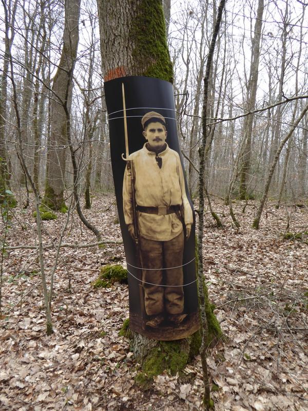
En 1915, il faut entraîner les recrues des régiments basés à la Caserne Maurice de Saxe à Blois (le 113ème RI d'active et le 313 de réserve) avant de les envoyer combattre au front. Après les hécatombes du début de la guerre, celle-ci s'était rapidement transformée fin 1914 en une guerre de position basée sur l'utilisation de systèmes de tranchées pour protéger les soldats du feu ennemi et stabiliser le front. Il fallu apprendre à construire et utiliser ces tranchées. Dans la forêt de Blois, l'aménagement d'un terrain de manœuvre dans une zone en bordure ouest de la forêt, les Sablonnières, fut négocié avec les Eaux et Forêts. C'est tout un système comportant les lignes de front, les deuxièmes lignes, les tranchées de liaison, les zones de repos, les postes de mitrailleuses et même les latrines qui est créé dans une zone où on l'extrayait auparavant du sable. La guerre est plus longue et plus dure que prévu et le camp sert de longues années avant de tomber dans l'oubli.
|
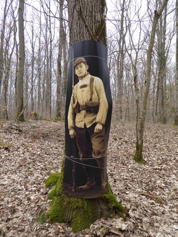
Un peu avant la fin du XXème siècle, Alain Gauthier, géomètre amateur de promenades en forêt, redécouvre le site (en retrouvant notamment une ancienne baïonnette), en relève la topographie en suivant des tranchées en partie comblées par l'humus et les feuilles et en fait l'interprétation basée sur des recherches d'archives. Il milite aussi activement pour sa conservation, ce lieu étant l'un des rares sites de ce type encore présents en Europe. Son action aboutit en janvier 2015 à l'installation d'un panneau explicatif en limite de parcelle 110, inauguré à l'occasion des commémorations de la Première Guerre Mondiale. Plus de 100 ans après, les visiteurs peuvent donc maintenant arpenter le site en en comprenant mieux son utilisation passée.
|
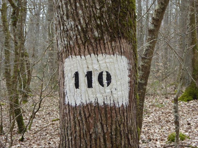
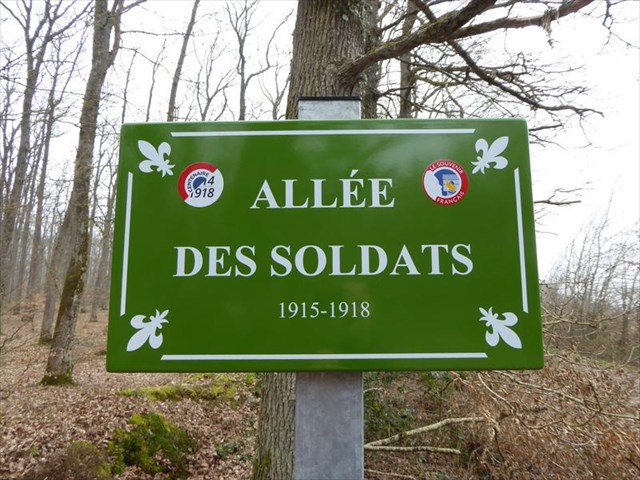
Le début recommandé pour la visite est au carrefour entre l'allée de la Loire, l'allée d'Anne de Bretagne et l'allé des Soldats, carrefour baptisé Henri Perthuisot du nom du garde forestier responsable de ce coin de forêt en 1915 et dont les carnets de terrain ont aidé à la redécouverte du site. Il est conseiller de ne pas descendre dans les tranchées pour limiter leur érosion et de les traverser aux passages indiqués sur le plan du panneau d'information.
Voici les indices à relever
- Au point 1 trouver la plaque du carrefour et noter A le dernier chiffre de la date de prise de poste de garde de triage.
- Lire le panneau explicatif et noter B le numéro correspondant au poste avancé dans le no man's land
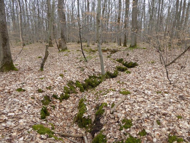
- Aller au point 2 et estimer la profondeur résiduelle de la tranchée. Si elle est inférieure à 50 cm, prendre C=0 , si elle est comprise entre 50 cm et 120 cm prendre C=2, sinon prendre C=5
- Aller au point 3, il y a un petit "îlot" de forme géométrique entouré de tranchées, soit D son nombre de cotés
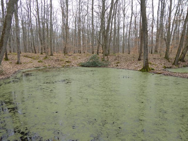
- Aller au point 4, sur une petite presqu'île au milieu des étangs d'une ancienne sablonnière, soit E le nombre de chênes sur cette petite zone.
La cache est située au point N 47 3D.E(B-C-D)(E-A) E 001 1A.(B/2)CD |
Source : Site de la Vallée de la Cisse
|
Following the trenches in the forest
In 1915, the new soldiers in the regiments based in the "Maurice de Saxe" casern in Blois need to train before being sent to the battle front. After the heavy casualties of the first months of the war, the strategy evolved to a position war based on the heavy usage of trenches to protect the troops and stabilize the front line. The soldiers needed to learn how to build and to use this trenches system. In the forest of Blois, the use of a portion of land is negociated between the Army and the Waters and Forests administration, in the Sablonières area, where sand was once excavated. A complete system including the no man's land, the first front line, the second line, the connecting trenches, the rest area and even the toilettes is set up. As the war continue longer than expected, the camp is used for several years by numerous trainees before being abandoned and forgotten.
|
At the end of the century, Alain Gauthier, fond of walks in the forest, discovered the area, including a lost bayonet : he made topographic measurements of the area, draw a map of all the trenches half filled with humus and leaves and found historical archives related to the site. He actively promoted this site, as one of the few last training areas of that kind still existing in Europe. Finaly, in January 2015, as part of the commemoration of the First World World , an information panel was inaugurated to explain the different parts of the area. More than 100 years later, visitors can now discover where men were taught to fight, hopefully raising their chances to survive the deadly assaults in the trenches.
|
The visit preferably begins at the crossroad between the Loire alley, the Anne de Bretagne alley and the Soldiers alley, named Henri Perthuisot from the forest guard that was in charge when the training zone was set up. Please refrain from going inside the trenches to avoid accelerating the erosion and cross then at the spots designated on the map on the information panel.
Information to gather:
- At waypoint 1, find the crossroad name plate and note A the last figure of the date when the guard began its mission in Blois
- Read the information panel and note B the number related to the advanced post in the no man's land
- Go at waypoint 2 and estimate the depth of the trench closer to the small coalmen hut. If it's below 50 cm, then C=0, if it's between 50 cm and 120 cm, C=2 else C=5
- Go at waypoint 3, there is a smal "islet" surrounded by trenches. Let D be the number of sides of its geometrical shape.
- Go at waypoint 4, on a small "peninsula" in the middle of the ponds remaining from the extraction of sand. Let E be the number of oaks on the area almost surrounded by water or mud.
The cache is located at N 47 3D.E(B-C-D)(E-A) E 001 1A.(B/2)CD |
Source : Site on the Cisse valley
|
|
|
|