Two major faults, which are lines of ancient earthquakes, are a feature of the geology of the island, namely the northern escarpment, which runs between Kirk Michael and Ramsey, and the Central Valley, connecting Douglas and Peel, which separates the northern uplands from the southern uplands. This basement fracture, known in geological terms as the Central Valley Lineament, also extends offshore to the south east and north west of the island.
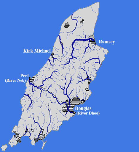
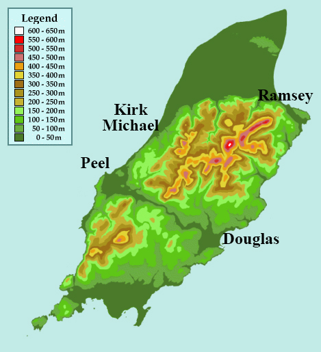
The map of rivers on the Isle of Man shows that most begin on comparatively high ground and have formed valleys, through erosion, as they flowed towards lower ground and ultimately the sea. However, the Central Valley is different in that it runs from coast to coast with very little elevation change. This is because it existed as an ancient fault, now thought to be inactive, before glaciers and the Dhoo and Neb rivers and their tributaries exploited this line of weakness to form the present valley.
The Central Valley is less than 50 metres above sea level along its entire length. Who knows, if geological history had been only a little different, we might ultimately have had the "Isles of Man" rather than the "Isle of Man".
And of course the route of the valley has been exploited in more recent times by the construction of rail and road links between the two towns of Douglas and Peel. More recently still, it has been exploited by geocachers setting the Heritage Power Trail.
The co-ordinates for this cache are at a point along the Heritage Trail where water flows down the hillside from the south and under the trail. The area is something of a watershed for the two rivers, being a flat, boggy area with dense vegetation known locally as curragh, although the rivers are also fed by tributaries from the surrounding hills. We recommend that you take a look at waypoints 1 and 2, where there are turning spaces and room for one or two cars, before answering question 3 at the cache co-ordinates.
To claim a 'find' for this Earthcache you must answer the following questions and send your answers in a message to the owner using the link at the top of the page. You can log your find as soon as you have sent your answers to the tasks. We will be in contact if there is a problem.
1. From waypoint 1, walk a short distance along the lane towards the main road. Look at the water which flows under the lane.
a) Describe the area it flows from and say in which direction it flows, east towards Douglas or west towards Peel.
b) What colour is the water? What could be a reason for this?
2. At waypoint 2 you will see a stream close to the lane. A little further down the lane towards the main road, the stream turns.
a) In which direction does it then flow, east towards Douglas or west towards Peel?
b) What colour is the water?
3. At the cache co-ordinates, in which direction do you think the stream will flow in order to join the sea and what are the reasons for your answer?