The Scenic Adventurer Challenge Mystery Cache
The Scenic Adventurer Challenge
-
Difficulty:
-

-
Terrain:
-

Size:  (small)
Please note Use of geocaching.com services is subject to the terms and conditions
in our disclaimer.
*This cache IS at the posted co-ordinates! But to get out here and claim a find, please read the rest of the cache description*
For a couple of years, I have been trying to get back out here again. How hard could could it be? 2WD access, 4km round trip. Should be easy right? WRONG! Excluding placing the cache and a bit of mucking around, we took about 3 hours to do about 2400m of walking. This does include some exploring and climbing (essential in such an interesting place). But as the scenic adventurer you would know these things!
The Scenic Adventurer Challenge
This challenge requires the Geocacher to find 40 caches with the Scenic view/location, difficult climbing and cliffs attributes.
The Rules:
1. Find at least 40 caches with the scenic view/location, difficult climbing and cliffs attributes on the one listing.
2. Caches can be traditional, multi, mystery, virtual, event, earthcache, wherigo, letterbox or webcam types.
3. Caches included must have a terrain of 4 OR HIGHER.
4. Caches may be found in any country, with no time frames or other snags that usually plague challenge caches.
5. When logging the find, please include your list either in your log, or attatched image. It would be nice if you included a brief story about the caches that you included, however, this is NOT a requirement.
*Please ensure that all the caches that you are using to qualify still meet the requirements on the day that you log the challenge (sometimes, the CO of the qualifying caches may change/update their cache atributes/terrain)*
I know that this will be no challenge to the cachers out there like MV who has probably found about 1000 caches which meet these requirements, but hey, not everyone has more than 13000 under their belt! For the average cacher, this will be an interesting enough. I have figured that many, (myself included at this stage) are close to the quota, however, need a few more finds with these qualities to qualify for the cache. The 4.5 terrain describes the challenge. The actual walk to GZ for this one is a 4, maybe pushing 4.5 when you realise how far it is to John Hunter or Royal North Shore from here...
Finding The Cache:
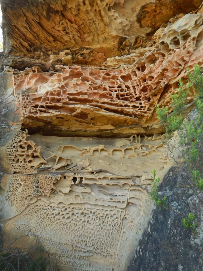
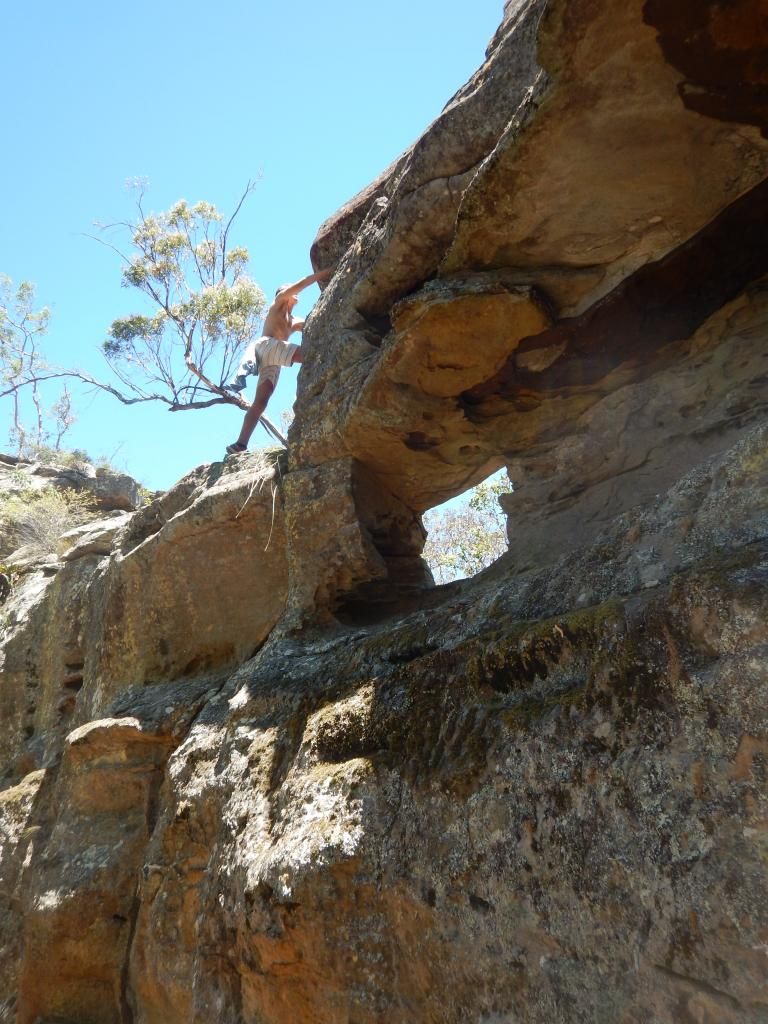
We had a great time getting out here! I spotted a rather interesting looking ridge on the topo map about 4-5 years ago, and on my third attempt, we got to walk on a hot 30-something degree day. The walk is very exposed, best done in winter, but for those nuts who enjoy the heat and the prospect of meeting some of the worlds most deadly snakes, please remember to take lots of water and a buddy. We drove almost to the trailhead coordinates (stopped by a fallen tree) in a RAV4. Realistically, in a 2WD, your walk may be about 500m longer each way along a fairly flat firetrail. From the trail head coordinates continue down to the cave. This has some of the more interesting sandstone honeycombing; a transition between the Watagan and Yengo sandstones:
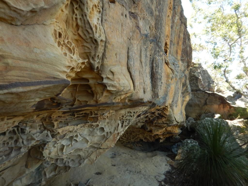
There is also some fascinating banding in the rock as seen below (someone should put an earthcache here!):
After a little tricky navigation around a small cliff which was too hard to climb down, you will begin to ascend again to get this sort of view:
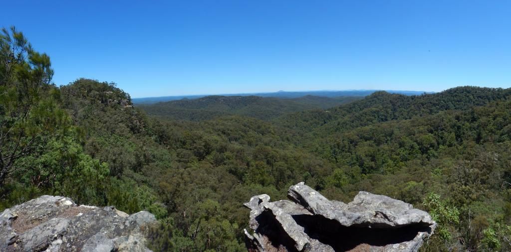
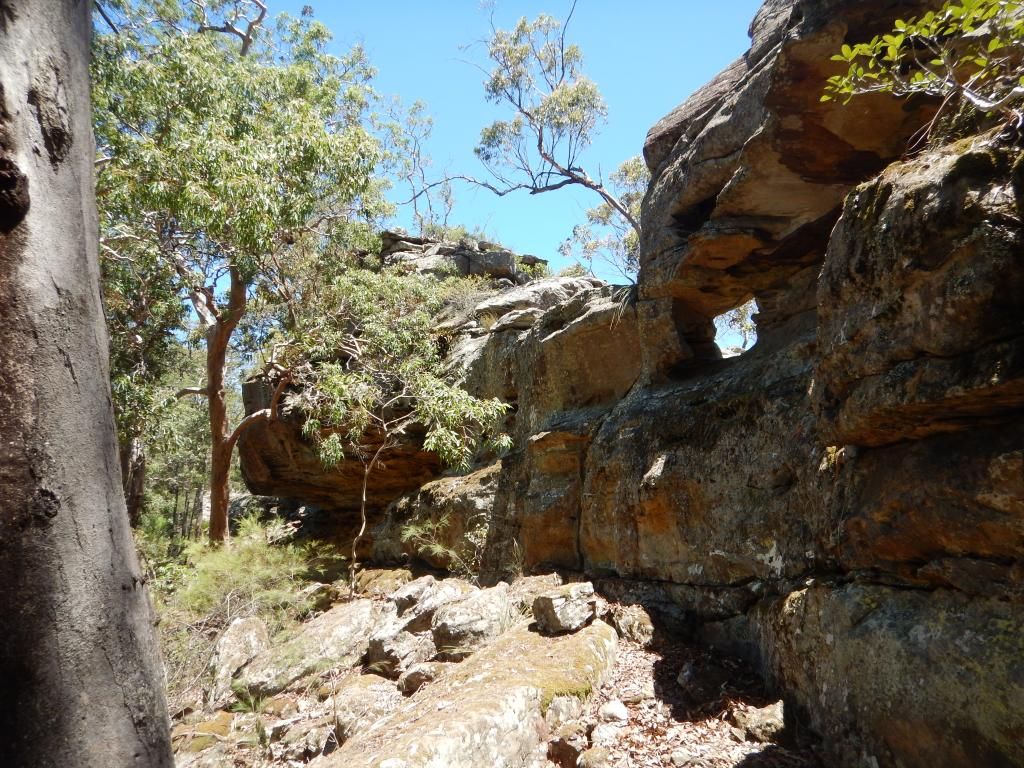
It is a little hard to see in the photo, but the small bump on the horizon is actually Mount Yengo (668m) an extict volcano. Moving on from here, it is important that you veer right at the next trackhead waypoint to avoid going onto the wrong spur. After some more ups, downs and views, a thin spine like ridge revealed some more intricate stuctures:
After a bit of climbing in and around the "air-conditioner" (the hole let through the cool breeze on such a hot day!):
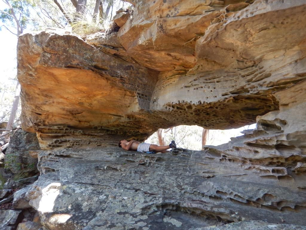
It's time for a well earned rest!:
From here, continue up the hill to the cache. The container is a 200ml sistema (sorry, I didn't have any amo tins or swaps in stock) hidden under a large rock, covered by some small ones at an excellent vantage point. If you have any questions or suggestions, please email me.
Additional Hints
(No hints available.)