Présentation / Presentation :
 Une petite promenade sur l’estran, à partir du centre de Sainte Marie sur Mer, et en direction de Pornic.
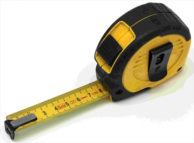
Attention, cette cache ne peut être réalisée qu’à marée basse. Matériel à emporter: mètre ruban.
 A stroll on the foreshore from the center of Sainte Marie sur Mer, and in the direction of Pornic.
Please note that this cache can only be done at low tide. What to bring: tape.
Rappel géologique / Geological reminder :
La tectonique étudie les déformations de la lithosphère. Les roches soumises à des contraintes fortes se déforment :
- soit de façon continue, on parle alors de déformation continue, en comportement ductile. On est alors dans le domaine de la tectonique souple : plis et plissements.
- soit de façon discontinue, on parle alors de déformation discontinue, en comportement cassant. On est alors dans le domaine de la tectonique cassante : failles.
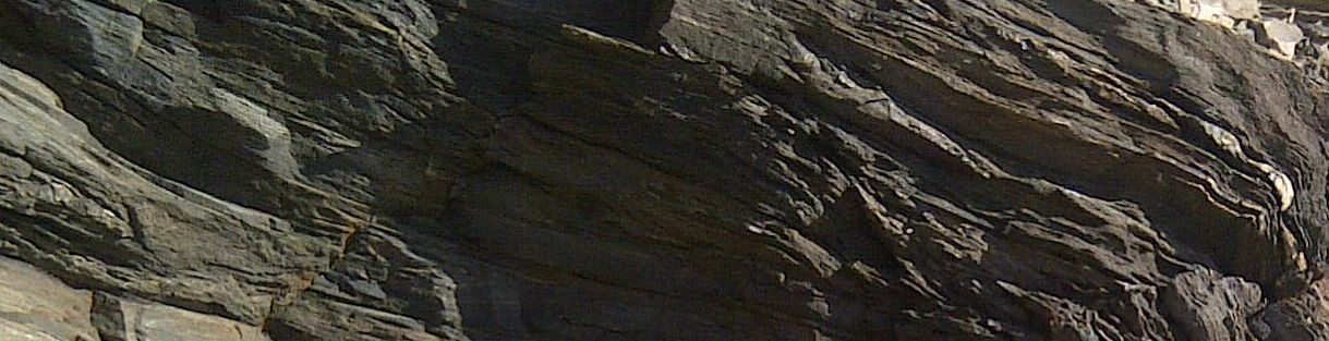
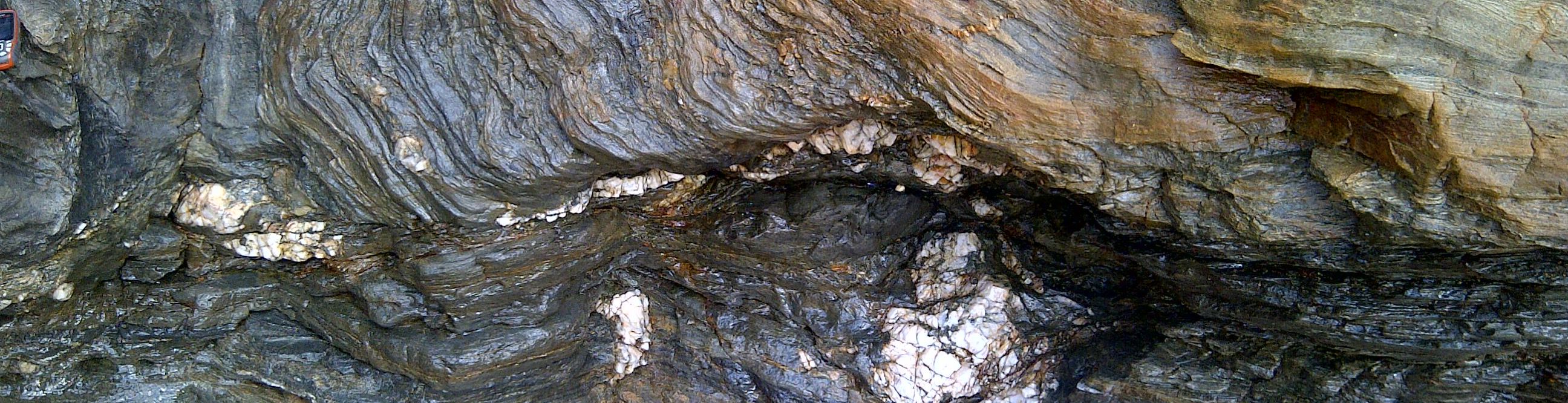
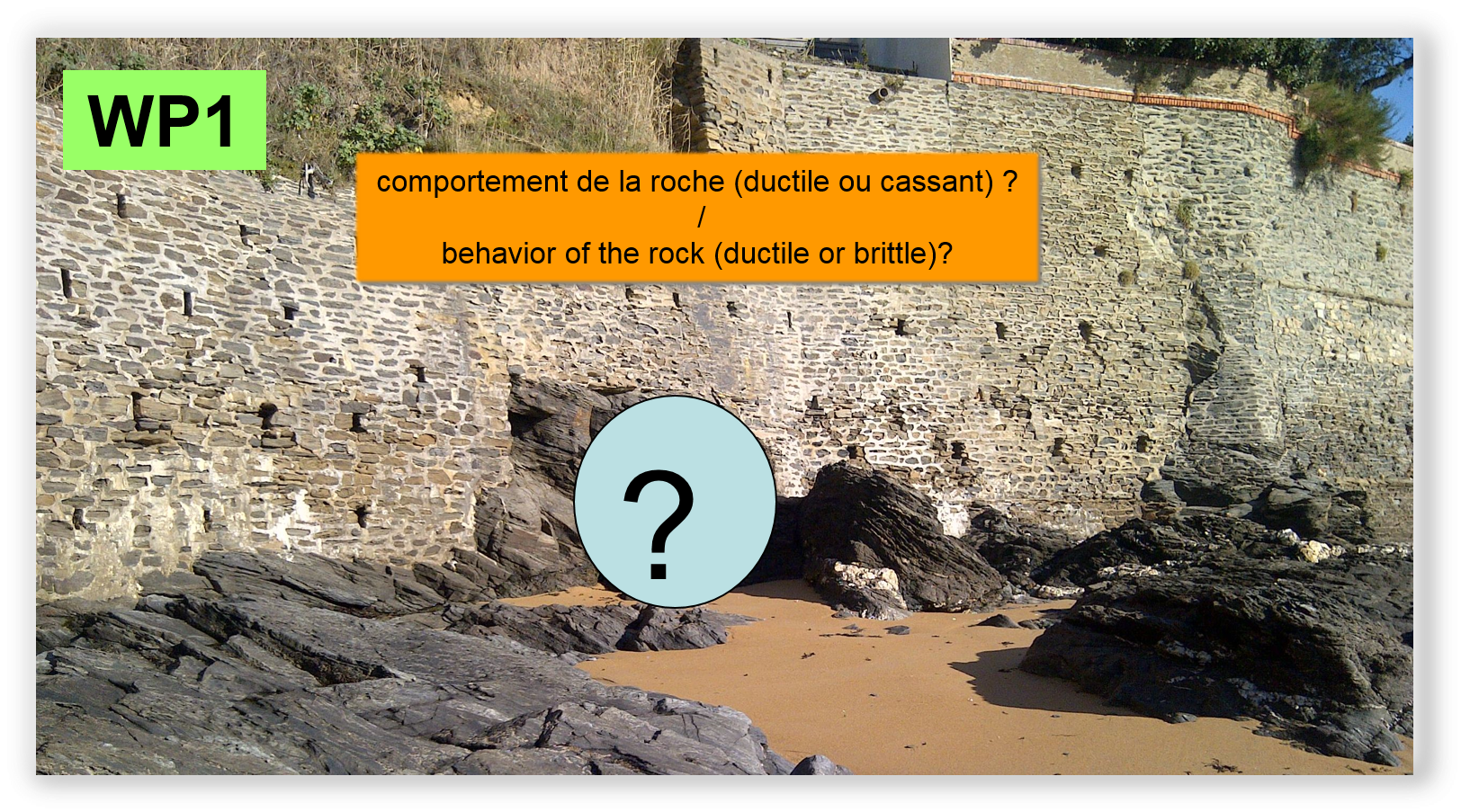
WP1 : sur cette affleurement, vous allez pouvoir observer une forme de déformation de la roche, à vous de reconnaître si celle-ci est continue, ou discontinue… en vous aidant du texte.
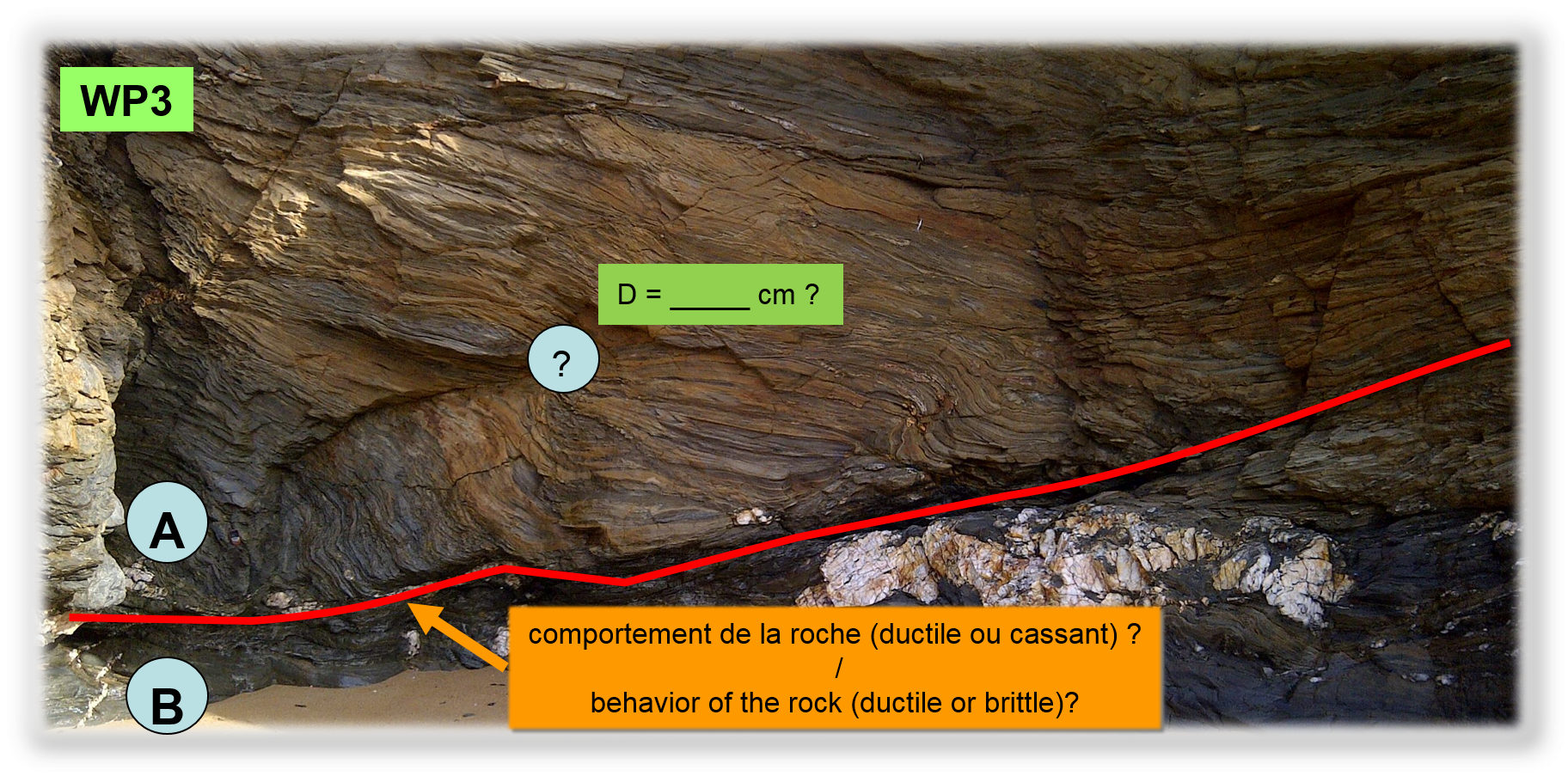
WP3 : sur cette affleurement, vous allez pouvoir observer une forme de déformation de la roche, à vous de reconnaître si celle-ci est continue, ou discontinue… en vous aidant du texte.
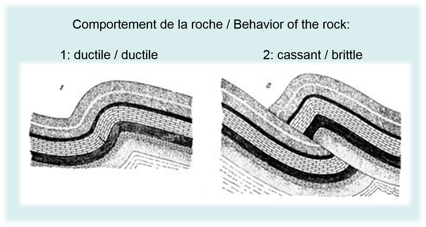
Tectonic deformation studies of the lithosphere. Rocks subjected to high stresses deform:
• either continuously, we speak of continuous deformation, ductile behavior. One is then in the field of flexible tectonics: creases and folds.
• or discontinuously, it is called discontinuous deformation, breaking behavior. One is then in the area of the frangible tectonics: faults.
WP1: this outcrop, you'll be able to observe a form of rock deformation, for you to recognize whether it is continuous or discontinuous ... in helping you text.
WP3: this outcrop, you'll be able to observe a form of rock deformation, for you to recognize whether it is continuous or discontinuous ... in helping you text.
Pour loguer cette cache / To log this cache :
Pour valider votre visite sur le site, envoyez-moi, en précisant bien le nom de l’earthcache, vos réponses par courrier électronique aux questions suivantes. Vous pouvez loguer "Found it", et je vous contacterai en cas de nécessité:
WP1: Q1: d’après les descriptions dans le texte, quel est selon vous le comportement de la roche (ductile ou cassant) ?
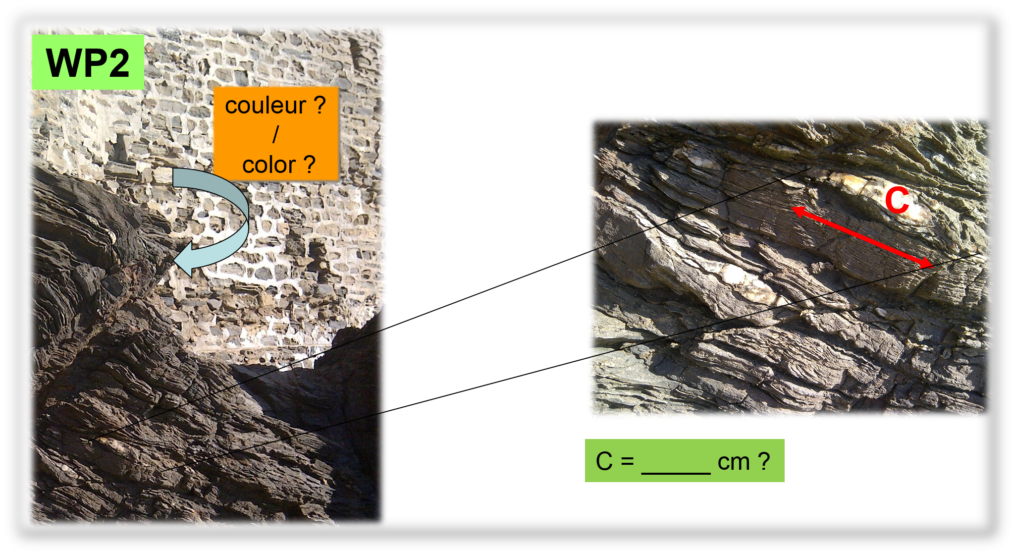
WP2 :Q2: quelle est la couleur de la roche au niveau de la flèche sur la photo ?
WP2: Q3: mesurer la valeur de C, en cm. C = ___ cm ?
WP3: Q4: d’après les descriptions dans le texte, quel est, selon vous, le comportement de la roche (ductile ou cassant) entre les blocs A et B ?
WP3: Q5: mesurer la taille C de l’œil de Quartz, en cm. Réponse : C = 12 à 15 cm.
Une photo du site, en noir et blanc, sera la bienvenue, bien que facultative.
To validate your visit to the site, email me, stating clearly the name of the earthcache your email responses to the following questions. You can log in "Found it," and I will contact you if necessary:
WP1: Q1: According to the descriptions in the text, what do you think the behavior of the rock (ductile or brittle)?
WP2: Q2: What is the color of the rock at the arrow on the photo?
WP2: Q3: measuring the value of C in cm. C = ___ cm?
WP3: Q5: According to the descriptions in the text, what do you think the behavior of the rock (ductile or brittle) between blocks A and B?
WP3: Q6: C measure the size of the eye of Quartz, in cm. Answer: C = 12 to 15 cm.
A photo of the site, black and white, will be welcome, but voluntary.
Sources / Sources :
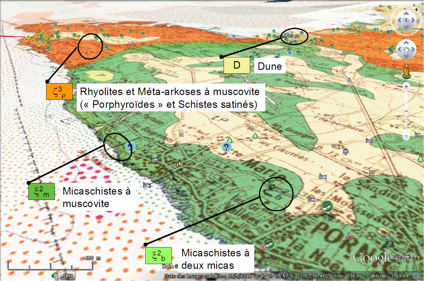
Documentation « papier » : Notice de la carte géologique de la France au 50000ème, feuille «Paimboeuf», XI-23, n°480, Notice de la carte géologique de la France au 50000ème, feuille «Ile de Noirmoutier - Pointe Saint Gildas», X-24-25, n°506-533, Dictionnaire de géologie Masson, Série des Guides géologiques régionaux Masson, Méthodes modernes de géologie de terrain - Tome 2a manuel d’analyse structurale - Editions Technip, The Mapping of Geological Structures - Ken McClay - Geological Society of London - Handbook Series, Principes de Tectonique - A.Nicolas - Masson, Initiation à la géologie - Mémento du géologue - Ch.Pomerol et A.Blondeau - Ed.Boubée.
Consultations sur Internet: http://infoterre.brgm.fr/ ; Google Earth ; Geowiki ; Wikipedia ; http://geophysics.ou.edu/geol1114, http://www.sandatlas.org/2011/11/ilmenite/
Rappel concernant les « Earthcaches »: Il n'y a pas de conteneur à rechercher ni de logbook à renseigner. Il suffit de se rendre sur les lieux, de répondre aux questions ci-dessus et de nous renvoyer les réponses.
Reminder on "Earthcaches" There is no container or logbook to find information. Simply visit the site, to answer questions above and send us the answers.
Vous aimez les earthcaches, mais alors, si ce n'est pas déjà fait, qu'attendez-vous pour vous inscrire ? C'est ici: http://coord.info/GC5HKV6
ou consulter le site dédié, c'est là: