Hawkesbury Heights #6 The end of the journey EarthCache
Hawkesbury Heights #6 The end of the journey
-
Difficulty:
-

-
Terrain:
-
Size:  (other)
Please note Use of geocaching.com services is subject to the terms and conditions
in our disclaimer.
This location is (almost) at the mouth of one the mighty rivers of the east coast of Australia. With one of the largest basins and catchment area of the state, it passes through many regions of varying weather patters, ecosystems and geology.
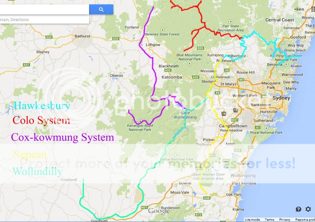
One of the more significant geological features of the area, is the rather famous Hawkesbury sandstone. This rock, otherwise known as Sydney sandstone is one of the many resources that this system has provided since its discovery by European in 1789. However, the Aboriginal people of the region also used the large rock platforms to display their culture and links to the land. In a somewhat, alternate form to the original locals, the British too used the sandstone for their ‘culture’. The town hall, QVB and many other historic buildings in the area, although not all sourced from the Hawkesbury basin, are all part of the Hawkesbury/Sydney sandstone group. Before I launch into the different formations, it is important to know what it is made of. The Hawkesbury Sandstone is a Triassic sedimentary quartzose sandstone (meaning that it is made predominately of quartz) with a smaller proportion of feldspar, clay, and iron compounds such as siderite (FeCO3). It was formed from the sands which came from Antarctica about 200 million years ago, carried by a vast river system. Part of this system was the ancient riverbed of the Hawkesbury catchment area. This sand today is why this harbour is so shallow in comparison with Port Jackson. As there are over 1000km’s of river which feed into this bay, much of the sediment and silt from upstream ends in the bay. Sydney harbour (Port Jackson) is much deeper, partially due to the lack of silt from feeding rivers, as its feeders are much shorter, bringing less silt. Anyway, back to the rock formation; over millions of years these sands were consolidated into sandstone up to 50 metres thick on the peninsula. Hawkesbury Sandstone contains minor shale beds rich in fossils. Essentially, due to its sedimentary nature, it is very brittle. Over time, the pure white and rich yellow surfaces weather to a grey. This sedimentary rock has many variations, and can form many interesting formations and patterns.
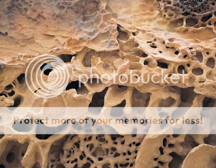
Honeycombing (as seen above) is a delicate form of weathering. Moisture gathers in the hollows, and ‘drawing’ soluble salts out of the rock, carrying them to the surface inside the hollows, where salt crystals fret the grains away. But however it is caused, honeycomb weathering offers us patterns of delicate stone filigree, dancing over the surface of sandstone under sheltered overhangs.
The fantastic banding in the sandstone is formed by the soluble ferrous iron which seeps slowly through the rock until it is oxidised again to ferric iron. This chemistry makes spheres of tough iron-rich stone, waiting deep inside the sandstone. Uncovered, they will make fantastic patterns in the stone, for the spheres are eventually revealed as complex rings and ovals of tougher, more resistant rock, etched and ridged and sculpted into the surface of the stone. With a combination of other minerals, banding can be as spectacular as this:

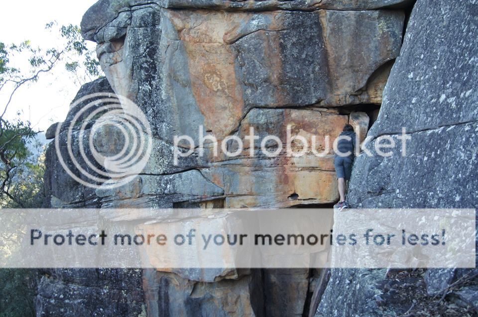
Another spectacular formation of Hawkesbury sandstone, probably the most spectacular are the large cliffs. Formations like these are formed by erosion by water and wind over many millions of years. These sheer drops can be found almost anywhere in this bay area. All the previous caches in the series were all at prime examples of a cliff. Here’s an image from #4 showing Seaeagles1997 clambering about the side of one:
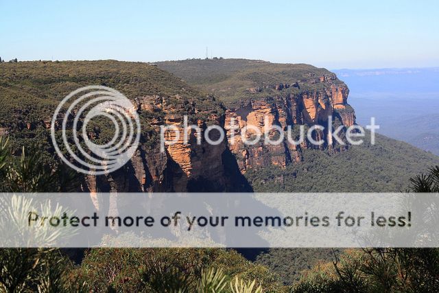
Here’s another example of out in the Blue mountains:
Anyway, enough geology lesson, now how to claim the find. Park at one of the parking area listed. Pearl Beach parking offers a longer, uphill firetrail walk, where as the Patonga hill parking is an easier walk which matches the 2.5 terrain. Once at GZ, you will get this view to the left:
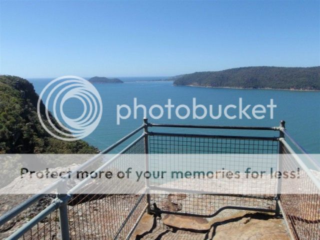
And this one to the right:

There is another good viewing platform without all the fencing about 100m to the right of the viewing platform, but this is NOT required for logging the cache.
***To log the cache please email me the following:***
- List three different examples of erosion at/within view of GZ
- Name three of the main components of the sandstone at GZ
- Describe the composition of the sandstone surface (is it coarse? Is it fine? Does it have small or large quartz crystals?)
Feel free to post up some photo's of your trip to Warrah Lookout with your log. Please enjoy this terrific, family friendly location in the Hawkesbury Heights series. Believe me, this is the easiest that they will come, the rest are a challenge. Hopefully, this will be a little teaser to entice you to attempt some more of the series!
Happy Caching!!!
Additional Hints
(No hints available.)