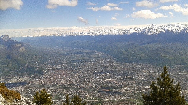

SEISME A GRENOBLE:
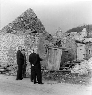
Dans la région grenobloise, certains séismes peuvent dépasser magnitude 5. Le plus important connu est celui survenu à Corrençon (Vercors) en 1962, qui a provoqué des dégâts jusqu'à Grenoble.
Les vibrations du sol associées a un tremblement de terre proviennent de la fracturation en profondeur. Celle-ci résulte d'une grande accumulation d'énergie entre les ruptures et marque la brutale libération de cette énergie lorsque le seuil de résistance des roches est dépassé.
L'origine de cette énergie est liée à la collision des plaques tectoniques Afrique et Europe.
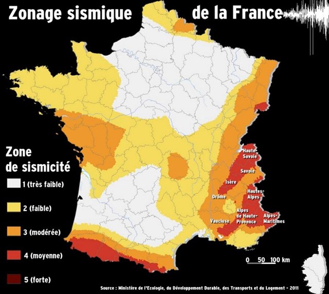
La plupart des séismes de la région grenobloise sont de faible magnitude, mais la population en ressent aussi d'autres dont les vibrations se trouvent amplifiées en raison de la présence dans les vallées d'alluvions lacustres et fluviatiles sur de grandes épaisseurs.
Les ondes sismiques qui se propagent dans ces terrrains meubles vont se réfléchir sur les massifs environnants plus rigides et être amplifiées par un effet de "résonance". Ces effets d'amplification appelés "effet de site" sont susceptibles d'entraîner des dégâts importants dans la cuvette grenobloise. Les plis et les failles témoignent de la déformation des roches, lors de la formation des Alpes qui s'est étalée sur 10 à 20 millions d'années.
Bien que très déformées, ces roches restent solides lors de ces déformations qui se produisent par des transferts de matière autour de micro-blocs rigides.Sous l'effet des forces géologiques, des minéraux de la roche (ici la calcite) sont dissous dans les zones de compression et vont re-cristalliser dans les fractures voisines.
Pour valider cette earth cache :
Rendez-vous aux coordonnées de la cache.
Là vous trouverez un panneau explicatif.
Répondez aux questions suivantes s'y rapportant par mail :
1/ Qu'est-ce qui indique la direction du glissement de roche lors de ruptures sismiques successives ?
2/ Qu'est-ce qui indique le sens du déplacement, qui s'est produit très très lentement, entre les séismes ?
3/ Comment est-il possible de voir maintenant ces roches déformées à pourtant quelques kilomètres de profondeur ?
4/ Comment s'appellent les zones de dissolution et pourquoi ont-elles 2 couleurs différentes ?
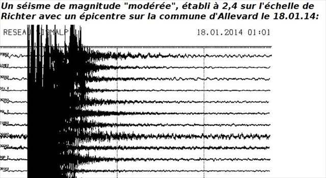
5/ De quelle ville les enregistrements sismiques sont-ils schématisés et quand a eu lieu ce séisme ?
__________________________________________________________________________________________________________________________
EARTHQUAKE IN GRENOBLE:
In the region of Grenoble, some earthquakes can exceed magnitude 5. The most important known took place to Corrençon ( Vercors) in 1962, which provoked damages to Grenoble.
The vibrations of the ground associated to an earthquake result from the fracturation in depth. This one results from a big accumulation of energy between the breaks and marks the brutal liberation of this energy when the threshold of resistance of cliffs is exceeded. The origin of this energy is bound to the collision of the tectonic plates Africa and Europe. Most of the earthquakes of the region of Grenoble are of weak magnitude, but the population also feels the other shocks the vibrations of which are amplified because of the presence in the valleys of lakeside and fluvial alluviums on big thicknesses.
The seismic waves which propagate in these soft grounds is going to be reflected on the stiffer surrounding massifs and to be amplified by an effect of "echo". These effects of development called " effect of site " may engender important damages in the geological depression of Grenoble. Folds and faults testify of the deformation of cliffs, during the forming of the Alps which spread out on 10 in 20 million years. Although very deformed, these cliffs remain solid during these deformations which occur by transfers of material around stiff micro-blocks. Under the influence of the geologic forces, minerals of the cliff (here the calcite) are dissolved in the zones of compression and go re - to crystallize in the nearby fractures.
To validate this earthcache :
Go to the coodonates of the cache.
There you will find an explanatory panel.
Answer the following questions relating to it by e-mail:
1/ What indicates the direction of the sliding of rock during successive seismic breaks ?
2/ What indicates the direction of the movement, what occurred very very slowly, between earthquakes ?
3/ How is it possible to see now these rocks deformed in nevertheless some kilometers deep ?
4/ What are the names of have the zones of dissolution and why 2 different colors ?
5/ Of which city are the seismic recordings schematized and when arose this earthquake?