Vegårshei på x og tvers
Dette blir en serie med cacher på kryss og tvers i Vegårshei kommune. Første del går gjennom Fidalen og opp til Åsveien. Denne skogsbilveien er stengt med bom i begge ender. Eneste framkomstmiddel er enten å gå eller å bruke sykkel. Lengden er vel 6 kilometer. Cachene #15 - #16 ligger på sti inn til Øksvann og #17 ligger med utsikt til Øksvann. Det er mye jakt her om høsten, så ta dere i akt. Ved Åsveien går trailen videre til høyre inn til Åsvann. Her snur vi og kjører ut til riksvei 414. Denne følger vi opp til Myra. Her tar vi av og kjører riksvei 416 mot Akland til vi møter kommunegrensa til Risør. Her kan en snu og kjøre tilbake til Myra, tettstedet i Vegårshei kommune. Vi fortsetter på 414 og videre vei mot de nordlige deler av kommunen. Vi passerer bla Høl, Sørfjorden, Nordfjorden, Vegår, Ufsvatn, Espelandsmyr og ender opp ved veidelet mellom Vegårshei kirke og Vegårshei stasjon.
Jeg har valgt ut steder med greie parkeringsmuligheter. Jeg har skrevet inn stedsnavn i tillegg til cachenavn der de er kjent.
De fleste cachene henger i gran, men noen få lock&lock bokser forekommer. Håper alle tar seg tid til å skru lokkene ordentlig til etter logging slik at neste geocacher også kommer til tørre loggbøker.
I utgangspunktet er det blyant i alle cachene. De har lett for å forsvinne, så ta med egen penn.
GOD TUR
ENGLISH
This is a series of caches that criss-cross the Vegårshei municipality. The first part goes through Fidalen up to Åsveien. This logging road is closed with barriers at both ends. Only means of transport are either walking or using a bicycle. The length is about 6 kilometers. CACHE # 15 - # 16 is on the path to the Øksvann and # 17 is located with views to Øksvann. There are a lot of hunting here in the fall, so take heed. By Åsveien go Trail continues to the right until Åsvann. Here we turn and run out to Highway 414. This, we follow up to Myra. Here we are off and running highway 416 towards Akland until we meet municipal border with Risør. Here you can turn around and drive back to Myra, a village in the municipality Vegårshei. We continue on 414 and on the way to the northern parts of the municipality. We pass Høl, Sørfjorden, Nordfjorden, Vegår, Ufsvatn, Espelandsmyr and ends at the road section between Vegårshei church and Vegårshei station.
I have chosen locations with decent parking. I have entered a place name in addition to the cache name which they are familiar. Most caches hanging in fir, but few lock & lock boxes appear.
Hope everyone takes the time to screw the lids properly after logging so that the next geocacher also going dry logs
.
Basically the pencil in all caches. They tend to disappear, so bring your own pen.
GRATULERER
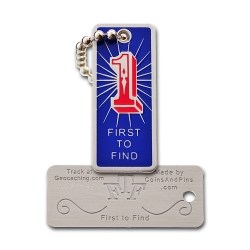
Terkel10 og Isola d'Vess med FTF

