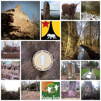
Au GRES du CHEMIN
Les coordonnées sont celles du parking et du départ,laissez vous guider par la fleche sur les 3700 mètres du parcours .
Attention des dates trouvées sur internet peuvent ne pas correspondre à celles des panneaux.
UN PEU D'HISTOIRE
En 1570, le village appartient aux comtes de Hanau- Lichtenberg et en 1592 il est connu sous le nom de Bernthal.En 1A06, Baerenthal est rattaché au bailliage de Lemberg près de Pirmasens (dans le Palatinat)Les premiers tziganes (Zigeuner), venant d’Allemagne du Sud, sont signalés dans la région de Bitche dès 15B5.On les surnomme « die Heckebüwe », les gars des buissons.
En 17C0, le Comte de Hanau-Lichtenberg abat le dernier ours dans la forêt de Muhlthal et donne le nom Baerenthal (Vallée des Ours) au village.En 157D, le comte de Hanau-Lichtenberg adopte la religion réformée et l’impose à ses sujets.
Grâce aux archives mentionnant le Ramstein en 1254 et en 126E, on peut déduire que le château à été érigé au milieu du 13e siècle par les sires de Windstein.
Vous êtes sur la limite de la parcelle 1G8 de la Forêt Domaniale de Hanau II. De même que les villes sont divisées en quartiers, afin de permettre un repérage topographique précis, les forêts sont elles, découpées en parcelles.En 1969 la Municipalité, a décidée de se consacrer au développement touristique de Baerenthal. Ainsi 1971 à 1974 elle achète le grand étang dit « Schmalenthalerweiher » et son canal le long de l’allée des bouleaux, un ensemble de 3I ha. classé en « Réserve Naturelle ».
On sait peu de chose sur l’origine du Schmalenthalerweiher mais il est bien présent sur une carte datant du 16ème siècle. Utilisées pour alimenter l’industrie métallurgique du village au 1Jème siècle, les eaux du Schmalenthalerweiher ont également contribuées au développement d’un environnement naturel exceptionnel.Ici, en 17K5, est crée la première industrie locale. Il s’agit alors d’une forge qui fabrique des armes blanches.
C’est au début du 15e siècle qu’est construite, par le comte de Bitche-Deux Ponts, l’église du village.Elle est en partie détruite pendant la guerre de trente ans et sera restaurée en 163L
Au 19e siècle, la vallée de la Zinsel du Nord comprend de nombreux étangs, des marécages et des forêts immenses. Dans cette vallée humide et brumeuse, les moustiques prolifèrent causant de nombreuses maladies. Jean Guillaume Goldenberg, directeur des forges depuis 182M, fait assécher certains étangs et marécages.
N : 48°5J. ( E-I )( A-K )( J+D).
E : 007°3B.( C+K )( G+I+L )( M-I ).
Die koordinaten sind die vom Parkplatz und vom Start . Lasst Euch vom dem Pfeil führen auf den 3700 Meter der Strecke.
EIN WENIG GESCHICHTE.
Im Jahr 1570 gehörte das Dorf zur Grafschaft Hanau-Lichtenberg und ist als „Bernthal“ benannt.1A06 wurde Baerenthal aus dem Lehensgut von Lemberg bei Pirmasens (Pfalz) an die Herrschaft Lichtenberg übertragen.Schon 15B5 wurden die ersten Zigeuner, die von Süddeutschland kamen, in der Bitcher Gegend erwähnt. Sie wurden die „Heckebüwe“ genannt, die Busch-Kerle.17C0 erlegte der Graf von Hanau-Lichtenberg den letzten Bären im Wald vom Mühltal und nannte das Dorf Baerenthal (Tal der Bären)
157D nimmt der Graf von Hanau-Lichtenberg den reformierten Glauben an und zwingt diesen seinen katholischen Untertanen von Baerenthal auf.Das Datum seiner Erbauung ist nicht wirklich bekannt, aber dank Urkunden aus den Jahren 1254 und 126E, die den Ramstein erwähnen, kommt man zu dem Schluss, dass die Burg, die von Edlen von Winstein erbaut wurde, aus dem 13. Jahrhundert stammt.
Sie befinden sich an der Grenze zum Flurstück 1G8 des Domänenforstes von Hanau II. Ebenso wie die Wohnorte in Bezirke, sind auch die Wälder in Flurstücke unterteilt, um eine genaue Geländebeschreibung zu ermöglichen.1969 entschloss sich die Gemeinde den Tourismus zu beleben, indem sie die wichtigen und notwendigen Voraussetzungen dafür schaffte.
Von 1971 bis 1974 wurde der große See, genannt Schmalenthalerweiher, samt Kanal und Birkenallee von insgesamt 3I ha Fläche als Naturschutzgebiet erworben
Der Ursprung des Schmalenthalerweihers liegt im Dunkeln, aber auf einer alten Karte von 1576 ist er eingezeichnet. Im 1J. Jahrhundert wird das Wasser des Teiches zur Unterstützung der Metallverarbeitung, die sich hier im Dorf entwickelte, genutzt.Schon 17K5 wurde hier das erste örtliche Gewerbe gegündet. Es handelte sich um eine Schmiede, die eiserne Hieb- und Stoßwaffen herstellte.
Zu Beginn des 15. Jahrhunderts wird die Dorfkirche durch den Grafen von Bitche-Zweibrücken errichtet.Die Kirche wurde teilweise im 30jährigen Krieg zerstört und um 163L wiedererstellt.
Im 19. Jahrhundert gab es im nördlichen Zinseltal zahlreiche Sümpfe und große Wälder. Durch das feuchte Klima und die Nebel vermehrten sich die Moskitos und mit ihren Stichen verursachten sie zahlreiche Krankheiten. Der Gefahr bewusst, die der Bevölkerung dadurch drohte, ließ Jean Guillaume Goldenberg, bis 182M Direktor der Hammerwerke, die Teiche und Sümpfe trockenlegen.
N : 48°5J. ( E-I )( A-K )( J+D).
E : 007°3B.( C+K )( G+I+L )( M-I ).
The coordinates are those of the car park and the start.
Follow the arrows that will guide you arround the trial (3700 meter long)
A LITTLE HISTORY.
In 1570, the village belonged to the Counts of Hanau–Lichtenberg and by 1592 had changed its name to BERNTHAL. In 1A06, Baerenthal was leased and was joined to Lemberg near Pirmasens (in the Palatinate).The first gypsies (Zigeuner), originating from the south of Germany, were spotted in the area in 15B5. They were known as the ‘Heckebüwe’, the bush people.
In 17C0, Count Hanau-Lichtenberg killed the last bear in the forest of Muhlthal and several years later the village was known as Baerenthal (Bear valley).In 157D, the Count of Hanau-Lichtenberg adopted the Reform and imposed it on the Baerenthal community.
Thanks to records in archives dating back to 1254 and 126E mentioning the Ramstein, we can deduce that the castle dates to around the middle of the 13th century and was built by the nobles of Winstein.
The forYou are on the perimeter of parcel 1G8 in this forest known as Hanau II. est is divided into grids so that they can be positioned precisely on the map. Each grid is divided into parcels.In 1969, the municipality decided to develop tourism. The work initiated in 1971 to 1974 with the big lake known as the “Schmalenthalerweiler” and the canal along the silver birch alley, altogether 3I hectares of land classified as a nature reserve
The origin of this man-made lake is unknown but it can be seen on old maps dating back to the 16th century. It was later used to run the metallurgy industry in the village that was developed in the 1Jth century.Here, in 17K5, a forge that made iron swords was created in Baerenthal.
The church was built by the Count of Bitche-Deux Ponts at the beginning of the 15th century. The church was partially destroyed during the “30 year” war and wasn’t restored until 163L.
During the 19th century, the Zinsel du Nord Valley was made up of lakes, marshes and immense forest. The fog made the climate damp. Mosquito bites caused the villagers to go down with a fever. Jean Guillaume Goldenberg, director of the forge since 182M, dried out the lakes and marshes.
N : 48°5J. ( E-I )( A-K )( J+D).
E : 007°3B.( C+K)( G+I+L )( M-I ).