During the early 1800's, this area was slowly being settled as the giant trees that had been in the area for hundreds if not thousands of years were being clear cut. As the need for easy cheap transportation was a necessity, a road was built from Waterford to Simcoe following an Native foot trail used for traveling from Lake Erie near Turkey Point to the Grand near Brantford. The path eventually became a cart path used by the local immigrates and was taken over by a company that provided "reliable" roads of the day. This company built the road with planks of wood to ensure that horse and carts could travel as efficiently and quickly as possible to trade goods between each town. The road was so valuable an asset to local farmers and merchants that the company added tolls to each end to help pay for and maintain the plank road.
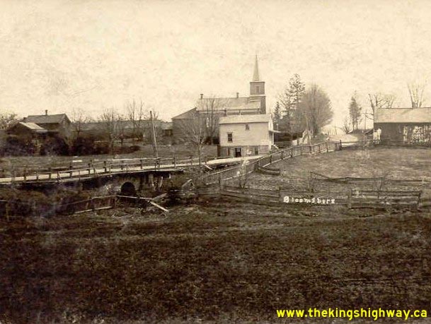
The plank road here for most part followed the existing road from Waterford up until Bloomsburg. From Bloomsburg to Simcoe, the original road actually held more of a South Western lie creating a more direct route to Simcoe as opposed to the Westerly direction to Highway 24 that it now lays.
This Roman Stone Arch is but a remnant that was left standing when the newer more modern road next to it was built. We are unsure at this time how come it was saved, but it has a plaque noting its location and date as well as its Historical Designation.
I would post pics of this area but that would give away a lot and ruin your surprise that this exists within feet of hundreds of passerby's each day. Lets just say, it was built in 1853 and leave it at that.
Hope you enjoy the area.