What Are The Grand Banks
Geographical Location and Background Information:
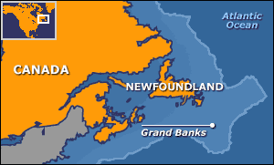
The Grand Banks are a series of underwater plateaus southeast of Newfoundland on the North American Continental Shelf. This self also reaches around Nova Scotia and the rest of Newfoundland. These areas are relatively shallow in most areas however ocean depths drop dirastically on the outside edge of the banks. The Grand Banks is a perfect illistration of the Atlantic Ocean's specific plate-tectonic events. The developmental history of the Grand Banks reflects a long history of continuous rifting, thermal events and erosion as the Atlantic Ocean was formed during the break up of the super continent known as Pangea.
Formation of the Grand Banks:
Three major rifting events are believed to be responsible for the natural creation of the Grand Banks:
1. The first rifting event was recorded during a period of time where North America and Africa slowly spread apart in the early Jurassic Period which occured from about 201 million - 145 million years ago. The result of these large land masses moving apart spreaded sediments and rock on the seafloor to the south of the Grand Banks. These continental movements are largely responsible for creating the central Atlantic Ocean as it is known today.
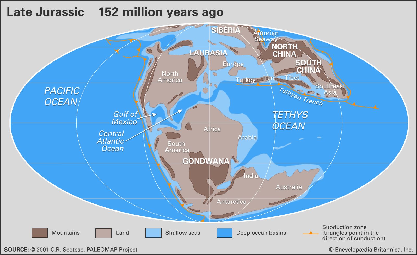
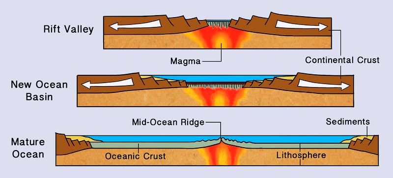
Most notably in the above Late Jurrassic map is the absence of subduction zones on the atlantic side of North America. A subduction zone is a plate tectonic boundary where one plate slides beneath another. In many cases this sliding results in earthquakes and volcanoes. This subduction activity is much more common on the pacific coast than the atlantic coast, which experienced predominently continental drift and rifting during its formation. It is this drift and rifting process which is why the atlantic undersea basins are characteristically smoothly rising with a long Mid Atlantic Ridge parting the European and North American sides of the Atlantic. Compare the rifting process with the subduction process in the images below.
Subduction:

Rifting:
2. The second rifting/faulting event collected a basin of rock under the sediments which have now collected on the seafloor of the Grand Banks.
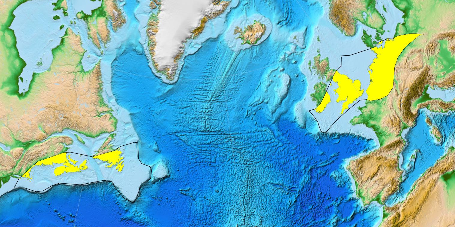
3. The third and final rifting event was known to be the period where the Avalon and Ben Nevis formations were depositied. "Avalon" is a term which is derived from Avalonia, was used by canadian geologist Harold Williams to describe the exotic rocks present in Newfoundland to Rhoad Island. Avalonia was a microcontinent which was split in two parts during the breakup of Pangea. Because of continual rifting, the two parts effectively drifted away from eachother, with some of those parts depositing and forming what is now Newfoundland, parts of New Brunswick / Nova Scotia and the Grand Banks. The remains of Avalonia are depicted below:
Interestingly, the Grand Banks were extensively glaciated during the last glacial maximum. By approximately 13,000 years ago, the majority of the ice had melted, leaving the Grand Banks exposed as several islands extending for hundreds of kilometers. It is believed that rising sea levels and intense erosion would have submerged these around 8,000 years ago. It is believed that the erosion process has now flattend the Grand Banks to create the underwater plateaus that are present now. This erosion process continues today.
Modern Historical Signifigance:
The Grand Banks are largely known today for its plentiful fish stock. The relatively shallow depths, mixing ocean currents and nutrient rich sediments make it an ideal breeding ground for many species of fish. Notes about the abundance of fish date back as early as the 15th centruy but the most extensive fishing occured during the 20th centruy. By 1992, over fishing lead to a collapse of the cod fish population which prompted the Canadian Government to ban the fishing of cod on the banks.
Many sailors with experience exploring the banks will comment on the sometimes treacherous conditions. The warm air masses passing over the generally colder waters on the banks lead to dense fog conditions particularily during the spring season. Today, environmental monitoring of the banks has been of interest because surface water temperatures on the banks have risen consistently from 1950-2010 despite that fact that depth averaged temperatures have not increased over the same time frame.
See Understanding Physical Drivers of the 2015/2016 Marine Heatwaves in the North Atlantic.
About This Earth Cache
Before Caching:
*Please note the following information before attempting this cache*
The posted coordinates are on a public dock which overlooks the Lunenburg harbour waters. To answer the questions for this cache you will need admission to the Lunenburg Fisheries Museum of the Atlantic. A link can be found here to the official website of the museum. The public dock which the coordinates sit on is about 200m away from the museum. They are both on the same waterfront road and it should be hard to miss.
It is suggested that you tour the town on foot. Parking meters can be expensive and the compact streets can be a headache to drive on. However, I do suggest touring the majority of the town aside from just doing the cache. There are many beautiful sights, small shops and friendly locals which you will want to take in. Take the time to make a day of the cache, explore the town and museum and have fun!
There is public wifi running all along the waterfront so you will likely be able to log this cache while you are on location, or review this listing if you need a refresher on the information provided. The museum has alot to offer besides the information needed on the Grand Banks.
To Log This Cache as Found You Must...
*All sincere attempts are accepted. Please send me a message with the answers to the following questions:*
1. What are the two different ocean currents which run through the Grand Banks? Point out which of these currents is warm and cold.
2. Describe rifting.
3. Roughly describe how deep the Grand banks are, a depth range is also acceptable. (ex. 25-60 feet deep)
4. *OPTIONAL* Post a picture of you or your GPS device at either the posted coordinates or the museum docks, overlooking the water.
Thanks for visiting Lunenburg and The Grand Banks Earthcache, I hope you enjoy your time in the area. I highly suggest taking full advantage of what the area has to offer.