
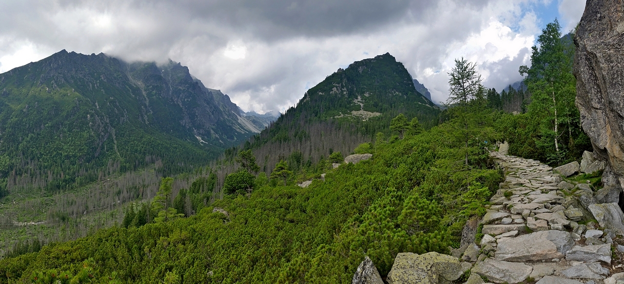
Prechádzate cez skalnú strž, jednu z najväčších vo Vysokých Tatrách. Vznikla tak, že steny doliny podťal ľadovec a mráz ich rozvetral. Balvanité sutiny strže, zložené z veľkých skalných blokov, neboli priaznivé pre vývoj súvislého pôdneho krytu, preto tu vznikol takzvaný zvrat vegetačných stupňov. V hornom lesnom stupni sa tu nachádzajú ostrovy kosodreviny. Z miesta je pekný výhľad na obe Studené doliny.
 Posledné zaľadnenie v Tatrách pred približne 20 tisíc rokmi je známe tiež ako Wűrmské obdobie. Priemerná ročná teplota nikde na Slovensku nevystupovala nad 0 °C, v najvyšších polohách Tatier bola pravdepodobne menej ako -15 °C. Klíma mala výrazné kontinentálne črty, a to aj preto, že Slovensko sa nachádzalo hlbšie vo vnútrozemí. Na polohu Slovenska nemal vplyv pohyb kontinentov (za 20 tisíc rokov je pohyb kontinentov zanedbateľný), ale hladina oceánov, ktorá bola o 120-130 metrov nižšie ako dnes. V Tatrách ani počas najteplejších letných dni teplota nevystupovala nad bod mrazu dostatočne dlho na to, aby sa nahromadený ľad roztopil. Z horských úbočí Tatier preto stekalo do dolín viac ako 50 ľadovcov. Niektoré z nich boli aj viac ako 10 kilometrov dlhé a dosahovali hrúbku 400-500 metrov.
Už na prvý pohľad je vidno ako je Veľká Studená dolina ľadovcom formovaná do pismena U, takéto ľadovcom formované údolie sa v geológii označuje aj tróg. Všimnite si výškový rozdiel Veľkej a Malej studenej doliny - je sposobený váhou ľadovca. Ľadovec v Malej Studenej doline bol ľahší, preto je menej prehĺbená. Po spojení ľadovcov v týchto miestach vzniklo oveľa väčšie prehĺbenie, pretože hrubší ľadovec s väčšou hmotnosťou pôsobil na steny doliny väčšou silou.
Úlohy
Na zalogovanie kešky musíte poslať odpovede na otázky. Čerpať informácie môžete z okolitého prostredia a listingu. Odpovede zasielajte cez môj profil. Logovať “Found It” možete ihneď po zaslaní odpovedí na otázky. Ak by odpovede neboli správne, budem Vás kontaktovať. Logy bez zaslaných odpovedí budem mazať. Pravidlo je: každý logujúci zasiela svoje odpovede.
Ak nesúhlasite s týmto pravidlom, tak prosím nelogujte túto earth kešku. Bližšie informácie o požiadavkách na logovanie earth cache nájdete tu http://www.geosociety.org/GSA/fieldexp/EarthCache/guidelines/home.aspx
1) Koľko výškových metrov smerom hore a dolu od chodníka odhadujete rozsah skalnej strže ?
2) Akým geologickým názvom sa označuje ľadovcové údolie ?
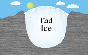
3) Aký je chemický vzorec ľadovca ?
Bonusová otázka
4) Prečo bola počas Wűrmského obdobia hladina oceánov o 120-130 metrov nižšia ako teraz ?

You are crossing a rock avalanche, one of the largest in the High Tatras. It was created when the rocky walls of the valey were undercut by the glacier. The boulders of the rocks, composed of large rock blocks, were not beneficial for the development of a continuous soil cover. So there was a so-called reversal of vegetation steps. In the forest and below there are islands of mountain pines. There is a nice view to both valleys Mala and Velka studena dolina (literally Small and Big Cold Valley).
The last glaciation in the Tatras about 20,000 years ago is also known as the Wűrm period. The average annual temperature in Slovakia did not rise above 0°C, at the highest peaks of High Tatras it was probably less than -15°C. The climate was affected by continental features because Slovakia was further from sea in the Europa continent. The movement of the continents did not affect the position of Slovakia (in 20,000 years, the continent movement is negligible), but it was influenced by the sea level, which was 120-130 meters lower than today. In the Tatras even during warmer summer days the temperature did not rise above the freezing point for long enough so that the accumulated ice could melt. From the mountains of High Tatras more than 50 glaciers flowed into the valleys. Some of them were more than 10 kilometers long and were this as much as 400-500 meters.
At first sight you can see that Velka studena dolina (Great Cold Valley) was formed by the glacier to a letter U shape. Such glacier shaped valley has geological name trog. Notice the altitude difference between Velka and Mala studena dolina. It is influenced by the weight of the glacier. Glacier in Mala studena dolina was lighter, so the formation was less deep. After joining the glaciers, the resulting glacier was much more heavier and therefore causing much more deepening.
Tasks
To log the cache you have to send the correct answer to the questions below. Replies should be sent via my profile. Log "Found It" immediately after sending the answers to the questions. Were the answers not correct, I will contact you. Logs without answers will be deleted. The rule is: everyone who is logging must send answers
If you do not agree to this requirement, please do not log this earth cache. For details about earth cache requirements see http://www.geosociety.org/GSA/fieldexp/EarthCache/guidelines/home.aspx
1) How many elevation meters is the extent of the rock avalanche up and down from the paved trail ?
2) What is the geological name of the glacial valley ?
3) What is the chemical formula of the glacier?
Bonus question
4) Why was during Wűrm period the sea level 120-130 meters lower than now ?