NOTE TO CACHERS:
Park entry fee required ($5)
Park hours Sunrise to Sunset
Ancient Formation
Western Nebraska, as well as most of the Midwest, was under a shallow inland sea about 70 million years ago. As this sea receded, and the Rocky Mountains uplifted, water was channeled to the east, carrying away and depositing immense quantities of sand, gravel, silt and clay across the plains. This sediment was laid down layer after layer, over tens of millions of years. Around 28 million years ago volcanoes erupted, sending wind-blown ash across the plains. Intermittent uplift and volcanism continued to lay down multiple layers of ash and sediment to a depth of 5,000 to 10,000 ft (1,524 to 3,048m).
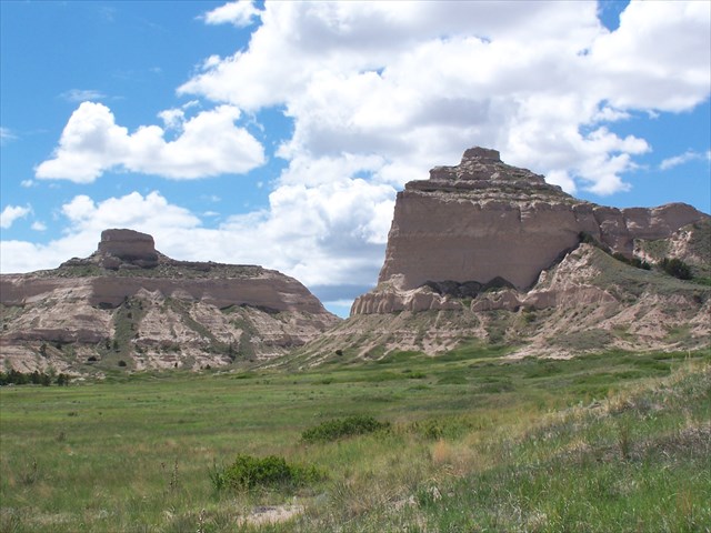
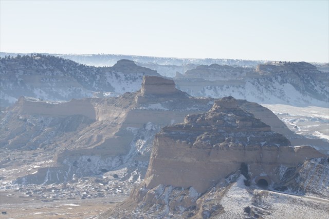
Bluffs
Five to ten million years ago, the last great uplift of the western region of North America occurred. The steeper terrain now forced streams to cut into and excavate the sediments they had formerly deposited. However, the original seabed still lies 250 ft (77 m) below ground level. As the sedimentary layers were carved out, harder cap rock resisted this erosive action. Four to five million years of this weathering carved out the prominent landscape visible today within Scotts Bluff National Monument. In their diaries, the early pioneers referred to them as sand hills, mounds, or bluffs. Indeed, the steep cliffs of the hills are bluffs, but in geographical terms, the bluffs are only a part of much larger formations.
Plateau
Plateaus are an extensive, raised, flat-surfaced area between 1,969 and 4,922 ft (600 - 1,500 m) above sea level, extending for many miles with little relief. About two million years ago, great ice sheets advanced southward from Canada into the United States, traveling as far south as Montana and the Dakotas. This area is a glacial-stream carved landscape modified by glaciers and covered by glacially transported mineral debris. Subsequent stream action has not had a significant role in further shaping the landscape. The unglaciated Missouri Plateau, however, stretching south from western Nebraska and east into Texas, was shaped by the cutting action of rivers and streams, primarily the Missouri River and its tributaries. Plateaus are usually exposed to more erosion than other land forms because of their high elevation and flatness. As water coursed over the plateaus, the loose sandstone was gradually carved out and carried away.
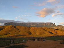
Mesa
Plateaus were further carved into smaller units, called mesas, which is Spanish for tables. A mesa is an isolated, high plateau with a flat top and steep sides that has been separated by the widening of canyons. Mesas are more often found in the drier southwestern states of Colorado, New Mexico, Utah and Arizona.
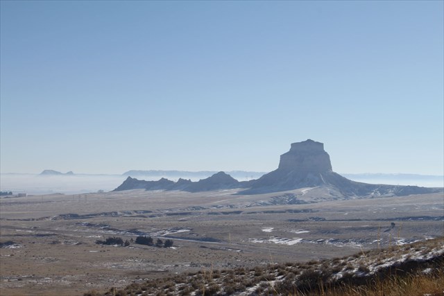
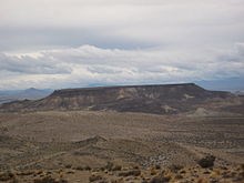
Butte
Smaller mesas that stand conspicuously alone, but were once part of a larger mesa before erosion separated it, are known as buttes. They are typically capped by a horizontal hard rock that protects the lower layers from erosion. Bear Butte, near Sturgis, South Dakota, is another type of butte. However, it was formed from igneous intrusion rather than erosion.
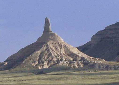
Pillar
If we take the ever-present erosion process a step further, the butte continues to be worn down until only a narrow pinnacle, or pillar, is left standing atop a wider base. 30 miles to the East stands a famous pillar. It not only marked a good camping site with good water, but also the end of the monotonous flat terrain they had spent the last two months crossing. Although diminished in stature since the covered-wagon emigrants passed by, today the column still towers nearly 500 feet above the North Platte River. As the various processes continue to wear down the ancient rock material, the existing formations so familiar to even modern day travelers will continue to change shape over the next hundreds and even thousands of years.
You are now atop Scotts Bluff, look around and think about the lesson above. (While staying on the path) Read the sign and answer the following questions.
1. What is the elevation indicated on the sign? What year was the benchmark placed?
2. How much erosion has happened since the placing of the benchmark?
3. What Butte can be seen from the summit?
4. What is the name of the Pillar that can be seen from the summit when looking east (on a day with good visibility)?
5. Including the land form you are standing on which types of Geologic Formations have you seen the day of your visit?