LES CONFESSIONNAUX DE SAINTE-HONORINE-DES-PERTES
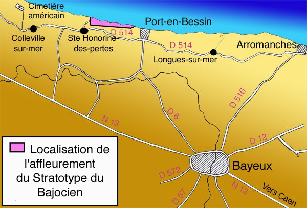
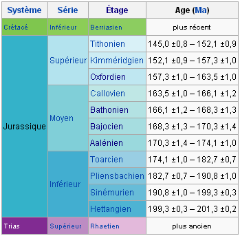
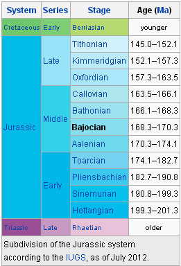
L'affleurement de Sainte-Honorine-des-Pertes est le site étalon retenu par Alcide d'Orbigny au 19ème siècle pour la définition du stratotype Bajocien (tiré du nom latin de Bayeux). Une révision générale de stratigraphie en 1994 a montré que le stratotype précédent était obsolète. La Commission Stratigraphique Internationale (ICS) a nommé la section de Murtinheira à Cabo Mondego (Portugal) comme nouveau stratotype du Bajocien en 1996.
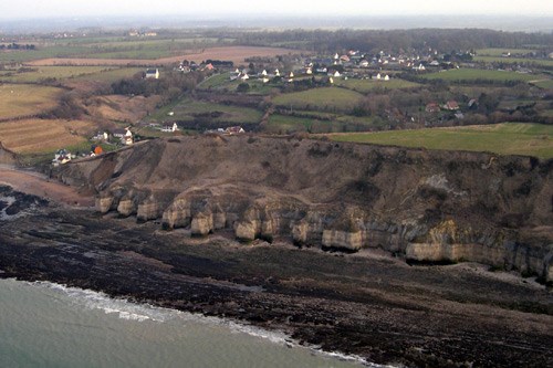
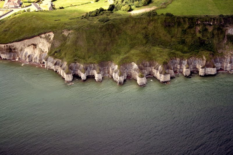
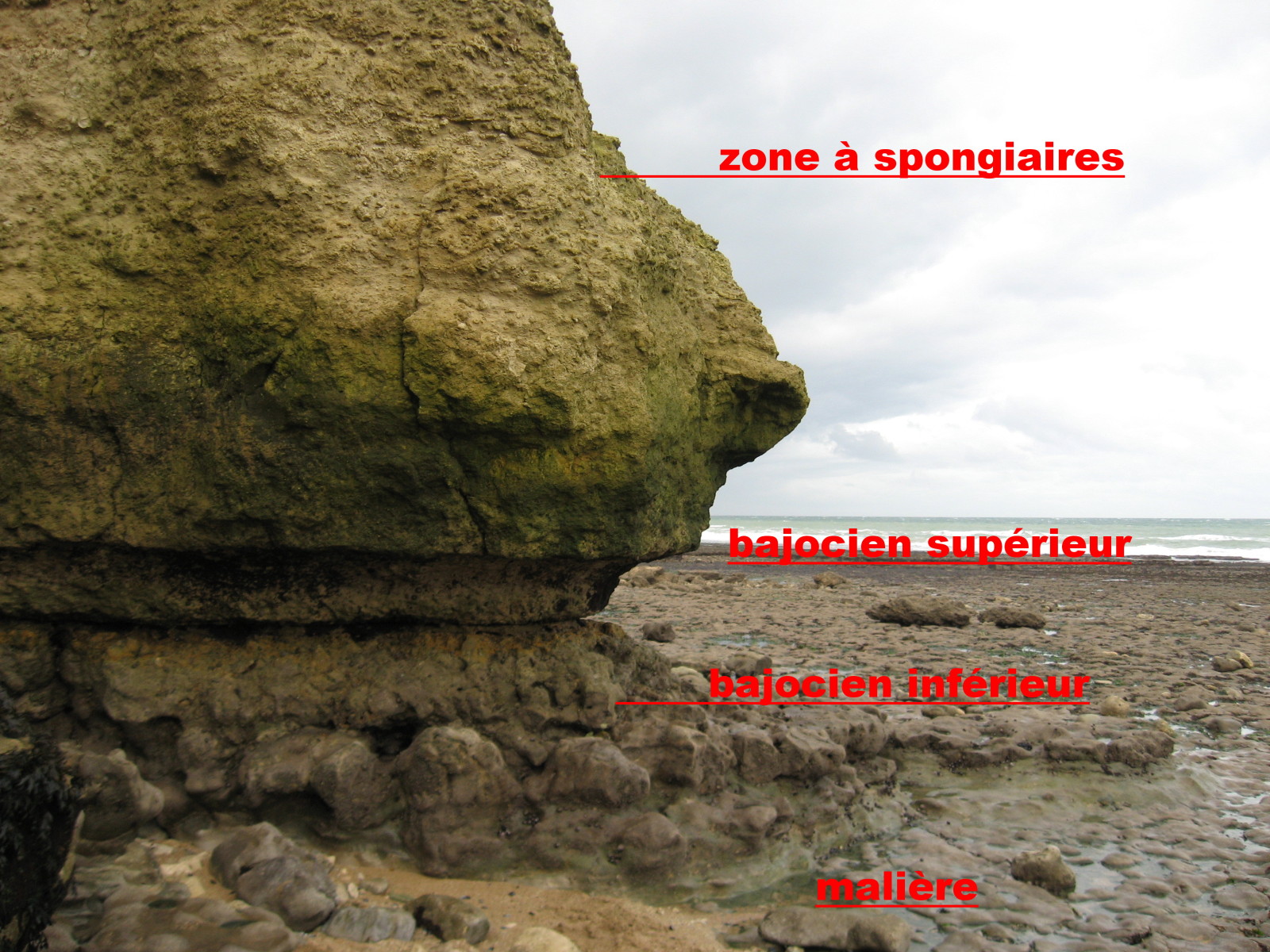
Les falaises, d'une soixantaine de mètres de hauteur, montrent un profil composite résultant de l'érosion différentielle entre des roches dures et tendres.
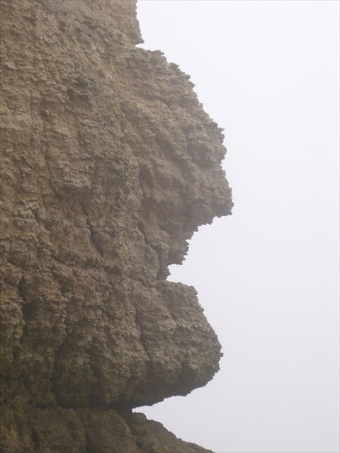
La partie inférieure de la falaise, verticale, est taillée dans un calcaire massif dans lequel la mer a creusé une succession de cavités, appelées localement « confessionnaux », en utilisant un réseau de diaclases et de failles et a isolé des proéminences calcaires (aiguilles) qui font face à la mer.
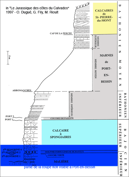
Décomposition de l'affleurement, de haut en bas :
- 1 - Calcaires du Bessin
- 2 - Marnes sombres de Port-en-Bessin
- 3 - Couches de passage, alternance de calcaires et de marnes
- 4 - Calcaire à Spongiaires
- 5 - Oolithe ferrugineuse de Bayeux
- 6 - Couche verte
- 7 - Malière (alternance de marnes et calcaires argileux)

L'acces au site doit être fait en respectant les règles de prudence, ainsi que les réglementations spécifiques indiquées sur place. Il faudra notamment tenir compte de la marée:
accès uniquement à marée descendante
Horaires des marées
L'extraction de tous matériaux est interdite sur les côtes du Calvados.
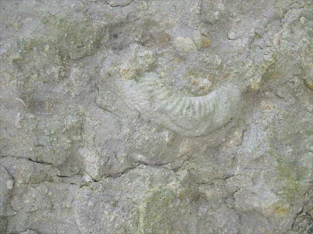
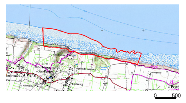
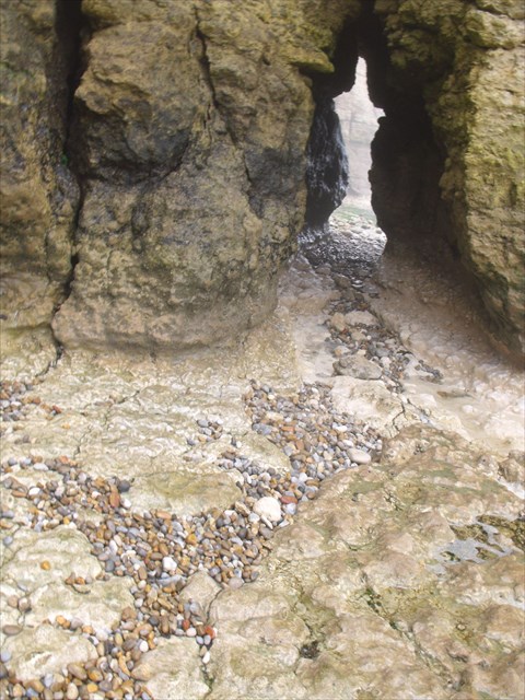
Des coordonnées de la EarthCache, dirigez-vous vers la falaise. Vous vous trouverez devant une cavité. Sur le sol, au milieu, se trouve un ensemble de rochers.
Pour valider cette EarthCache, vous devez répondre aux questions suivantes:
- A - Mesurez la hauteur de la grande cavité ovale entre le sol et la voûte (au point le plus haut, soit au centre et à l'avant), en centimètres
- B - Ddéterminer la nature des gros rochers au sol sous la voûte
- C - Indiquez quels sont les couches de l'affleurement du site qui forment le stratotype Bajocien (parmis les 7 de la liste ci-dessus)
Avant de loguer votre "Found it", envoyez vos réponses à l'adresse de notre profil.
THE CONFESSIONALS OF SAINTE-HONORINE-DES-PERTES
The outcrop of Sainte-Honorine-des-Pertes is retained by Alcide d'Orbigny in 19th century for the definition of the Bajocian stratotype (from the Latin name of Bayeux ) standard site. A general review of stratigraphy in 1994 showed that the previous stratotype was obsolete. The International Commission on Stratigraphy (ICS) appointed section Murtinheira, Cabo Mondego (Portugal ) as new Bajocian stratotype in 1996.
The cliffs, sixty meters high, shows a composite profile resulting from differential erosion between hard and soft rocks .
The lower part of the cliff, vertical , is carved in a massive limestone in which the sea has carved a succession of cavities, locally called " confessionals ", using a network of joint and faults, and isolated calcareous prominences (needles) facing the sea.
Decomposition of the outcrop, from top to bottom:
- 1 - Limestones of Bessin
- 2 - Marls of Port-en-Bessin
- 3 - Passage Bed, alternating Limestones and Marls
- 4 - Spongia Limestone
- 5 - Ferruginous Oolite of Bayeux
- 6 - Greensand (Glauconite)
- 7 - "Malière" (alternating marl and argillaceous limestones)
The access to the site must be done according to the rules of prudence, as well as specific regulations stated on site. It will take particular account of the tide:
access only at ebb tide
Tide times
The extraction of any materials is prohibited on the coasts of Calvados.
On the coordinates of the EarthCache, look the cliff. You will find yourself in front of a cavity. On the middle, you can see a group of rocks.
To validate this EarthCache, you must answer the following questions:
- A - Measure the height of the large oval cavity between the ground and the roof (at the highest point, center and front), in centimetres
- B - Determine the nature of the large rocks on the ground under the vault
- C - Indicate the strata of the outcrop of the site who form the Bajocian stratotype (in the list of 7 strata above)
Before logging your "Found It ", send your answers to the email address of our profile.