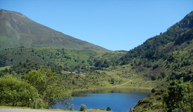
L'étang de L'Hers, situé dans le canton de Massat, est non seulement un but d’excursion très apprécié de par la beauté de son environnement, mais c’est aussi un petit paradis pour les géologues et minéralogistes amateurs ou professionnels qui viennent de très loin pour voir cette fameuse Lherzolite.
La lherzolite est une roche de profondeur magmatique relativement rare. Elle a été découverte et définie en Ariège il y a 200 ans sur le site de l’etang de L'Hers. On retrouve quelques affleurements tout le long de cette faille (qui passe par le col de Marmare, le col de Lordat, le port de Lers, le port de Saleix, le col de Latrappe) mais le plus gros gisement se trouve ici, tout autour de l'étang de L'Hers, d'où son nom.
Une telle roche de profondeur n’est jamais observable directement, sauf sur ce site qui est une référence au niveau mondial et fait l'objet de recherches par de nombreux chercheurs du monde entier.
C'est le seul endroit au monde où l'on peut observer le manteau supérieur de la Terre à l'air libre : en effet, la lherzolite est une roche grenue qui a cristallisé en profondeur dans une zone appelée le manteau supérieur, sous la croûte terrestre. Elle en est sortie lors de la formation des Pyrénées.
Altérée en surface, elle a une couleur brun rouille caractéristique. Mais c’est là que l’on distingue le mieux les trois minéraux principaux qui la composent.
- les pyroxènes vert émeraude
- le spinelle noir
- l’olivine qui donne la couleur verte.
Sur cassure fraîche, la roche est verdâtre.
Adaptation des textes de : - Didier Fert
- Association GéoPyrène - Isabelle Corbières.
Pour loguer cette cache, vous devrez vous rendre à la position donnée, près d'un gros rocher, et répondre aux questions suivantes via Email à l'adresse de notre profil : BettyP31@gmail.com.
1/ A quelle famille appartient la lherzolite ?
2/ La lherzolite est une roche de profondeur. Quel est le phénomène qui en a fait remonter des lambeaux à travers la croûte terrestre ?
3/ Quelle est la hauteur approximative du rocher qui se trouve devant vous à partir de sa base ?
4/ Quel est son volume approximatif ?
Vous pouvez vous loguer sans attendre notre confirmation. Si vos réponses posent problème, nous vous en ferons part.
Merci beaucoup pour vos visites et bon Geocaching !
***************************************************************************
The pond of L'Hers, located in the canton of Massat is not only a popular excursion destination for the beauty of its environment, but it is also a paradise for amateur or professional geologists and mineralogists come from afar to see the famous Lherzolite.
Lherzolite is a relatively rare magmatic depth rock. It was discovered and defined in Ariege 200 years ago on the site of the pond of l'Hers. There are a few outcrops all along this fault (which passes through the passes of Marmare, Lordat, L'Hers, Saleix, Latrappe) but the largest deposit is here, all around the pond of L'Hers, hence its name.
Such a depth rock is never directly observable, except on this site which is a global reference and the subject of research by many scientists around the world.
Indeed, this is the only place in the world where you can see the upper mantle of the earth in the open air: in fact, lherzolite is a granular rock which crystallized in depth in an area called the upper mantle, beneath the earh's crust. It came out of it during the formation of the Pyrenees.
Altered on the surface, it has a characteristical brown rust colour. But this is where the three main minerals that compose it can be best seen. .
- The emerald green pyroxenes
- Black spinel
- Olivine which gives the green color.
Freshly broken, the rock is greenish.
Adaptation of texts by: - Didier Fert
- Association GéoPyrène - Isabelle Corbières.
To log this cache, you need to go to the given coordinates next to a big rock and answer the following questions via the email address on our profile: BettyP31@gmail.com.
1 / What family does the lherzolite belong to?
2 / Lherzolite is a depth rock. What is the phenomenon that made some shreds go up through the earth's crust?
3 / What is the approximate height of the big rock you have in front of you, from its base?
4 / What is its approximate volume?
You can log without waiting for our confirmation. If there is a problem with your answers, we will contact you.
Thank you very much for your visits and ... Happy Geocaching!