WaStatePks100: Rosario Beach - Deception Pass Traditional Cache
WaStatePks100: Rosario Beach - Deception Pass
-
Difficulty:
-

-
Terrain:
-
Size:  (micro)
Related Web Page
Please note Use of geocaching.com services is subject to the terms and conditions
in our disclaimer.
This cache was originally placed in 2013 as part of the Washington State Parks Centennial GeoTour - "100 caches in 100 parks to celebrate 100 years" - cosponsored by Washington State Geocaching Association (WSGA).

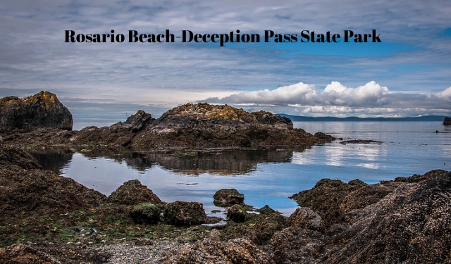 Deception Pass State Park is a 4,134-acre marine and camping park with 77,000 feet of saltwater shoreline, and 33,900 feet of freshwater shoreline on three lakes. Rugged cliffs drop to meet the turbulent waters of Deception Pass. The park is outstanding for breathtaking views, old-growth forests and abundant wildlife. Park hours: Summer: 6:30 a.m. to dusk. Winter: 8 a.m. to dusk.
The trails in this area are among the most scenic in the entire park. Hikes to Lottie Bay, Lighthouse Point and Rosario Beach are short but rewarding, and offer spectacular views of Puget Sound, Deception Pass, and the San Juan Islands.
The cache is located on the trail between Rosario Beach and Bowman Bay. From the limited parking lot, (PK), one will travel south to the water. If you turn right, (west), you will reach Rosario Beach and the tidepools. If you turn left, (east), you will reach the cache and eventually Bowman Bay. Trail maps can be found here.
 Rosario Beach offers visitors a protected cove with smooth rocky beaches and wonderful tidepools to explore at low tide. As an added bonus there are volunteers on hand most low tides, Memorial Day to Labor Day to teach the wonders of the Puget Sound‘s habitat and animal life. Tidechart can be found here.
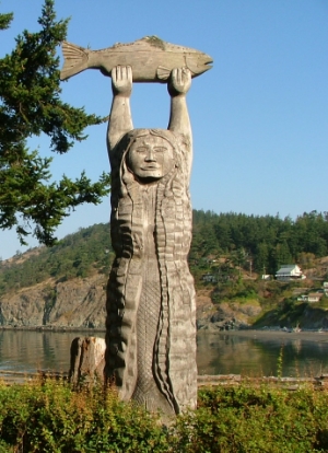
Before receiving its modern name, Bowman Bay was known as “Reservation Bay” due to the period in which it was a military reservation. The area was eventually renamed in honor of Amos Bowman, who was one of the first white settlers on Fidalgo Island. At the turn of the century, Bowman had a wooden dock built at the bay in hopes that it would become a major port, but Bowman’s dream was never realized. The nearby Civilian Conservation Corps Interpretive Center was created by the Washington State Parks and Recreation Commission to honor and document the achievements of the Corps in Washington.

|
- This geocache has an approved Permit to be placed at this location on property managed by the Washington State Parks and Recreation Commission. Visitors are responsible for acquainting themselves with policies and rules pertaining to State Parks areas.
- The following items may not be placed in the geocache: food, illegal substances, medications, personal hygiene products, pornographic materials, hazardous materials, or weapons of any type.
- By searching for the cache, visitors agree that they are responsible for their own actions, and acknowledge that neither the State of Washington nor the cache owner is responsible for any loss or injury that may occur in relation to such search.
- Report any incident, problem, or violation to State Parks staff.
|
Additional Hints
(Decrypt)
Sbyybj gur phg Abegu-fbhgu ybt arkg gb gur genvy gb gur Jrfg-rnfg ybt. Vafvqr gur uvqrl ubyr. Jnnnnnl va gurer! Cyrnfr ercynpr rknpgyl nf lbh sbhaq vg .