DO NOT LOOK FOR THIS CACHE ON OR AFTER OCTOBER 21, 2014.
This cache and some others that I own on Mackinac Island are going to be disabled on Oct. 13th and archived sometime after Oct. 27th. The disable log will help warn geocachers that this cache will soon be gone.
On Oct. 21 - 25 I will be removing this cache and reusing the container to create a new cache. Normally I would just archive a cache and let the container remain for several weeks so anyone with old waypoints wouldn't look for a cache that has been removed. I can't do that with this cache as the existing container will be reused.
Logs will be allowed until Oct. 20th despite this cache being disabled.
M-185 circles the shore of Mackinac Island. This road is 8.3 miles round trip, paved with asphalt, and is very level except for a small rise near the north end. This road is often traveled by island visitors. Most users of this road ride bikes or walk, but a few rent saddle horses or horse drawn carriages. It is the equine group that provides the inspiration for the name; "Road Apple Series" (RAS).
These caches were placed for everyone that travels M-185 around the island. Most caches are close to the road, or at most, a dozen or two steps off the roadway. A few of the caches in this series will be off of a side trail, such as the Shoreline Trail (crushed stone), or the Lake Shore Nature trail (boardwalk and crushed stone). There are a number of picnic tables and other points of interest to stop and take in the sights.
If you use a bicycle, please remember to park your bike off of the road. The road gets busy with other users, some of which may not be paying attention to where they are going. Let's help to limit the number of accidents please.
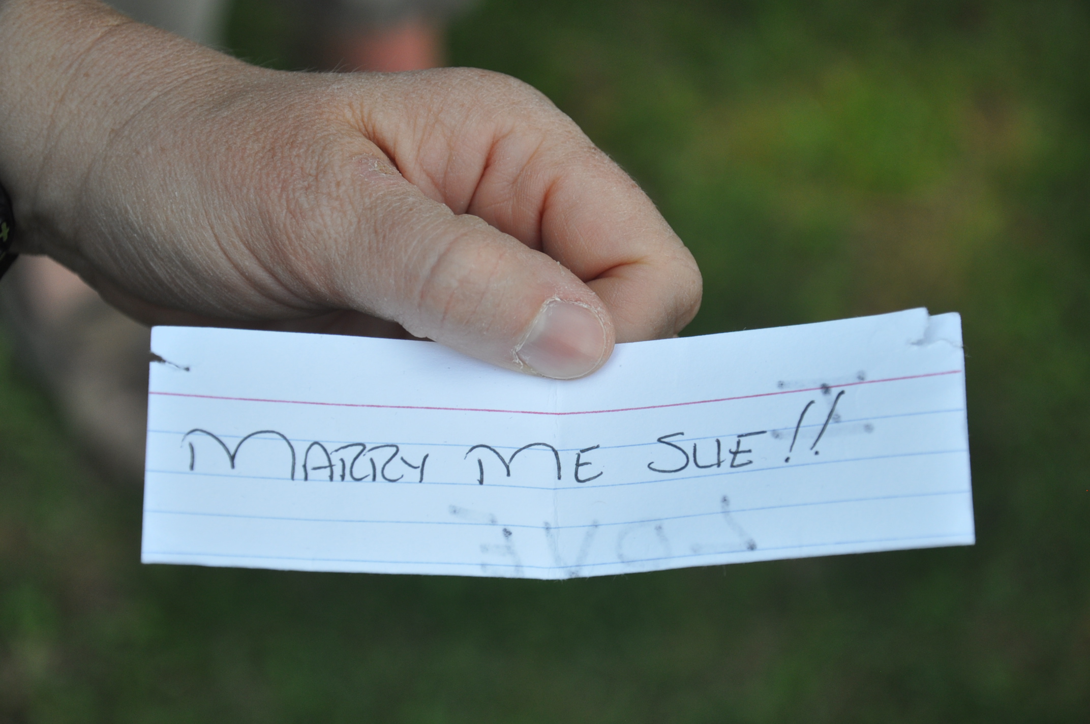
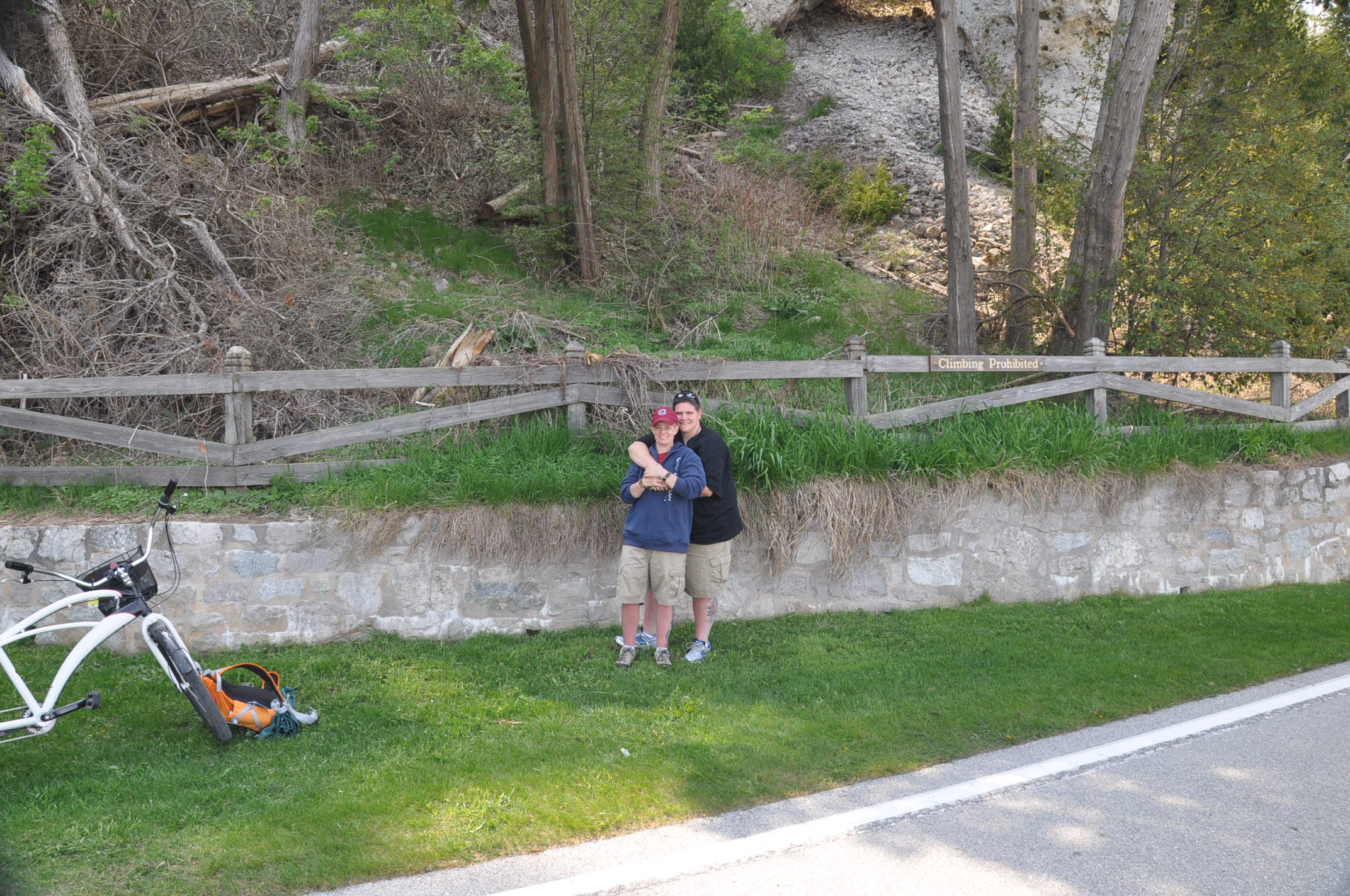
This past summer one of the many logs that I get caught my eye. It was from a team called hiking_duo. They're know in the non-caching world as Misti and Sue. Here's their May 15, 2012 log;
"Tftc caching our way around the island while I looked for the perfect place to propose to the other half of hiking_duo. this was the perfect place!! My future mother-in-law distracted her while my future father-in-law and I looked for the cache container. I signed the log and placed a note in it for my other half...then "forgot" to leave the TB I started here. So the other half goes to put the TB in the cache while I get my camera out and give it to my mother-in-law. While my other half is opening the container with her back to me, I take out the ring and drop to one knee behind her and wait...ever so nervously and patiently....for her to turn around. Of course she said yes, and my mother-in-law was great to take pics for us of the occasion...through teary eyes!! Thanks Mom!! And thanks for the cache!!"
I've heard of other geocachers using a cache site as the place to propose marriage. This is the first time it's happened at one of my caches. The cache that he selected was RAS - Arch Rock Grove which was placed just to the east of this cache's location. I'm so happy for them and wish for them only "Found It" logs. It is in their honor that I'm naming this cache. You will be searching for a small container. Please re-hide as found or better. Please trade fair or don't trade.

I have created, and will up date as needed, a bookmark list called Mackinac Island's M-185 Accessible Caches. Caches on this list are best found while traveling along M-185. I strongly recommend that any cache that is not on this list be found while traveling the roads or trails on the higher elevations in the interior of the island. I have not placed any cache that would require you to scale any steep grade. If you think you need to climb or descend any steep grade, there's a better way to approach from a different road or trail.
I highly recommend picking up an "Mackinac Island Map" from the information booth across the street from the Arnold dock. If the maps are not in the holders on the front of the building, look on the side of the building. For your convenience and planning, you can view or print the PDF file for the Mackinac Island Map. The one available at the information booth is printed on a glossy paper and holds up fairly well when repeatedly tucked in and out of a pocket or caching bag.
For your convenience, I have created some non-geocache waypoints. They are for:
| Name |
Coordinate |
Description |
| Maps |
N45° 50.971
W84° 37.075 |
Mackinac Island Maps at the information booth |
| BathDrink |
N45° 50.994
W84° 37.091 |
In town bathrooms and drinking fountain |
| SEDrink |
N45° 51.200
W84° 36.217 |
Southeast Water Fountain |
| BritishLanding |
N45° 52.656
W84° 38.690 |
Bathrooms, drinking fountain and snack bar |
| UpperArchRock |
N45° 50.971
W84° 37.075 |
Bathrooms and drinking fountain |
| TurtlePark |
N45° 51.571
W84° 37.515 |
Bathrooms, drinking fountain, picnic shelter and a playground |
| GeneralStore |
N45° 51.516
W84° 37.735 |
Harrisonville General Store, limited supplies |
These waypoints can be downloaded as a zipped GPX and a LOC file here. I've provided the coordinates if you would rather type them in by hand. I would love to hear how this works out for you or if you have any suggestions.
I read many of the logs that are posted on my caches, but sometimes I can't read all emails. If you find a problem with any of my caches, please post a "Needs Maintenance" log. Logs of that type are filtered into a special inbox that gets 100% read. Thank you.