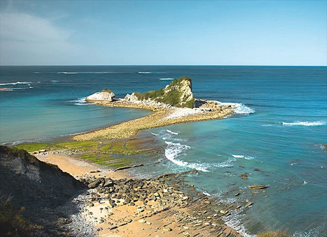
Le tombolo de Loya à marée basse
Cordon de terrain constitué de sable ou de galets, le tombolo se créé naturellement entre une île et la côte avoisinante. L'accumulation de ces sédiments est favorisée par la protection offerte par l'île à l'assaut des vagues et par l'action de la houle et des courants marins.
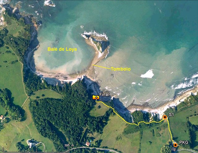
Vue aérienne
Pour atteindre le point final d'observation du tombolo, garez-vous au Parking PKG puis passez par le point S1 d'où vous apercevrez, à marée basse, le tombolo sur votre gauche. Poursuivez alors le sentier en longeant la haut de la falaise sur environ 500m vers le point Final (Final FN). (Ce chemin appelé "Sentier du Littoral" est facilement praticable par beau temps mais très glissant les jours de pluie!!)
Pour valider cette Earthcache vous devrez répondre aux 2 questions suivantes
1) Quelle est la longueur approximative du tombolo?
- Réponse A : 13 m
- Réponse B : 130 m
- Réponse C : 1300 m
La Baie de Loya tire son nom du mot Basque "loya" ou "loia" qui signifie "boue" à cause de l'aspect d'eau boueuse souvent présente dans la baie (voir photo aérienne).
2) Quel est, selon vous, l'origine de ce phénomène?
- Réponse D : une conduite d'évacuation d'eau usagée se déverse dans la baie
- Réponse E : sous l'effet des vagues, les marnes constituant les falaises se désagrègent dans l'océan.
Envoyez-moi simplement vos réponses et loguez-vous en Found-it sans plus attendre.
Nous vous contacterons en cas de problème. N'hésitez pas à poster une photo qui témoigne de votre passage sur les lieux (facultatif)
Bon geocaching !!!
ENGLISH
Located on the Basque Coast between St Jean-de-Luz and Hendaye, at a place called "Loya Bay", a rocky islet is connected to the mainland by a strip of shingle exposed at low tide.
Such a geological formation is called a TOMBOLO. This Earthcache will take you there !
Ground cord made up of sand or pebbles, the tombolo is naturally created between an island and the nearby coast. The accumulation of these sediments is helped by the protection given by the island against the assault of waves and the action of the swell and currents.
To achieve the final point of observation of the tombolo, park at the PKG point then pass through the S1 point where you will see, at low tide, the tombolo on your left. Then continue the path along the top of the cliff about 500m to the Final Point (Final FN). (This path called "Sentier du Littoral" is easily walkable in good weather conditions, becomes very slippery on rainy days !!)
To validate this Earthcache you must answer the 2 following questions
1) What is the approximate length of the tombolo?
- Answer A : 13 m
- Answer B : 130 m
- Answer C : 1300 m
Loya Bay take its name from the original Basque word "loya" or "loia" meaning "mud" is the aspect of muddy waters usually found in the bay (see aerial photo).
2) In your opinion, what is the origin of this phenomenon?
- Answer D : a discharge of wastewater flows into the bay
- Answer E : under the action of waves, clay marls forming the cliffs crumble into the ocean.
Send me your responses and log you as "Found it". We will contact you in case of problem. Do not hesitate to post a photo that reflects your visit to the scene (optional)
Good geocaching !!!