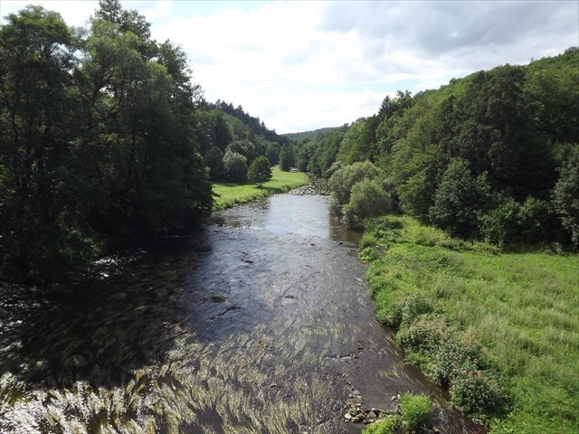
EN: Austrian meadows are located near the village Jamolice, deep in the picturesque valley, which winds through the crystal clear river Jihlava. This valley of the boundaries between the Vysočina Region and the South Moravia Region.
CZ: Na levém břehu nad řekou se nachází přírodní rezervace „Velká skála“, na pravém pak „Bílá skála u Jamolic“ s nádhernými výhledy do okolí a najdete tam také další kešky do Vaší sbírky. Přes řeku nevede v blízkosti most ani lávka, takže na druhou stranu se budete muset jedině přebrodit, hloubka řeky se tady ale pohybuje jen kolem 50 - 75 cm.
EN: On the left bank of the river, is located the nature reserve "Velká Skála", on the right, the nature reserve "Bílá skála u Jamolic" with magnificent views of the surrounding area and you will find other caches in your collection. Across the river near the bridge does not bridge, so on the other hand, you only have to wade it, but the river's depth here is only about 50-75 cm.
CZ: Pokud do tohoto místa budete cestovat autem, odbočíte přibližně v polovině cesty (T1) mezi obcemi Jamolice a Dukovany ze silnice č. 152 na polní cestu směrem ke zřícenině hradu Templštýn. Pokud máte povolení k vjezdu od Lesy ČR s.p., můžete pokračovat vozidlem i dále. V opačném případě zaparkujte na doporučeném místě (PK) a pokračujte pěšky. Na prvním rozcestí (T2) se dáte vlevo a půjdete po asfaltové cestě, minete první odbočku vpravo a na dalším (T3) uhnete z asfaltové cesty na lesní a pak už podle navigace GPS.
EN: If you travel at this point by car, turn about halfway (T1) between the villages Jamolice and Dukovany of road No. 152 on the field road toward the ruins Templštýn. If you have permission to enter from Lesy ČR s.p., you can continue the vehicle even further. Otherwise, the recommended place to park (PK) and continue on foot. At the first crossroads (T2) turn left and walk along the asphalt road, you will pass the first turning on the right and the other (T3) get out of asphalt road to the forest and then by GPS navigation.
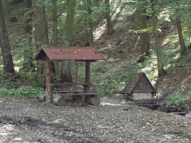
CZ: Keška je malý Lock & Lock box a nachází se v blízkosti studánky „Rakouská louka“ (R1), kde se můžete skrýt před deštěm na zastřešeném posezení nebo se za horkého letního počasí případně osvěžit ledově chladnou vodou ze studánky. Pít ji ale nedoporučuji, rozbor kvality vody bohužel nebyl k dispozici.
EN: The cache is a small Lock & Lock box is located in the vicinity of the well "Austrian Meadow" (R1), where you can hide from the rain in a covered seating area or in hot summer weather or refresh your ice cold water from the well. Drink it but I do not recommend water quality analysis was unfortunately not available.