Getaryggens Dödisgrop
Här ser man en mäktig dödisgrop.
Man kan tänka sig att småsjöarna i området är vattenfyllda dödisgropar, men denna är vanligtvis torrlaggd.
En dödisgrop bildades när ett stort isberg bröts loss från inlandsisen, flöt iväg och strandade i grusmassorna, där det snabbt bäddades in i mer isälvsmaterial (sten, grus och sand som inlandsisen fört med sig). När isblocket sedan smälte bildades en stor grop. De flesta dödisgropar är i dag sjöar, men denna är helt torr.
För 10 000 år sedan började inlandsisen smälta i våra trakter. Stora mängder isälvsmaterial spolades ut ur isen av vertikala isälvar, från isens översida ner mot dess botten. Isälvarna mynnade vid iskanten och mötte där havet.
Isälvsmaterialet sorterades, det grövsta materialet sjönk till bottnen nära iskanten och lättare material hamnade längre bort.

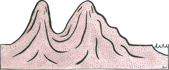
Figur 1. Ett stort isblock har brutits loss från inlandsisen och strandat i grusmassorna. Illustration: Jon Sund.

Figur 2. Isblocket smälter. Illustration: Jon Sund.
Figur 3. En torr dödisgrop har bildats.Illustration: Jon Sund.
För att få logga denna earthcache som funnen måste du :
1. Maila svaret på de följande tre frågorna till cacheägaren. Använd din GPS för att mäta med.
A. Hur stor omkrets har gropen?
B. Hur djup är gropen enligt din gps?
C. Vad är koordinaterna för den lägsta punkten i gropen?
2. Ladda gärna upp ett(eller flera) foton på dig och din GPS vid dödisgropen, det är inget krav men skulle uppskattas mycket!.
[English]
Getaryggens dry kettle.
The kettle hole was formed when a large iceberg broke away from the inland ice, float away and stranded in the gravel masses, where it quickly was embedded in more materia from the ice river (stone, gravel and sand which the inland ice brought with it). When the ice block melted, then it formed a large pit. Most kettle holes are now lakes, but this one is completely dry.
For 10 000 years ago, the inland ice melted in our region. Large amounts materia was washed out of the ice by vertical glacial river, from the top of the ice over the side down towards the bottom. Glacial river culminating at the ice edge, where it met the sea. The glacial river materia was sorted, the coarsest material sank to the bottom near the ice edge and lighter materials ended up further away.
Figure 1. A large block of ice has broken off from the glacier and stranded in the gravel masses. Illustration: Jon Sund.
Figure 2. The ice block melts. Illustration: Jon Sund.
Figure 3. A dry kettle hole is formed . Illustration: Jon Sund.
In order to log this cache as found, you must:
1st Mail the answers to the following three questions to the cache owner.
A. What is the perimeter of the pit?
B. How deep is the pit according to your GPS?
C. What are the coordinates of the lowest point in the pit?
Feel free to upload a photo of you at the pit, it is not required but greatly appreciated!.