It is located in region of Banat, a part of the Pannonian plain bordered by the River Danube to the south, the River Tisa to the west, the River Mures to the north, and the Southern Carpatian Mountains to the east. Banat is currently divided between three countries: Romania, Serbia and Hungary
It is mostly flat and therefore suitable for easy cycling. To arrive here from Belgrade, you must first cross the Pančevo bridge, which have no bike trail, then ride the highway up to Pančevo, which is forbidden, but are generally tolerated. Further from the Pančevo you can ride in several directions, the roads are good without heavy traffic. One direction will be: Crepaja, Debeljača and Kovačica. Then you can ride back a same route, or for an extended route go to Idvor, and through Sakule and Opovo, back to Pancevo.
From Pančevo other direction can be Alibunar and Vršac or Kovin and Smederevo.
Easy ride can spoil the wind, which can blow quite strong, or sun. In the villages there are plenty of trees and usually a nice park where you can rest, but between the villages there are not a single trees, so the sun shines mercilessly.
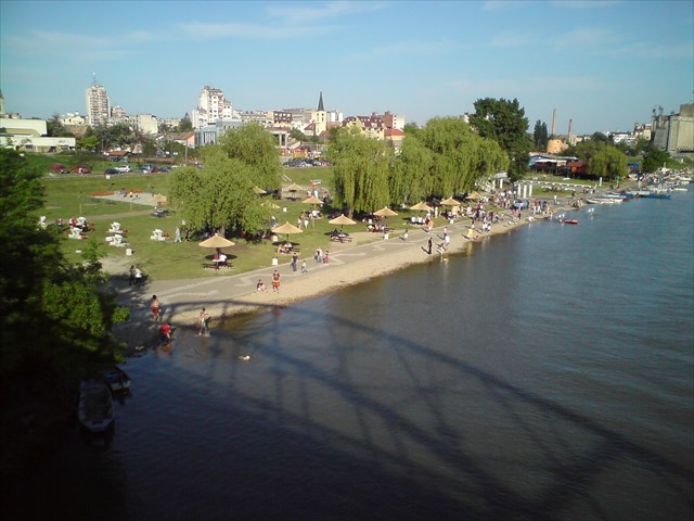
This cache is placed in Pančevo near a Tamiš river, which is used for recreation and picnic. This is micro cache, bring pen with you, please.