[Warning: This listing will probably not fit onto your GPS device, please be sure to plan ahead, print, or check that your device displays everything you will need to fulfill logging requirements. It is a real d4, no joking..]
Coole is a Nature Reserve!

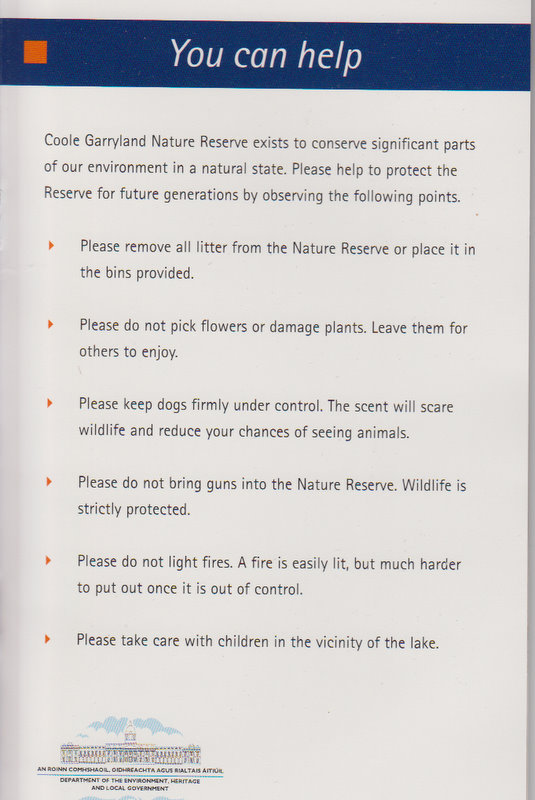
This listing has been officially approved after consultation with the Conservation Ranger and the Regional Manager for the Heritage Office. I am extremely thankful that these listings have been allowed. Now, it is critical that every cacher who comes after them honors the Leave no Trace Principles (as adapted for Geoacaching) and all specific rules of the Nature Reserve. In particular:
- Keep to paths!
- Do not disturb either animals or plants!
- Keep dogs on leash.
- Watch your kids (not at last for their own safety)
About reference points in this listing
Signposted Trails and hardpack roads in Coole
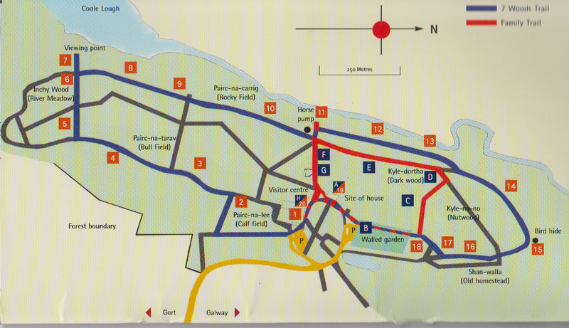
The listing coordinates are just one of several given reference points suitable for exploring the flooding habits of the Coole Turlough. I chose these coordinates as this is also the official scenic viewpoint (unless itself flooded; it might well be flooded in January, exceptionally also in other winter or autumn months).
But do not worry you can fulfill the logging tasks without reaching specifically this or any other of the reference points. The trick is in the fact that the Turlough as a karstic transient lake is itself a moving target, and your task will be to use your GPS to ascertain and share with me the actual extent of the Turlough at the day of your visit.
Descending to the turlough, make use of the advised reference points and do not go cross country, not to upset wildlife. In winter months you will not be able to walk along the turlough as the floodline will reach far into the woods. Walk along the floodline on the hardpack roads (signposted trails) and descend to the turlough to take your GPS readings only where you see existing paths!
Definition of turlough
According to World English Dictionary
turlough [ˈtɜːlɒx] — neutrum
[is] a seasonal lake or pond: a low-lying area on limestone, esp inIreland, that becomes flooded in wet weather by the upsurge ofunderlying ground water
[C17: from Irish tur dry + lough (lake)]
Collins English Dictionary - Complete & Unabridged 10th Edition
2009 © William Collins Sons & Co. Ltd. 1979, 1986 © HarperCollins Publishers 1998, 2000, 2003, 2005, 2006, 2007, 2009
Sounds good?
Maybe, I like the Wikipedia definition better, although they do not give a source for the correction of the common mistaking lach for loch (lough) in turlough
A turlough, or turlach, is a unique type of disappearing lake found mostly in limestone areas of Ireland, west of the River Shannon. The name comes from the Irish "tuar", meaning dry, with the suffix "lach", meaning a place (in an abstract sense). The "lach" suffix is often mistakenly spelled and/or thought to refer to the word "loch", the Irish for lake. They are found in Irish karst (exposed limestone) areas.
Geological Characteristics and Geographic Distribution of turloughs
[I am not giving info on karstic phenomena in general, basic knowledge of karstic processes and phenomena is assumed; you may gain this insight e.g. by doing the Burren Eartcache or the somewhat related Aillwee Cave; the connection is in hydrological significance of Aillwee Cave for the area..]
Although highly interesting phenomenon for earth scientists such as geomorphologists, but also for hydrologists, botanists, and ecologists, it is quite hard to come by scientifically acurate and reliable resources on turloughs online on the Web. The main Irish online resource on turloughs (referenced from Wikipedia) seems to have disappeared from Trinity College Dublin (TCD) webpage. TCD now only features a largely botany driven account of Irish turloughs from 2007.
So that my main online resource is this excellent account on the webpage of the Bath Spa University, by Darrel Watts. Watts features this map of overall (Republic of) Ireland [no NI turloughs on the map] distribution of turloughs 
http://users.bathspa.ac.uk/watd2/Turlough.jpg and this one specific for county Clare [and, actually, South Co. Galway]  http://users.bathspa.ac.uk/watd2/clare_turlough.jpg
Due to lack of online resources, I even bought geological maps by Geological Survey of Ireland, both sheets and booklets pertaining to the karst reqions West of the River Shannon. Even this was a disappointment. After some searching for a proper account of turloughs I only found a general account of a Galway Bay hydrology, where of course turloughs play an important role, and sample description of one of many Gort region turloughs, the Lough Coy turlough in Peterswell: "glaciofluvial sediments capped by laminated clays and white calcareous marl floor [..] there is no surface water in or out-flow." The above described turlough features an estavel, i.e. a two way flooding and draining hole in its bottom bedrock.
Coole turlough belongs to the turloughs of the Gort region, where the hydrological setting is very complex, so that also the turloughs are untypically complex (except for the simple and small Lough Coy).
In general after reading through some scientific accounts, I would say that authorities agree that formation of turloughs has a significant connection with damage to the karst region caused by gliding glaciers during the last Ice Age. The damage by the gliding glacier is deemed to have partially destroyed the natural profile of the karstic area, denuded it, and locally clogged the complex drainage systems including fissures, swallow holes, and caves.
In the terms of flooding and draining means, I would abstract three main types of turloughs:
- simplest and smallest with a single estavel (i.e. flooding and draining hole),
- turloughs with a filling hole or spring and a separate swallow hole
- complex systems including subteranean and partially resurfacing streams and springs, and possibly multiple subterranean connections to other turloughs; Coole Turlough clearly belongs to this category.
The water levels of turloughs are entirely dependent on the levels of groundwater and the draining capacity of the whole region. E.g. the Gort region only drains to Galway Bay through subterranean draining systems (except for some man-made surface drainage built after 1995 to prevent too dangerous flooding). The drainage capacity is limited due to the mentioned clogging, so that groundwater originating from springs (to lesser extent) and (to larger extent) from rain water raises and is forced to resurface largely through turloughs.
Logging conditions
Send the requested answers and data to CooleTurlough@davidf.org. You can also send your answers via curus.lulus geocaching profile, but the required data might be easier attached as separate files than entered manually into a basic mailing form.
You must not put the data or answers into your log. Logs that are not supported with correct answers AND credible datasets within 24 hours will be deleted.
1. Questions to answer
[Answers are to be obtained through 1) reading the long description, 2) thinking of it, 3) investigating the area on maps and in situ, 4) thinking of it again, and finally 5) drawing your own conclusions.
Reading scientific articles, popular information available from the Visitor Centre, and/or the referenced sources might help, but is not necessary for correctly answering any of the below questions.]
a. What is the relationship of Coole Lough and Coole Turlough?
b. Name all sources of water that fill the turlough (generic information, no geographical names needed).
c. How does the turlough drain (one main means, generic)?
d. Why are the tourlough water levels higher in autumn/winter? Can they flood also in spring/summer? If yes, under what conditions?
Data to provide
[Take the GPS readings as close as possible to the current flood line, i.e. ideally "with one foot in the water".] Provide high precision GPS coordinates along the current (at the date of your log) east coast of the turlough, so that the current level of flooding is documented.
Ideally, the data should be presented in a spreadsheet, such as MS Excel or Libre Office calc. Optionally, you can include pictures and visualization of the flood line on a map, such as Google Earth, or a GPX file that can be created e.g. in EasyGPS by simply reading your track and marked points of interest from your GPS unit.
Option 1: In case you have a high precision outdoor GPS device that can get on the day 5m or lesser error due to excellent satellite lock
Take at least 7 simple high precision readings between southernmost and northernmost reference point.
Option 2: In case you cache with a smart phone or car navigation unit or some such
Achieve high precision through extrapolating (averaging) each GPS coordinates set from 3-5 readings; depending on how bad your satellite lock is [3 in case your GPS error is between 7-13m, 5 in case your GPS error is worse than 13m]. As this is obviously much more hassle, I will be happy with 5 resulting readings altogether, instead of 7.
For both options
The distance between reading locations should not be less than 120m but not more than 250m.
Yet, sometimes the flood line will create patterns that would warrant measuring in smaller distances to get an idea of the flooding extent. You should say so, if you take the measurements closer than advised for that reason (altough it should be self evident from visualisation if you provide one).
=============================
I hope that you have enjoyed the Coole Turlough thoroughly, as I have been.. :-)
