At this earthcache you will be able to walk easily from the spring to the delta.
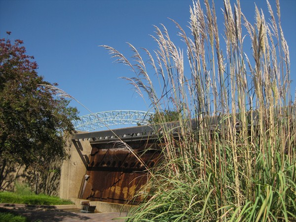
Join the trip along The Riverwalk (It is an exact scale model of the Lower Mississippi River flowing from its confluence with the Ohio River at Cairo, Illinois south to the Gulf of Mexico) and get rewarded with a great view of the river and Memphis Downtown.
The entrance to Mudd Island is free during the regular opening hours:
10:00 a.m.- 5:00 p.m. Tuesday - Sunday (Closed Mondays)
You are free to book additional tours, but these are not necessary to claim credit for this EarthCache.
To reach the area of the model you can use the walkway above the Monorail for free or buy a ticket for an smoth ride.
The Mississippi River
The Mississipi is the largest river system in North America.
Flowing entirely in the United States, rises in western Minnesota and meanders slowly southwards.
Native Americans lived along the Mississippi and its tributaries.
Most were hunter-gatherers or herders, but some such as the Mound builders formed prolific agricultural societies.
The arrival of Europeans in the 1500s forever changed the native way of life as first explorers,
then settlers, ventured into the basin in increasing numbers.
The river served first as barrier – forming borders for New Spain, New France, and the early United States –
then as vital transportation artery and communications link.
In the 19th century, during the height of Manifest Destiny, the Mississippi and several western tributaries,
most notably the Missouri, formed pathways for pioneers partaking in the western expansion of the United States.
The Name:
On May 8, 1541, Spanish explorer Hernando de Soto became the first recorded European to reach the Mississippi River,
which he called Río del Espíritu Santo ("River of the Holy Spirit"), in the area of what is now Mississippi.
French explorers Louis Jolliet and Jacques Marquette, began exploring the Mississippi in the 17th century.
Marquette traveled with a Sioux who named it Ne Tongo ("Big river" in Sioux language) in 1673.
Marquette proposed calling it the River of the Immaculate Conception.
Waypoint 1: Mississippi's watershed N35° 08.993 W90° 03.469 & N35° 09.009 W90° 03.475
At this spot you can see two walls which show a part of the Mississippi's watershed.
Task: From the information on these walls, list the States that form the watershed for the Mississippi River.
Waypoint 2: Memphis Downtown
N35° ??? W90° ???
Find the point were Memphis is located at the model.
Task: if you are standing at the Memphis model area and view to the oposite site of the river you can spot a big sandbank.
Can you see this sand bank at the real river as well? or is it flooded?
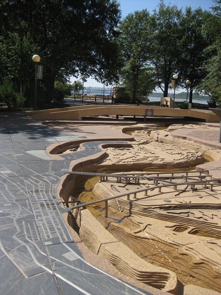
Waypoint 3: the delta N35° 08.757 W90° 03.507
You now reach the point were the river ends it's long journey at the Gulf of Mexico
Task: After how many miles does the journey of the river end?
|
Questions:
1) From the information on these walls, list the States that form the watershed for the Mississippi River?
2) How visible Is the big bank of sand on the opposite river side?
3) After how many miles does the journey of the river end?
4) How many gallons of water are running through the model?
5) Add a picture of you and the Mississippi River to your online log.
Please send your answers to my profile and log online afterwards.
Logs without answering the questions will be deleted by me.
However, they can be posted again as soon as the online log is available.
|
Did you know:
The sport of water skiing was invented on the river (!)
in a wide region between Minnesota and Wisconsin known as Lake Pepin in the year 1922.
The Mud Island - Riverwalk and the escalators at the entrance towards the Monorail
were a part of the final chase in the movie "the Firm" (1993)