Santa Elena Canyon EarthCache
-
Difficulty:
-

-
Terrain:
-

Size:  (not chosen)
Please note Use of geocaching.com services is subject to the terms and conditions
in our disclaimer.
The EarthCache coordinates will bring you to Santa Elena overlook,
where you fill find a covered viewing area and information
panel.
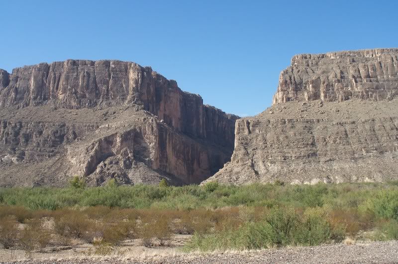
Santa Elena Canyon is one of the most famous landmarks of the Big
Bend National Park. It is visible from over 10 miles away, and can
be seen, if unobstructed, from almost any location in the
park.
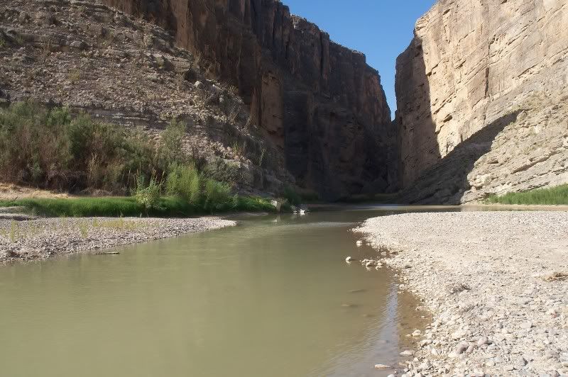
The view at river level gives no clue to the extent of the
canyon-carving. Santa Elena Canyon is 8 miles (13Km) long and 1,500
feet (450m) deep. In some places the canyon is only 30 feet (9m)
wide at the bottom.
The Rio Grande established its present course on basin- filling
sediments that covered the rocks and faults we see exposed today.
The river cut through the surface layers and cut steep sided
canyons in the more resistant Lower Cretaceous limestone. Today you
can see those ancient limestone formations exposed in the canyon
walls.
Once you have gathered the information needed for this EarthCache,
take a short ride down the road and visit the canyon up close. Hike
the trail and view the canyon walls. Examine the many layer of
deposited sediment of the ancient ocean that once occupied this
area. If you look closely you will find fossilized sea life hidden
with in the rocks.
To claim this cache, please provide the following information to
me in a private message, not in you online log.
1) Post a picture of yourself with the canyon in the background
with your online log. (optional)
2) According to the information panel located at the EarthCache
coordinates, how do they describe the Rio Grande’s currents
that carved the canyon?
3) What Geological processes formed the Canyon? (Erosion,
weathering, deposition, volcanic activity, or glacial
action.)
4) Bonus: At the EarthCache coordinates: How many boards
make-up the bench seating nearby.

Additional Hints
(No hints available.)