To the hills! EarthCache
-
Difficulty:
-

-
Terrain:
-

Size:  (not chosen)
Please note Use of geocaching.com services is subject to the terms and conditions
in our disclaimer.
Do not park on the bridge. The road is wide
enough on either side to park for the short period of time
necessary to complete this cache. DO NOT WANDER OFF THE PUBLIC ROAD
OR THE BRIDGE. All of the land on either side including the creek
and the falls is private property and is posted
"No Trespassing". Please respect this.
I will state the requirements needed to
complete this Earthcache first so that you will know what to look
for on your way here. Please email me the answers to the following
questions. DO NOT post the answers in your log or I will be forced
to delete them.
1. How would you describe the land that you see on your way to this
Earthcache?
a) Rich farmland
b) Thin layers of soil with rock protruding through
c) Land strewn with rocks and boulders
d) A combination of some of the above (which combination?)
2. From which direction does the water flow
and is there water currently present?
3. During periods of active rainfall would you suspect water flow
to be greater or less than in the non-hill country and why?
4. Judging by the rocks that you can see and by the degree of
erosion (or lack of erosion) would you say that the rocks present
are predominately limestone or granite?
5. To verify that you were at the site you will need to stand in
the center of the bridge and look to the west. There you will see a
tree to the left of the falls. On this tree there is a sign. What
is written there?
6. Optional, post a picture of yourself or just your GPSr showing
either the falls or the creek. Please do not show the sign in your
photo.
Limestone is a sedimentary rock composed largely of the minerals
calcite and aragonite, which are different crystal forms of calcium
carbonate (CaCO3). Limestone makes up about 10% of the total volume
of all sedimentary rocks. The solubility of limestone in water and
weak acid solutions leads to karst landscapes, in which water
erodes the limestone over thousands to millions of years. Most cave
systems are through limestone bedrock.
Granite is a common and widely occurring type of intrusive, felsic,
igneous rock. Granite is nearly always massive (lacking internal
structures), hard and tough, and therefore it has gained widespread
use as a construction stone. It is highly resistant to
erosion.
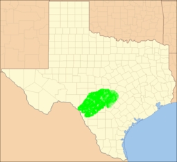
Texas Hill Country is the region of Central Texas that consists of
rugged hills of limestone or granite covered by thin layers of
soil. The area includes portions of San Antonio's north suburbs and
the western half of Travis County ending just west of downtown
Austin. It is bounded by the Balcones Fault to the east and the
Llano Uplift to the west and north. It is the eastern portion of
the Edwards Plateau.
The terrain is comprised of limestone or granite rocks with only a
thin layer of topsoil. This prevents the retention of moisture and
makes the region very dry and prone to flash flooding. Because of
its "karst topography" (Karst topography is a geologic formation
shaped by the dissolution of layers of soluble bedrock, usually
carbonate rock such as limestone or dolomite) the area features a
number of caves (Inner Space Caverns, Natural Bridge Caverns,
Bracken Cave, Longhorn Cavern State Park, Cascade Caverns, Caverns
of Sonora, Cave Without a Name and Wonder Cave). Deeper caverns
form aquifers which are a major source of drinking water for the
area.
The Texas Hill Country is also home to several native Southwestern
types of vegetation, such as various yucca, prickly pear cactus,
and the dry Southwestern tree known as the Texas live oak.
Using the above information as well as your observations traveling
to and while at the site you should be able to complete this
Earthcache. As per Earthcache rules, any log not accompanied by the
appropriate email within a reasonable time period will be deleted.
Have fun and enjoy the area.
Additional Hints
(No hints available.)