El río
Miñor
Forma un
importante valle, al que le da su nombre, el Val Miñor(Valle
Miñor), que es una comarca natural de Galicia. Desemboca en los
lugares de Ramallosa y Sabaris pertenecientes a Nigran y Baiona
respectivamente.
En su
desembocadura hay una marisma declarada espacio protegido por su
alto valor ecologico. Dicha marisma esta incluida en la Red Natura
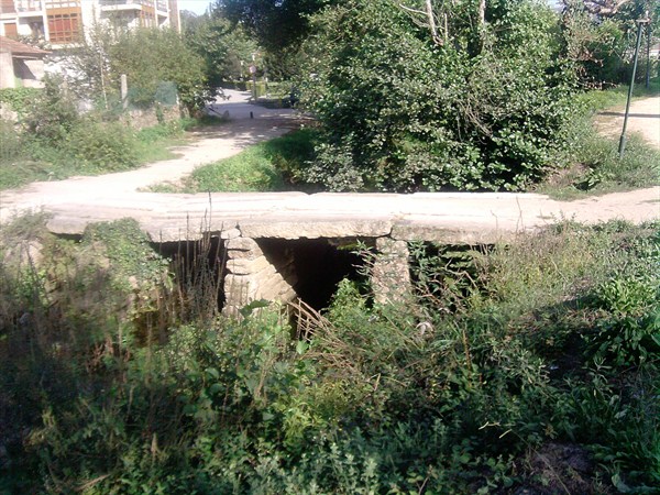
2000. En Ramallosa cuenta con un importante puente del romanico
tardio que une los ayuntamientos de Baiona y Nigran el puente
romano de Ramallosa.
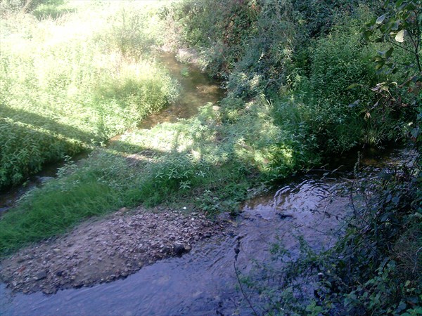
El estuario
del rio Miñor se extiende desde la Xunqueira (Gondomar) hasta su
entrada en la Ria de Baiona junto a la playa de Ladeira. A su paso
por el puente de Ramallosa el cauce se estrecha hasta tan solo unos
60 m de anchura. En su parte mas ancha alcanza los 350 m, y al
final de su recorrido vuelve a estrecharse por causa de la playa
Ladeira justo antes de unirse con el oceano Atlantico, en donde
tiene apenas unos 75 m.
Miñor
River is a small river, 16 km in length. Born in the mountains do
Galiñeiro, 400 m altitude in the municipality of Gondomar, runs
through this and the neighboring municipality Nigrán and Bayonne,
serves as a boundary between them. River also receives water
Zamans, also born in the Galiñeiro. This river has a small
reservoir that provides water to towns of the valley as Gondomar
and Nigrán. Form a large valley, which gives it its name, the Val
Minor (Valley Minor), which is a natural region of Galicia. It
flows in places of Ramallosa and Sabarís belonging to Nigrán and
Bayonne respectively. At its mouth there is a declared wetland
protected area for its high ecological value. this
marsh
is
included in the Natura 2000 network. Ramallosa has an important
late Romanesque bridge linking the towns of Baiona and Nigrán
Ramallosa the Roman bridge. Miñor River Estuary extends from the
Xunqueira (Gondomar) until its entry into the Ria de Baiona near
the beach Ladeira. As it crosses the bridge Ramallosa the channel
narrows to only about 60 m in width. At its widest point reaches
350 m, and at the end of its travel narrows again because of the
beach Ladeira just before joining the Atlantic Ocean, where it has
only about
75m.
THE
CACHE
This cache is intended to show you where they meet the two most
important rivers of Val Minor, in the vicinity is the park with the
ride Corredeira Carlos Casares, linking it to the council. This is
a small container that includes logbook, pencil, sharpener, FTF
certificate and various toys for
children.
Be cautious because it is a fairly busy and try
to leave it well
protected.