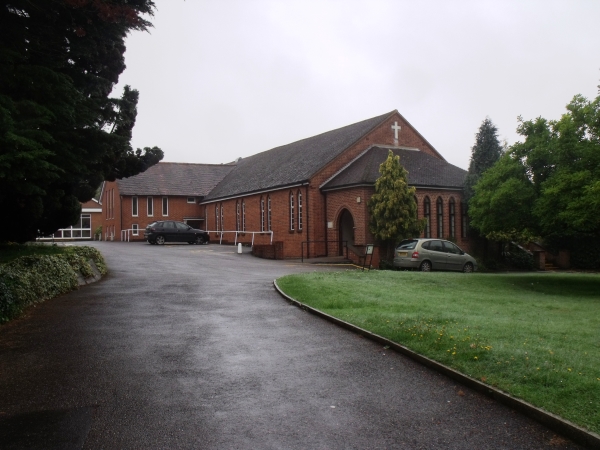
The parish church of St Ann’s is Roman Catholic and is part
of the Diocese of Arundel and Brighton. The church was started in
1930 on a site of a former army hut provided by Father Chrystal of
Epsom. The main church building itself was built in 1954 and is
named after the Virgin Mary. From 1938 for six years, the hut near
the church was used as a school, but the school then relocated to a
convent on Court Road near Banstead High Street. The convent was
shut down in 1991, but the school continued to this day.
There is no cemetery in the church, but a remembrance garden and
hall. The interior of the church is a modern design with a
mezzanine level to cater for more seating space.
There is plenty on road parking on the slip road.
A simple off-set multi where the above coordinates are for a
notice board outside the church.
At the notice board you need to collect some information to find
the cache;
The Parish Priests telephone number; 01737 ABCDEF
The cache is at;
N51° 19.A(C+F)(D-C) W000°
12.(A+C)B(D-B)
Please be careful approaching the cache as it is near a busy
road, so take care of geodogs and geokids. The cache has a log book
but no pen so please bring your own. The final location is on the
same side of the A217 as the church.
If anybody would like to expand
to this series please do, I would just ask that you could let
Sadexploration know first so he can keep track of the Church
numbers and names to avoid duplication
To view the church micro stats page, please click here