Emei Mountain - GE7 EarthCache
-
Difficulty:
-

-
Terrain:
-
Size:  (not chosen)
Please note Use of geocaching.com services is subject to the terms and conditions
in our disclaimer.
Mount Emei (3099m) is one of the Four Sacred Buddhist Mountains of China, and is traditionally regarded as the bodhimanda, or place of enlightenment, of the bodhisattva Samantabhadra. This is the location of the first Buddhist temple built in China in the 1st century. The site has seventy-six Buddhist monasteries of the Ming and Qing period, most of them located near the mountain top. The monasteries demonstrate a flexible architectural style that adapts to the landscape.
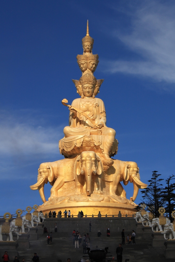
Great spectacles of Mount Emei include the sunrise and Clouds Sea seen from the Golden Summit of the mountain. Difference between peak and plains bellow is incredible 2600 meters, that rise a lot of question about geology of this area.
The late Sinian to early Ordovician (500 million years ago) this area was under the sea. The sediment formed a nearly 1000 m thick carbonate-based dolomite, that is present in Line-Sky, Daping, Hong Chunping and other places. During this period, a large number of low vegetation and animals began the birth of a single cell, and now on the rock near Hong Chunping can be clearly seen the fossilized remains of algae. Later, the crust continues to decline, and the sedimentary formation of sandstone, shale and dolomite about 1000 meters thick were formed. From Sianfong Temple to Xixiang Chi Temple rock formation contains abundant fossils document, trilobites and other fossils.
Early Permian period (about 270 million years ago) Emei Mountain area become again under sea. Sediment layer of carbonate rock with thickness of 400 ~ 500 meters was formed. It is in the Emeishan cliff, Ling Tung and Lei Dongping cliff with preserved corals, brachiopods and winding branches fossil.
Next strong Variscan movement led the area into the fire, which occurred in the mantle base shaking out of the magmatic eruption, covered about 50 million square kilometers, formed after cooling to 400 meters thick basalt, the famous Emei Mountain basalt. Present mainly in the Golden Summit, Wanfo Ding, Buddhas top and Qingyin Pavilion and so on. (by other theories that mass extinctions were caused by meteor or comet impact events).
From the late Permian (250 milion years ago) to early Triassic (180 milion years ago) the sea apperead once again and made sedimentary formation about 1500 meters thick - pebbly sandstone, lithic sandstone, mudstone and so on. At present, the Longmen rock area remains of this period.
Between the late Eocene (about 50 million years ago), the Indian Plate and the Euroasian plate collide, leading to the world's highest mountain Himalayan fold rise. Mount Emei are also exposed to the main east-west compressive stress squeeze. Mountain Emeishan large fault along the fracture surface uplift rapidly, reached an altitude of 2000 meters high. Since that the peak is still slowly increasing, currently about 2 mm per year. Sedimentary rocks on the top of Mount Emei suffer from weathering erosion and other factors of erosion (glaciers, water, air). In the end Emeishan uplift was eroded to a basalt rock, that is very hard and its weathering is very slow.
To claim this earthcache you have to go to the Golden peak and descent to one of view posts. You can look 2600m down to the plains, but notice the rock around too.
Please send me via email the answers to the following questions
1) What rock you can see around?
2) What type is this rock (sediment, igneous or methamorphic)
If you look back at the Golden summit, you will see in front of you outcrop with two Chinese characters.
3) Estimate the height of the outcrop.
Below it you can see small columns of this rock.
4) What is the diameter of this columns? What is its origin?
峨眉山(3099m)是中国四大佛教名山之一,是中国传统的菩提道场。1世纪时,中国修建的第一个佛教寺庙便在这里。峨眉上共有76座明清时代的寺院,其中大部分都修建在山顶附近。这些寺院都具有非常独特的造型,且和地形相辅相成。
峨眉山金顶上的日出和云海是其最有名的风景。山顶和平原之间的垂直距离达到了惊人的2600米,这给我们抛出了很多关于这里地形地貌的问题。
晚震旦系至早奥陶系之间,这里还是一片海洋。海底沉积物形成了约1000米厚的碳质白云岩,在一线天、大坪寺和洪椿坪等地都有出露。在这段时期,大量的单细胞动植物出现,我们可以在洪椿坪附近的岩石上清楚地看到很多藻类化石。然后,水平面继续下降,1000米厚的砂岩、页岩和白云岩沉积成露出水面。仙峰寺和洗象池之间的岩石中含有丰富的化石遗迹,三叶虫和其他的化石。
早二叠纪时期(大约两亿七千万年前),峨眉山又沉入了海底,并再次沉积了约400至500米厚的碳酸盐岩。雷洞坪崖壁上保留了很多珊瑚以及腕足类的化石。
著名的海西运动中,地幔喷发出来的岩浆将整个峨眉山覆盖了五千万公里,并堆积了400米厚的玄武岩,这就是著名的峨眉山玄武岩,主要出露于金地、万佛顶、清音阁等地。(也有其他理论认为大灭绝是由小行星或彗星撞击地球造成的)
晚二叠纪(两亿五千万年前)至早三叠纪(一亿八千万年前)之间,海洋又再次出现了,并又沉积了约1500米厚的砾质砂岩、岩屑砂岩、泥岩等。现在,龙门峡地区的岩层即为那个时代沉积形成的。
晚始新世时期(大约五千万年前),印度洋版块和欧亚大陆版块发生冲撞,并产生了喜马拉雅山脉和世界最高峰——珠穆朗玛峰。峨眉山同样也位于该东西挤压褶皱带上。沿该断裂面上的峨眉山大断层迅速升高,达到了海拔2000米以上。从那以后,峨眉山仍然以每年2mm的速度在升高。峨眉山顶的沉积岩受到风化和其他作用(冰川、水流、空气)的影响出现了严重侵蚀,以致很难被风化的坚硬玄武岩露出地表。
要拿到这个Earthcache,你必须攀上金顶,然后去到其中一个观景处。你可以从那里展望2600米以下的山下风景,但是请务必也留意你身边的各种岩石。
请通过Email把以下问题的答案发送给我
1)你附近都是一些什么岩石?
2)这些岩石属于什么类型(沉积岩、火成岩、变质岩)?
如果你回头,你可以看到金顶附近的露头上有两个中国人
3)估计一下这个露头的高度
在露头的下面,你可以看到一个由这种岩石构成的小柱子
4)这个柱子的直径是多少?这个柱子是怎么来的?
Additional Hints
(No hints available.)