On the side of the marker is a small plaque with a three digit number. To validate that you have the right number, the digits will add up 11.
A = The last digit minus first digit
B = The second digit
C = The second plus third digit
D = Last digit
The final cache is located at: N40° 20.B0D W074° 26.ACC
Bethel Indian Town.
Warning History Below, you might learn something.
Welcome to Bethel, located in Thompson Park, Monroe, NJ. Bethel was often simply referred to as the "Indian Town", but Bethel was really missionary community that helped build the relationship between Native Americans, Christian missionaries, and colonists. Founded by John Brainerd, Bethel ended up being a stepping stone to the Brotherton Reservation in Burlington County.
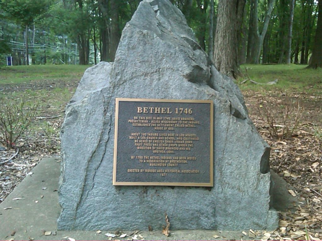 There is some debate on the exact location of the village, but what has been documented is that for twelve to fourteen years, Delaware Indians lived in a community located along the Manalapan River. Approximately forty homes, a church and a schoolhouse were built nearby and over 80 acres of farmland was cultivated by the residences. While many 18th century artifacts have been found in the area, most of these are common to European settlers.
The debate really heated up during the construction of the new Monroe high school, which is about one mile south of this site. Some Native Americas staked claims that the area where the high school was to be built was their land and the politicians claimed that the location of Bethel was else where in the park. From tax and property records, it is know that Bethel was located at the headwaters of Wigwam Brook, on the Falconer Tract, which is the area around the Jamesburg townhall.
Bethel Indian Town was situated on the road from Freehold to Princeton, between Englishtown and Cranbury, approximately eight miles from Rev. Tennent’s church in present-day Manalapan. The tract of land was five hundred acre tract that was secured to the Delaware Indians. Rev. Tennent frequently visited Bethel village in the morning and return to his own church by the afternoon. He wrote in detail about his service at the Bethel and it's location. In 1765, after Brainerd and the Delaware Indians abandoned Bethel and movedto the Brotherton Reservation in Burlington County, Lewis MorrisAshfield’s advertised the five hundred acre tract for sale. It is from letters written by Tennet that; land was for sale was the location of Bethel and confirms that the village was to the north of this marker.