Skip to content

ROTEIRO ETNOGRAFICO DE ZAMANS Traditional Cache

This cache has been archived.

SUFRIDORES CELESTES: Por motivos personales, en estos momentos no podemos hacer su justo mantenimiento y decidimos el archivamiento. Gracias por vuestras visitas
💙💙 saludos Celestes 💙💙

More
Hidden : 5/21/2011
Difficulty:
3 out of 5
Terrain:
1.5 out of 5

Size: Size:   small (small)

Join now to view geocache location details. It's free!

Watch

How Geocaching Works

Please note Use of geocaching.com services is subject to the terms and conditions in our disclaimer.

Geocache Description:


La parroquia de Zamáns, situada en el sur del ayuntamiento de Vigo, a los piés de los montes do Galiñeiro, recibe su nombre del río que la cruza. Con las cotas más altas de todo el valle de Fragoso, con 705 metros de altura, limita por el norte con las parroquias de Valadares, Beade y Bembrive, y con los ayuntamientos de Mós, o Porriño y Gondomar por el este y sur.

Segun los datos de los censos recientes es la parroquia con menos habitantes de Vigo, con 761 vecinos y vecinas.

Esta ruta forma parte del antiguo camino real que unia las poblaciones de Vigo y Tui, que actualmente se llama camino do regueiro do forno, parte del camino antiguo se encuentra sumergido en el embalse
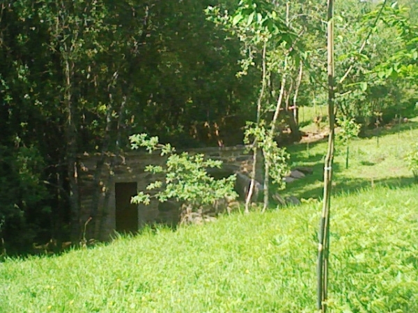


EL CACHE

Situado en un ambiente natural, se esconde tambien en algo natural, olvidaros de piedras o de muros, se intentó tomar la medida lo mas próxima posible y llevó varios intentos y triangulaciones, debido a la gran cantidad de árboles, al final puede haber un error de + - 2 metros, una vez descubierto volver a dejarlo como estaba asegurando que queda bien sujeto.

El contenido inicial: lápiz, sacapuntas, logbook, certificado FTF y pequeños juguetes para los peques.

Espero que os guste el recorrido y no os quedeis dormidos como unos “tronquitos”


Zamans Parish, located in the southern city of Vigo, at the foot of the mountains do Galiñeiro, named after the river running through it.

With the highest peaks around the valley Fragoso, with 705 meters high, bounded on the north by the parishes of Valadares, Beade and Bembrive, and the municipalities of Mos, or Porrino and Gondomar in the east and south.
According to the latest census data is the least populated parish of Vigo, with 761 neighbors.
This route is the old highway that linked the towns of Vigo and Tui, which is now called Regueiro way do do forno, part of the old road is submerged in the reservoir


THE CACHE


Located in a natural environment, it also hides a natural thing, forget you stones or walls, we tried to take the measure as close as possible and it took several attempts and triangulations, owing to the large number of trees, in the end may be an error of + - 2 meters, once discovered, leave it as it was re-assuring that it is secure.
The initial content: pencil, sharpener, logbook, certificate FTF and small toys for children.
I hope you enjoy the journey and do not stay asleep like some "chunks"


Additional Hints (Decrypt)

RA RY HYGVZB NEOBY QBAQR FR WHAGNA YBF QBF EVBF VA GUR YNFG GERR GBTRGURE JURER GUR GJB EVIREF

Decryption Key

A|B|C|D|E|F|G|H|I|J|K|L|M
-------------------------
N|O|P|Q|R|S|T|U|V|W|X|Y|Z

(letter above equals below, and vice versa)