RW B48 - Strebersdorf Traditional Cache
-
Difficulty:
-

-
Terrain:
-
Size:  (small)
Related Web Page
Please note Use of geocaching.com services is subject to the terms and conditions
in our disclaimer.
Ein schneller Tradi am Radweg B48 in Strebersdorf.
A fast tradi at the bicycle route B48 in Strebersdorf.
Der Radweg B48 verläuft von Oberpullendorf bis zur ungarischen
Grenze nahe Lutzmannsburg.
Er verläuft meist den Stoober-Bach entlang und ist 14,7 km lang.
Der Weg verläuft über eigene Radwege oder wenig befahrene
Nebenstraßen.
An dieser Stelle nehmen der B48 und der B47 die selbe Route.
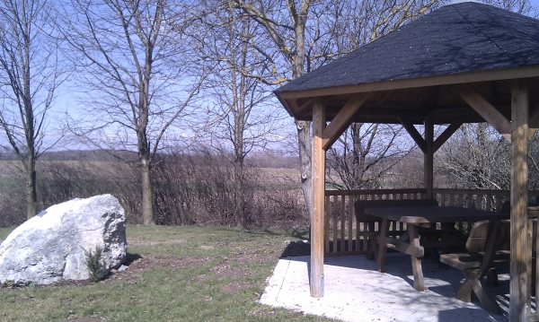
Nahe den Koordinaten findet sich eine Laube, in der man (vor allem im Sommer)
eine Jause machen kann.
Die Dose ist eine Filmdose mit einem Logbuch (bitte Stift mitbringen).
English:
The bicycle route B48 runs from Oberpullendorf to the Hungarian
border near Lutzmannsburg.
Mostly it follows the Stoober-River and is approx.14,7km long. The
route takes its course either on specific bicycle paths or on
secondary roads with low traffic.
At this point the B48 and the B47 take the same route.
Near the coordinates there is a pergola where you can have a snack(above all in summer).
The cache is a film container with a logbook (please bring your
own pencil).
Happy Caching!
Additional Hints
(Decrypt)
Q: Eözvfpurf Zvyvgäeyntre, yvaxf hagra, Fgrva, fvrur Ovyq
R: Ebzna zvyvgnel pnzc, yrsg ng obggbz, frr cvpgherfgbar