
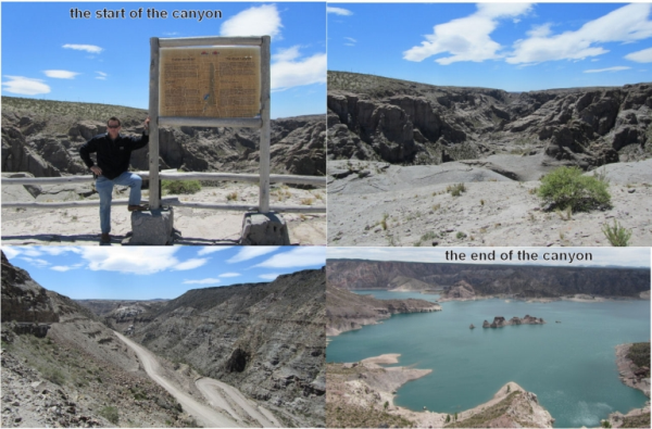
Cañon del Atuel
El Cañon se formo por la accion de Rio Atuel durante millones de a años. Su basamento de tiempos precambricos fue cubierto por sedimentos de periodo Devonico, Carbonifero y Permico, entre 400 y 250 milliones anos atras.
Los fenomenos volcanicos durante el Triasico y el Cuarernario terminaron por delinear su composicion. El rio, con la ayuda del viento y las lluvias se encargaron de esculpir la roca y dar forma a este paisaje de millones de anos.
Rio Atuel
El rio Atuel en la laguna del mismo nombre y corre hacia el sur hasta el Cerro EL Sosneado desde donde toma direccion SE. Cerca de Malargue recibe al Salado que es su principal al luente. Asi llega hasta El Nihuil, penetrando luego por el Canon del Autel.
Es un rio de caracteristicas netamente cordilleranas de regimen nival, paco caudaloso, pero torrentoso. Ha sido aprovechado en su curso medio con la construccion de Presas y Cantrales hidroelectricas para regular los derrames naturales, controlar las cercidas, aprovechar la energia de los saltos, y mejorar la red de riego.
Preguntas:
1.Nombre de la época en que el cañón fue creado?
2.Cual longitud tiene el Cañon del Atuel, en kilómetros.
3.Cual es la altura máxima del Cañon del Atuel en metros?
4.Si usted desea, puede colocar una foto con usted y el GPS..
Para responder las preguntas, por favor, envíeme un email a Navigator111@freenet.de. Suerte!
English:
The Atuel Canyon
The Canyon was formed by the action of the River during millions of years. Its basin of precambrian times was covered by sediments wich belong to the Devonian, Carboniferous and Permian periods, between 400 and 250 million years ago.
During the Triassie and the Quatenary periods some vulcanic phenomena outlined its geological composition. The river , together with the wind and rain, managed to carve the rock and gave form to this landscape of million of years.
The River
The Atuel river is born in lagoon of the same name and runs south until El Sosneado hill, where it turns south-east. Near Malargue it receives the Salado river, its main affluent. Then the Atuel river arrives to El Nuhuil before going into the Atuel Canyon.
The Atuel has the characteristics of a mountain river, it has show regime, it os torrential but with a low volume of water. Men have taken advantage of its medium course with the construction of dams and hydroelectric power stations, to regulate the effects of the natural spills, control swellings, use the energy of the jumps and improve the irrigation network.
Questions:
1. Name of the era in which the canyon was created?
2.Which length has the Atuel Canyon in kilometers?
3.Which is the maximum height difference of the Atuel Canyon, in meters?
4. If you like you can a photo of you and your GPS set with the information board in the background.
To answer the questions, please send an email to navigator111@freenet.de . Good luck!