Million Dollar View (Rock Dunder) EarthCache
Million Dollar View (Rock Dunder)
-
Difficulty:
-

-
Terrain:
-

Size:  (other)
Please note Use of geocaching.com services is subject to the terms and conditions
in our disclaimer.
My
inspiration for this cache:
Every since I started caching in 2008, I've had many interesting
geocaching experiences and have been taken to spots that have
simply amazed me. However, on October 10th, 2008, my geocaching
life was changed forever, for that was the day I did Yorkshire's
"Dunder Thunder" (GCXF76). I couldn't believe the view up there and
the beautiful hike up to Rock Dunder was amazing, it was at the
time and remains now, my favourite cache of all time. It really
personifies what a perfect caching experience should be. It's not
just about the cache, but about getting to the cache and being
introduced to something you've probably never seen before. I have
since made the climb to Rock Dunder about 15 times with family and
friends, getting excited each time I go in anticipation of what
that experience will bring. So today when I went for hike #16, I
decided that this would be a perfect spot for an Earthcache, given
all the obvious geology around.
The geology and things you may want to
know about Rock Dunder:
Rock Dunder is shown on some geological maps as a
pluton. On others it is part of a much larger igneous feature
termed Lyndhurst granite. But beyond definition, Rock Dunder is a
remarkable formation of beautiful pink granite. It took form deep
in the roots of the Grenville Mountains that a billion years ago
towered over this part of Laurentia. We can call this core of our
continent the Canadian Shield. These massive snow-capped ranges and
deep unforested valleys once extended north-east to present-day
Labrador and south-west to Kansas. In fiery ovens deep beneath
those mountains, plutons such as Westport Mountain and Rock Dunder
were formed, their mineral recipes were baked. Earthquakes in
Indonesia remind us that mountains are still being heaved up when
and where the plates of our planet’s thin crust jostle and
collide. Volcanoes erupt on land and beneath sea. Plutons are
forming within the crust as they did a billion years ago.
Conversely wind, water and ice eternally wear mountains down even
to their very cores. The Ice Ages of the Pleistocene Epoch occurred
within the last mere million years of our planet’s history.
That choreography of ice did much to sculpt Rock Dunder’s
ancient and hard pink granite into its present shape on the Rideau
Cataraqui landscape. Indeed, several great advances of continental
and alpine glaciers occurred during the Pleistocene across the
higher latitudes and altitudes of North America and all other
continents. These advances were interspersed with interglacial
phases; millennia of climate much like the present. Our most recent
Ice Age (the Wisconsin) seems to have begun about 100 000 years
ago. Shorter summers failed to melt all the winter snow that fell
on the highlands of Quebec and Labrador. Delicate snow flakes
packed into layers of bluish ice along with bubbles of air, grains
of pollen from distant flora, particles of ash from volcanoes and
forest fires half-the-world away. When annual layers of ice
accumulate to a depth of about 50 metres, a glacier is born. It
starts to flow under its own weight like icing on a cake; oozing
and sliding outward and/or southward a few metres to several
kilometres per year. From Northern Quebec and Labrador, the
Laurentide Ice Sheet crept south into the St. Lawrence Valley,
across eastern Ontario and as far south as New York City.
To the west, the Laurentide teamed up with the continental ice
sheet that was spawned on the highlands of Keewatin. Together, they
bulldozed as far south as Wisconsin. Like Caesar’s army, the
Wisconsin Ice Age came. It conquered. It melted away. It melted
from its gravels and boulders piled on New York’s Long Island
about 12 000 years ago. About the same time it melted from the
bouldery moraines it had bulldozed onto Wisconsin. It finished
face-lifting Rideau country roughly 10 000 years ago. It melted out
of Hudson Bay about 5 to 3 millennia ago. You and I are helping its
disappearance from the Arctic now.
The Wisconsin Ice Sheet was not only composed of layers of ice. It
carried in its sole fragments of rocks picked up as it slid
southward; fragments as tiny as clay platelets; boulders as big as
your house. Some fragments were very hard, like pebbles and
boulders of quartzite that could survive hundreds of kilometres of
transport and grinding. Some diamonds from Inuit lands of the
present were exported to the northern U.S.A. Soft soapstone did not
survive the trip.
Here in Rideau country, glacial flow was from north-east to
south-west. Coincidentally this was the same orientation as the
ranges, valleys and roots of the Grenville Mountains of a billion
years ago. The Wisconsin Ice Sheet was 2 to 5 kilometres thick. It
oozed across the countryside, flowing around and even up and over
mere rocky obstacles like the hard granite of Rock Dunder.
Conversely, the soft skarn beneath nearby Morton Bay was gouged and
deepened. Murphy Bay on the Big Rideau and most local bays and
lakes were gouged and deepened, north-east to south-west. Canoe
Lake and Loughborough Lake are fine examples of long, narrow lakes
sculpted by the ice sheet. The fabled Finger Lakes of New York
State became the ancestral waters and shores of the Iroquois. If
such deep and narrow basins were adjacent to a sea or an ocean,
they would be filled with salt water rather than fresh water. They
would be called fjords like you would see along the coasts of
Norway, Labrador and the west coast of Newfoundland.
The Wisconsin Ice sheet oozed over the hard granite of Rock Dunder
like a massive sheet of sandpaper. It polished the north-east
(stoss) end and its flanks. In some places, hard rocks in the sole
of the ice sheet chipped half-moon shapes in the granite, crescents
called chatter marks, notes in the “sole music” of the
Ice Age. At Dunder’s south-west end something quite different
happened. Even the hardest of granite has cracks called joints,
some very visible, some microscopic. As the ice sheet made its way
over the lee end of Dunder, it tugged and pulled on these lines of
weakness much the same as you might fan a deck of cards with your
thumb. Blocks of Dunder’s hard pink granite were pulled away
by the oozing ice and were then used to gouge and polish more
southerly lands. This left the south-west end as a very sheer cliff
many metres high.
Cliffed at the lee end, gently polished at the stoss end; these are
features of a glacial landform called a roche moutonnée; a
“stone sheep” in French. Rock Dunder is one heck of a
big sheep! And a pink sheep at that! Maybe the term came about
because flocks and shepherds found refuge from cold winds and
blizzards sweeping down Alpine valleys. Maybe the cliffed lees of
roche moutonnées were giant motherly ewes of stone. Indeed, at the
base of the shear south-west end of Rock Dunder we discovered, not
sheep but an amazing ecosystem. Here trees and smaller plants
typically found far to the south are protected from cold north
winds and nurtured with extra warmth by sun’s energy
re-radiated from its granite backdrop. In this tiny Garden of Eden
we found American Linden trees at the very northern limit of their
habitat. On the opposite or north-east end of Dunder, more exposed
to wintry north winds and more oblique to the sun’s rays, we
found trees and mosses typical of more northern latitudes. This
tells of the incredible biodiversity to be found on every hill,
every island in Rideau country.
The Earthcache, the hike and what you have to tell CZ to get a
smiley:
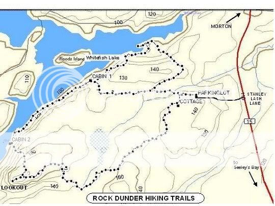
So you've made your way to Morton, found the
entrance to the parking area and are ready to go for a hike. There
are a few things you should know before committing yourself to the
task. The distance from the trailhead sign to Rock Dunder is
about 1.5 kilometers as the crow flies, however as the trail goes,
it's going to be a little further. There are maps and a trailguide
at the trailhead sign that will assist you, but the north trail is
very well worn and marked. There are two trails to take you to the
top, but I'd suggest staying to the right and taking the north
trail. It's very scenic, offering great views of the water on the
way up. There are also multiple benches for resting and two cabins
on the way up to take a break as well.
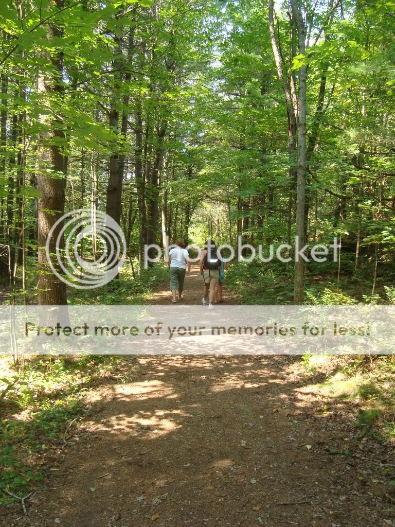
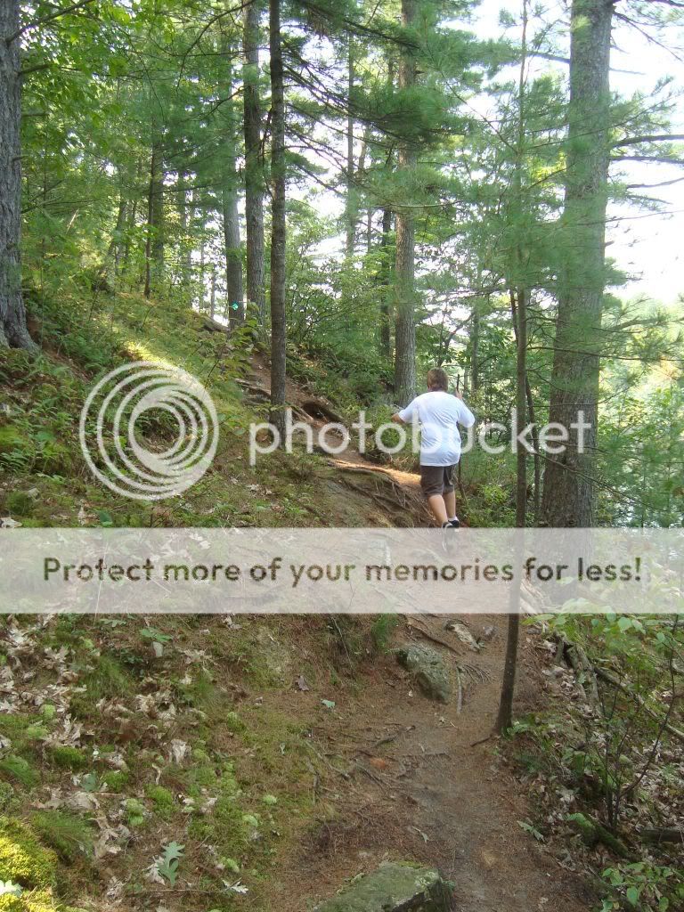
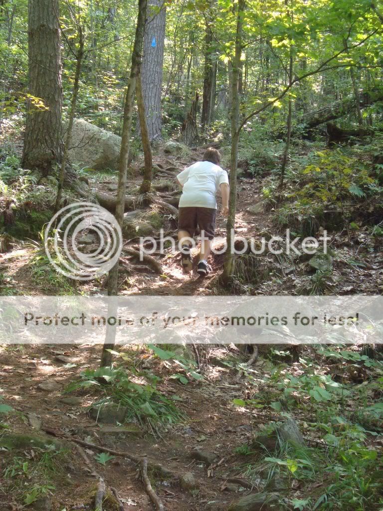
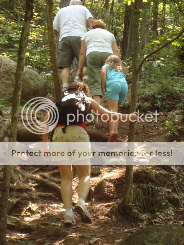
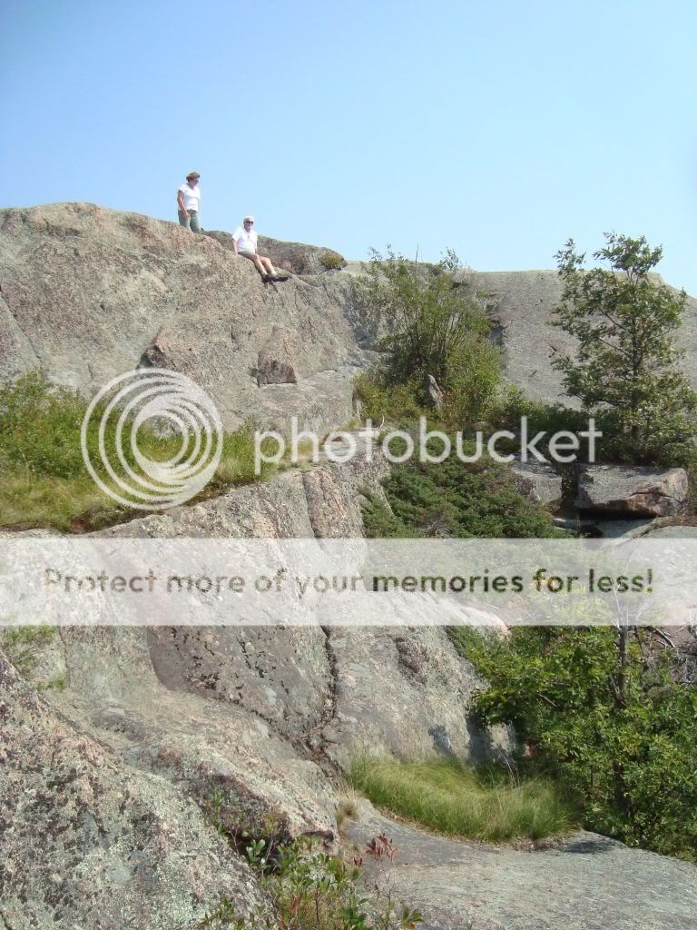
The trail starts out fairly flat and becomes a little more rolling
the closer you get to the water. I would suggest parents with young
children monitor their young ones along this route as there are
spots that have steep drop offs if you get off the trail too far,
however, I have taken my children here since they were 7 and 9 and
we've never had any problems. You will find the trail becomes
somewhat more rolling when you get past the first cabin, but again,
my 65 year old father has done this trail with me several times and
has done fine. The trail starts to go "up" significantly after the
second cabin, but again, nothing that requires special equipment
and for the most part you will remain on two feet and not require
the use of your hands to pull you up a rock. After this brief, but
energizing section is completed, you need only walk through some
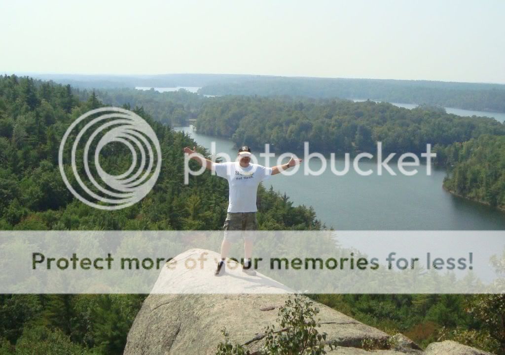
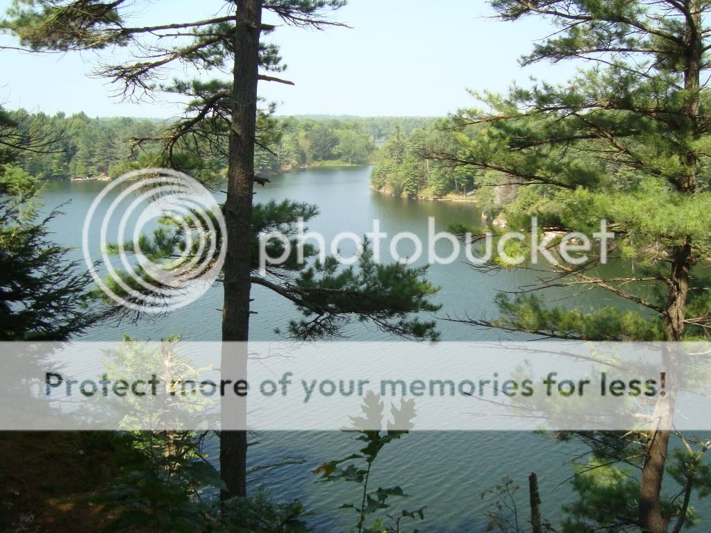
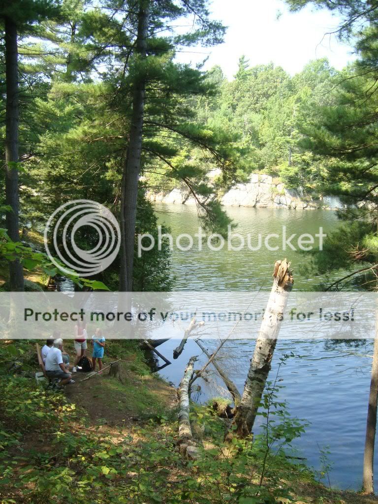
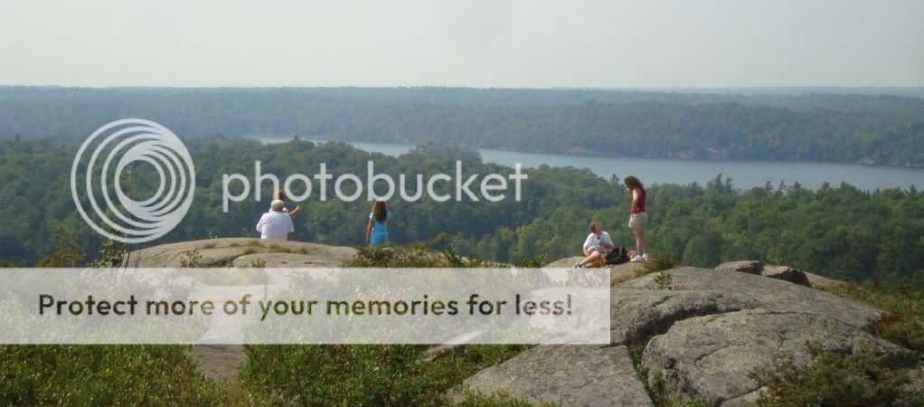
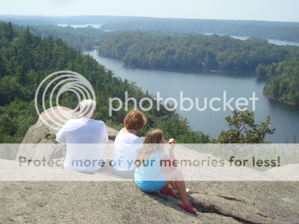
scrub brush and you'll be at the one of the most amazing views in
this part of Ontario. You'll be close to 300 feet over Morton Bay
with a view that will take your breath away. You'll see Turkey
Vultures flying overhead and boats traversing the water (if you do
it it summer) way down below. Again, my suggestion is for people
that have little ones is to keep an eye on them around here. There
are plenty of spots to sit and enjoy the view far from the edge and
safe for curious little ones.
Now just take a deep breath and enjoy the total awesomeness of this
spot, it's truly awe inspiring and I promise, you'll love this spot
forever as I do.
Now that you've made it up here, what will I have you do? Well if
you look around, you'll see a variety of different glacial
formations here, but I'm only going to ask about a few, here's what
I want. Please send send me these answers to my geocaching.com
address and please don't post them or any spoiler pics in your
cache log or your log will be deleted. Now, on to your tasks:
#1: At N 44 31.669 W 076
13.118 or Glacial Feature
#1, please tell me what you're seeing in the rock. It's
bigger than a wheel, but smaller than a car.
#2: At N 44 31.612 W 076
13.139 or Glacial Feature
#2, please tell me what those marks at your feet are
called.
#3: At N 44 31.921 W 076
12.190 or The Trailhead
Sign, take a measurement of
your elevation above sea level, this can be in meters or feet, then
when you get to N 31.577 W 076
13.191 or The Million Dollar View, take another measurement of your elevation and tell me
the difference in meters or feet.
#4: Take a picture of yourself or your gpsr (if you're shy) at the
top of Rock Dunder and either send it to me via e-mail or include
it in your log entry.
I hope that this Earthcache will have taught you something about
our local geology and given you some positive memories that you'll
have forever. As with all CZ caches, the most important thing is to
have fun and be safe, please do both here.
Additional Hints
(No hints available.)