de boersberg EarthCache
-
Difficulty:
-

-
Terrain:
-

Size:  (other)
Please note Use of geocaching.com services is subject to the terms and conditions
in our disclaimer.
de boersberg
De Boersberg.
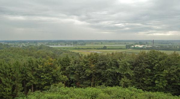
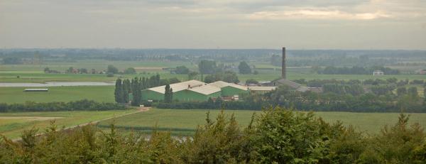
Je bevindt je hier op een prachtige locatie. Voor je zie je de rivier Nederrijn stromen en achter je liggen de bossen van de Veluwe. In de verte is bij mooi weer zelfs Nijmegen te zien.
Dat je hier hoog over de rivier uitkijkt komt omdat de berg waar je hier opstaat tijdens de ijstijd is opgestuwd. Grote ijsmassa's duwden het zand voor zich uit en zo ontstonden deze zogenaamde stuwwallen. Toen het ijs weer smolt, en het water naar de rivieren stroomde, onstonden allerlei beken, droge dalen en hier en daar ging het zand ook weer verstuiven. Waar de rivier de Rijn langs de stuwwal stroomde ontstonden steile wanden. Daardoor is een met hoogte afwisselend terrein ontstaan. Dit soort hoge plekken met goed uitzicht hebben altijd al een grote aantrekkingskracht gehad op mensen. Al duizenden jaren lang hebben mensen in de gate gehad dat het slim is om juist hier nederzettingen, dorpen en kastelen te bouwen. Je hebt water, vruchtbare akkers, droge gronden voor als het water steigt en voldoende zicht op eventuele naderende vijanden.
Voor de moderne mens speelt dat natuurlijk niet meer zo. Wel is deze plek met z'n unieke overgang van de hoge heuvels, de beken en de rivier, al sinds de tijd van Napoleon een favoriete plek voor recreanten.
De cache.
Om deze cache te loggen moet je een aantal vragen beantwoorden en een foto van jou met je gps maken bij of op de uitkijktoren. De antwoorden kun je vinden op het informatiebord, voor en op de uitkijktoren. De antwoorden kun je via mijn profiel opsturen, en de foto kun je bij je log plaatsen. Logs zonder goed antwoord of zonder foto worden verwijderd.
Vragen:
* Hoe hoog is volgens het informatiebord de Boersberg?
* Wanneer mag je de uitkijktoren niet beklimmen?
* Hoever is het naar Beuningen?

Englisch
.
De Boersberg. You are here on a magnificent location. In front of you you see the river Nederrijn and behind you are the woods of the Veluwe. When the weather is bright you can see Nijmegen.
You can see the river from a high point because the mountain where you're standing on was in the Ice Age stowed. Large parts of ice squeezed up huge river deposits of sand, gravel and clay. The lateral moraines remained. The melting water made its way to lower-lying areas, washing away part of the lateral moraine in some areas, forming hollows and gorges. Along the river Rijn steep walls where formed.
This type high spots with good view has always had a large attraction on people. For thousands of years people knew it was good to built here settlements, villages and castles. You have water, fertile lands, dry ground as the water rises and you have sufficient visibility on possible approaching enemies. In these modern times it's less important. However, this spot with it's unique passage of the high hills, the creek and the river, already was favorite spot for recreation in times of Napoleon.
The cache.
To log this cache, send a mail to the owner of this cache with the distance and the 2 answers to the questions. Also include the picture (with you and your gps at the watchtower) in your log. You can find the answers on the information board, in front of watchtower and on the watchtower. Logs without the right answers or without the picture will be removed.
Questions:
* How high is de Boersberg according to the information board?
* When is it not allowed to climb the watchtower?
* What is the distance to Beuningen?
Additional Hints
(Decrypt)
Fgnngfobforurre vf bc qr ubbtgr ina qr irezvffvat ina urg vasbobeq, urg nagjbbeq vf bbx gr ivaqra va Tbbtyr.
Iennt 2: ybtvfpu anqraxra.