
Klimperne i Stensbæk Plantage
Velkommen til en helt speciel vestjysk hedeplantage. Selve Stensbæk Plantage har en størrelse på ca. 770 hektar, men med nærliggende plantager og skove har man her et naturområde på over 2.000 hektar.

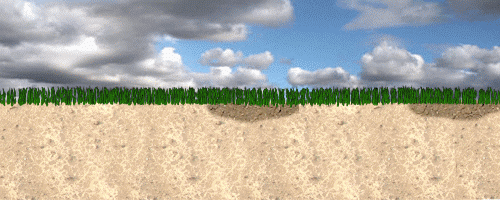
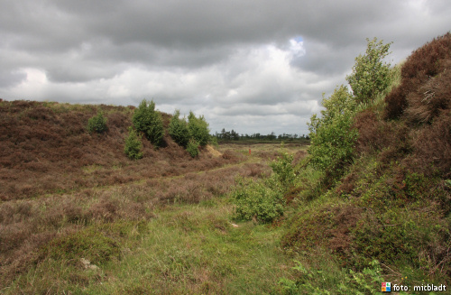
I plantagens østlige del – Stensbæk Hede (ca. 60 hektar) – bemærker man straks nogle mærkelig ”øer”. Det er små bakker (klimper) med stejle sider og en flad top. Siderne er ofte så stejle at man blive lidt forpustede hvis en bakke skal bestiges.
En klimpe opstår
Videnskabelige undersøgelser (foretaget af Geografisk Institut, Københavns Universitet) viser at klimperne er dannet i perioden for 10.000 år tilbage og frem til for ca. 400 år siden. Dengang lå terrænet noget højere end i dag (svarende til toppen af klimperne) og bestod af sandet hedeslette med små partier af moser.
Under en eller flere kraftige sandstorme er sandet (flyvesand) føget væk, men kun der hvor der ikke var små mosepartier. På disse steder holdt mosen/vandet på underlaget, og stod derfor tilbage – efter stormene – som små øer med en mose på toppen. Stadig i dag er der - på nogle af klimperne - mere vådt på toppen end i det lavere terræn omkring dem. Hvis du kigger godt efter oppe på klimpen, kan du finde tørvemos, som tegn på højmosedannelse.
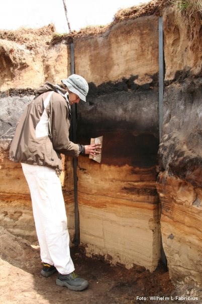
 Udgravning af tværsnit, juni 2009: Nederst ses det lyse flyvesand der føg ind over hedeslette for 10-11.000 år siden. Oven over dette ses en hedemose med det cementhårde al-lag i bunden. Omkring år 1600 (+/- 20 år) optræder en eller flere sandflugter. Dels fyldes mosen med sand (det mørke område) og dels fyger sandet væk fra alle områder hvor der ikke er mose. Tilbage står klimperne. Siden er der på enkelte klimper igen dannet mose (højmose - idet den kun forsynes med vand og næring fra nedbøren).
Logning af denne Earthcache
For at logge denne Earthcache skal du besvare følgende spørgsmål pr e-mail via min profil. Du må ikke skrive svar eller hints til svar i din log:
- Gå op på toppen af klimpen på cache-koordinaterne (N55° 16.262 E008° 57.909). Beskriv formen af denne flade del. Er den helt flad?
- Hvor høj er klimpen? Brug din GPS til at finde højden, ved at finde højdetallet ved hhv toppen og bunden af klimpen. (Hvis du ikke har en GPS der kan fortælle om højden, må du komme med et kvalificeret skøn. Se evt. højden i forhold til din egen højde).
- Hvad finder du på WP1 (KL2A9MV) - (N55° 16.235 E008° 57.972)?
NB: Send svarene INDEN du logger cachen som fundet. Du behøver ikke at vente på et svar fra mig før du logger cachen som fundet. Jeg kontakter dig, hvis der er problemer.
Jeg ser gerne at du uploader et billede med dig, eller din GPS og en klimpe i din log, her på geocaching.com, men der er ikke noget krav!
Fotos må ikke være spoiler-foto i forhold til spørgsmålene!!
|