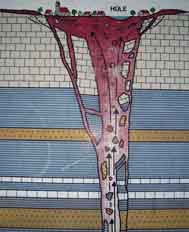
DIE ZAININGER HÜLE
Vor etwa 20 Millionen Jahren rissen durch Spannungen in der
Erdkruste tiefreichende Spalten in den Gesteinen
Südwestdeutschlands auf. Im Raum Urach-Kirchheim reichten sie bis
zu einem in der Tiefe lagernden Magmaherd hinab. Die in Magma
enthaltenen Gase schossen in den Spalten empor und rissen
Magmatropfen und Nebengesteinsbrocken – Gneis,
Keupertonsteinen, Jurakalk, u.a. – mit. Dieses Lockermaterial
fiel in weitem Umkreis um die Ausbruchsstellen nieder. Bei der
eruptiven Fördertätigkeit wurden die schmalen Spalten vielerorts zu
Vulkanschloten erweitert.
Als die vulkanische Tätigkeit wieder nachließ, blieb Tuff in den
Förderkanälen stecken und von den Seiten her rutschten
Nebengesteinsschollen in den Schlot. Im Krater über dem Schlot
sammelte sich dann auf den wenig wasserdurchlässigen Tuffen das
Niederschlagswasser. Es entstand ein See- eine –Hüle. Da in
den umliegenden, kluftreichen Kalken das Wasser in die Tiefe
versickert, waren die Kraterseen in den wasserarmen
Weißjuralandschaft ein begehrter Mittelpunkt von
Ansiedlungen.
Logbedingungen:
Beantworte folgende Fragen und sende mir zuerst die Lösungen
per E-Mail (über mein GC-Profil). Logfreigabe kommt, wenn die
Antworten richtig sind.
Frage 1: Was erstarrten zu Tuff während der vulkanischen
Tätigkeit?
Frage 2: Bis zum welchen Jahr wurde die Hüle als Viehtränke
und Gebrauchswasserreservoir benutzt?
Frage 3: Welches versteinertes Tier sitzt am Ufer hinter der
Infotafel?
Fügt anschließend eurem Log ein Foto von euch mit GPS in der
Hand. Das Foto muss vor der Hüle gemacht werden.
Viel Glück!
THE ZAININGER HÜLE
About 20 million years ago tore up columns deep reaching to
tensions in the earth's crust in the rocks of Southwest
Germany.
They reached a magma stove storing in the depth in the area
Urach-Kirchheim. The gasses contained in magma shot in the columns
upward and dragged magma drop and country rock chunk, gneiss,
limestone, along. This loose material fell down around the outbreak
places in wide surroundings. At the eruptive promoting activity the
narrow columns were enlarged in many places to volcano chimney
stacks. When the volcanic activity fell off again, tufa stone got
stuck in the promoting channels and country rock plaices slipped
into the chimney stack from the sides. The precipitation water then
collected in the crater over the chimney stack on the little
permeable to water tuffs. It one sea arose a Hüle. Since the water
seeps into the surrounding, ravine rich limes in the depth the
crater lakes were white Jura Mountains landscape into the arid one
a popular center of settlements.
Answer my following questions and send the solutions first by
e-mail (about my GC profile). Permission for Logs comes if the
answers are correct.
Question 1: What stiffened to tuff during the volcanic
activity?
Question 2: Which year ones became the Hüle as a cattle
watering place and use reservoir uses up to this?
Question 3: Does a fossilized animal sit which one
information panel on the shore behind this?
A photo of you with GPS in the hand then obey yours lied.
The photo must be taken in front of the Hüle.
Good luck!