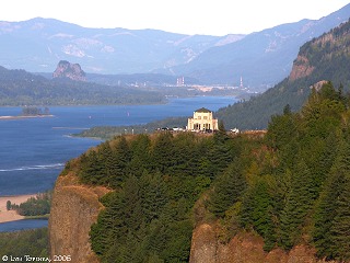
Chanticleer Point Crafted by Cataclysms EarthCache
Chanticleer Point Crafted by Cataclysms
-
Difficulty:
-

-
Terrain:
-
Size:  (not chosen)
Please note Use of geocaching.com services is subject to the terms and conditions
in our disclaimer.
The Chanticleer Point is another part formed by the Missoula
Floods. The Missoula Floods refer to the cataclysmic floods that
swept periodically across eastern Washington and down the Columbia
River Gorge at the end of the last ice age. The glacial flood
events have been researched since the 1920s. These glacial lake
outburst floods were the result of periodic sudden ruptures of the
ice dam on the Clark Fork River that created Glacial Lake Missoula.
After each ice dam rupture, the waters of the lake would rush down
the Clark Fork and the Columbia River, inundating much of eastern
Washington and the Willamette Valley in western Oregon. Please
answer these questions and email them privately. 1.How much topsoil
was removed in this area by the floods? 2. How deep were the floods
by the time it got to the Portland Basin? 3.What local named
attraction on the sign was covered by the flood? 4.The flood
created the highest concentration in the North America of what? 5.
Which Geologist and when did he write the paragraph on the posted
sign? 6. Please post of photo with your log.
Additional Hints
(No hints available.)