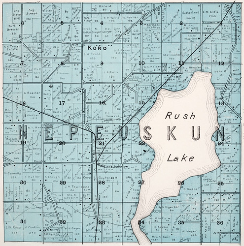
The cache is an ammo box that's hidden on DNR managed land which
means that hunters could be present during the hunting season. The
entrance to the driveway where its hidden is located at N43
55.013, W088 50.432.
The code for the final coordinates is:
N43 54.ABC
W088 49.XYZ
The name NEPEUSKUN is an Indian name meaning “Sweet
Bush” which is the Sugar Maple Tree. The Town of Nepeuskun is
located in the southwest corner of Winnebago County. Its southern
border is Fond du Lac County and its western boundary is Green Lake
County. It is the most rural town in the county with a population
of approximately 700 people. Located in the town is an
unincorporated area called Rush Lake, which has about 25 homes, an
automotive repair shop, and a bar/restaurant business.
These are the Town of Nepeuskun Series caches
Hanging Dog - GC283X0
Rush Lake - GC283Y1
Storm of 1907 - GC283YE
GHRA - GC283ZB
Anti-Horse Thieves Association - GC282JV
Strawberry Fields - GC283YX
The Geocache Notification
Form has been submitted to the Oshkosh office of the Wisconsin DNR.
Geocaches placed on Wisconsin Department of Natural Resource
managed lands require permission by means of a notification form.
Please print out a paper copy of the notification form, fill in all
required information, then submit it to the land manager. The DNR
Notification form and land manager information can be obtained at:
http://www.wi-geocaching.com/hiding
*Congratulations to CodeJunkie on the FTF*