Swedish: Rövarekulan kallas det naturreservat
som sträcker sig 2,5km längs Brååns dalgång. Nere i dalgången
finner man betesmarker och slåtterängar och längs med sluttningarna
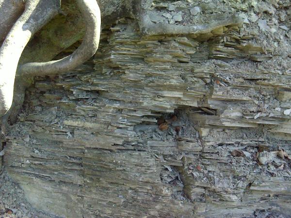
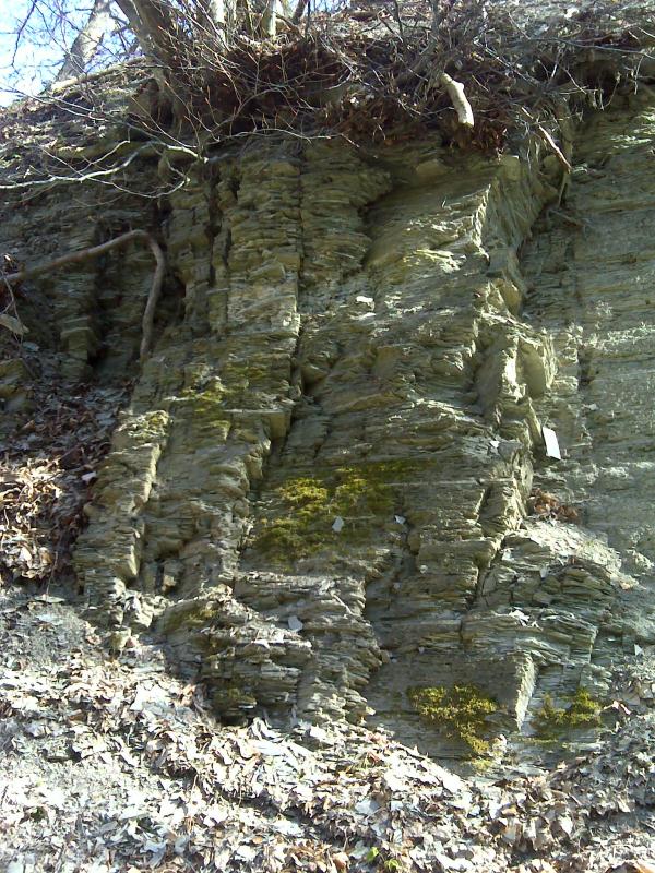
växer det bokskog. Där ravinväggen stupar lodrätt kan man tydligt
se lerskiffret som utgör områdets berggrund.
För att logga denna earthcache ska du göra följande:
Svara på frågorna: Vad kallas lerskiffret som man kan se i området
och från vilket fossil har det fått sitt namn? Hur länge sedan var
det som detta fossilet bäddades in i leran?
Svaren går att finna vid informationstavlor vid parkeringen.
Räkna antalet trappsteg som leder från parkeringen söderut upp på
höjden.
Skicka svaren på frågorna i ett email till mig.
Valfritt: Ta en bild från cache-koordinaterna där man kan se
lerskiffret tillsammans med er och/eller er GPS på bild och posta
den tillsammans med er logg.
Ni behöver inte vänta på att få godkännande på mail innan ni
loggar, jag hör av mig om det skulle vara något problem.
English: Robbers Den is the English translation
of the Swedish name Rövarekulan. Robbers Den is a nature reserve
that goes 2,5km along the Brå Stream's valley. Down in the valley
you will find pasture lands and meadows and along the slopes grows
beech wood. Where the ravine wall goes vertical you can clearly see
the clay shale that the bedrock of the area consist of.
To log this earthcache you will have to do the following
things:
Answer the questions: What is the name of the clay shale that you
can find in this area and from what fossil has it got its name? How
long ago was it when this fossil was inbedded in the clay?
You can find the answers at information boards by the parking
lot.
Count the steps on the stairs leading south from the parking lot up
the hill.
Send the answers to the questions in an email to me.
Optional: Take a picture from the cache-coordinates where you can
see the clay shale with you and/or your GPS in the picture and post
it together with your log.
You don't have to wait for an approval-mail before you log the
cache, I will get in touch if there should be any problems.