Lammerklamm
a Earthcache by Torti
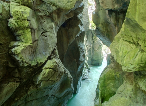

Bereits vor der Eiszeit hat sich der Fluss in Form eines engen Kerbtales in den Berg eingegraben. So kann man sagen, die Lammerklamm ist eigentlich ein Tal im Tal.
Deutlich erkennbar ist, dass die Lammerklamm im oberen Tal von steilen, mehrere hunderte Meter hohen Felshängen begrenzt ist. In dieses Kerbtal sind dann jene gewaltigen Wassermassen geströmt, die vor etwas mehr als 10.000 Jahren durch das beginnende Abschmelzen der Gletscher entstanden sind. Innerhalb kurzer Zeit konnte sich der Ur-Fluss in den Talboden eingraben, der aus Ablagerungen der Eiszeiten bestand.
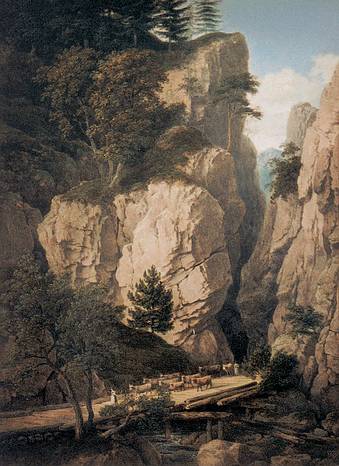
Vermutlich wurde die Klamm schon seit dem Mittelalter begangen. Damals wurden zur Holzbringung Triftsteige errichtet. Holz aus dem Abtenauer Raum wurde zum Bau der Stollen im Salzbergwerk Hallein und als Heizmaterial für die Saline benötigt. Die Klamm wurde bis 1920 für den Holztransport genutzt.
1984 wurde die Lammerklamm durch eine Steiganlage für den aufkommenden Tourismus erschlossen.
Wie bei fast allen Earth-Caches ist auch hier erforderlich:
1. Begebt Euch zu den Header Koordinaten:
N 47° 35.283 E 013° 16.200
2. Beantwortet mir für die Log-Erlaubnis folgende Fragen:
a) Wie entstehen Klammen?
b) Wie heisst der andere Name für diesen Klamm?
c) Schätze wie breit der Klamm ist (an der Location)!
d) Welche Farbe hat hier das Gestein?
Über ein Foto in der Klamm würde ich mich sehr freuen, ist aber optional.
Sende ein mail mit den beantworteten Fragen an mich. Du brauchst meine Logerlaubnis nicht abzuwarten - sollten die Antworten falsch sein melde ich mich.
Parken kannst du bei: N 47° 35.253 E 13° 16.174

Even before the glacial period the river "Lammer" started to dig its way through the mountain like a very narrow valley. Actually you can say it was like a valley within a valley.
You will find out that the upper part of the canyon is determined by steep walls of rocks which are several hundred metres high. 10.000 years ago the glacier started to melt and the tremendous amounts of water created the "Lammerklamm". At some parts of the canyon it seems like the rocks touch each other.
The "Lammerklamm" was probably already hiked through during the medivial times. At that time the river was used to transport wood. The wood out of the area of "Abtenau" was brought to "Hallein" and was used to build the tunnels in the salt mines as well as to heat the mines. Up to 1920 the river was that kind of mean of transportation.
1984 the "Lammerklamm" was equipped with stairs and opend to the public.
As for all Earth-Caches:
1. Start at the Header coordinates:
N 47° 35.283 E 013° 16.200
2. Answers the following questions for log permission:
a) How are canyons formed?
b) How the other name is called for this canyon?
c) How is wide of the canyon on the location?
d) Which colour has here the rock?
Make a photo from the Canyon, but is optional.
Send a mail with the answered questions to me. Dont wait for my logpermission, if the answers are incorrect i will contact you.
Parking is available at: N 47° 35.253 E 13° 16.174.
Happy Hunting
Torti
