Le Lez Traditional Cache
-
Difficulty:
-

-
Terrain:
-

Size:  (small)
Please note Use of geocaching.com services is subject to the terms and conditions
in our disclaimer.
|
 |
|
 |
|
 |
|
|
Sylani |
|
lausiclanic |
|
Equipe Rabateau |
|
La source
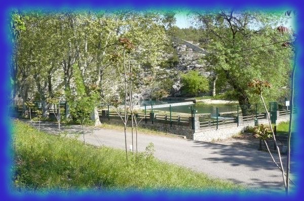

Le Lez est une petite rivière de moins de 30 kms de long. Sa source naît d'une résurgence du vaste ensemble karstique (d'environ 400 km²) des garrigues du piémont montpelliérain.
Curieusement cette source est située sur la commune de St Clément de Rivière, peut-être est-ce dû au fait qu'auparavant, principalement les sources de St Clément alimentaient la ville de Montpellier.
Grâce à son débit très élevé, elle permet d'alimenter en eau la ville de Montpellier, depuis 1859. Un captage d'environ 1500 l/s à 75 m. de profondeur situé sur le haut de colline de la source permet actuellement de fournir suffisamment d'eau à la ville de Montpellier. D'anciens captages sont visibles près et en aval de la source.
Un volume de 160 litres/secondes est restitué à la rivière pour permettre au Lez d'avoir toute l'année une eau limpide. Suivant l'époque de l'année l'étiage du Lez est compensé par des apports fournis par le canal ''Bas-Rhône-Languedoc ''.
Un projet d'aménagement ''touristique'' complet du bord du Lez est à l'étude.
Accès à la cache : Petite grimpette, bonnes chaussures, cela peut glisser si le temps est humide.
Pour plus d'infos :Source du Lez
Cache : Tupperware.
Mis : Logbook, crayon et petites babioles.

Lez is a small river of less than 30 kms. It spring arises from a resurgence of the vast karstic area (about 400 km²) scrublands of Piedmont from Montpellier.
Curiously this spring is situated on the municipality of St Clément de Rivière, maybe it is due to the fact that previously, mainly St Clément's springs fed the city of Montpelier.
Due to a very high flow, she allows to feed with water the city of Montpelier, since 1859. A harnessing on about 1500 l/s in 75 m. of depth situated on the top of hill of the spring allows at present to supply enough water for the city of Montpelier. Ancient harnessings are visible near and downstream to the spring.
A 160 liter / seconds volume is restored to the river to allow Lez to have all year long a crystal clear water. According to the period of the year the low-water mark of Lez is compensated with contributions supplied by the channel" Bas-Rhône-Languedoc ".
A project of "touristic" development of the banks of Lez' river is in the study.
Access to the cache : Small climb, good shoes, it can slip if the weather is wet.
Cache : Tupperware-like
In : Logbook, pencil and small knick-knacks.
"En tant que propriétaire de la géocache, j'assure que le lien Facebook mène vers un groupe Facebook local actif et utile à la communauté et qu'il contribue au géocaching de manière positive. Ce lien n'a pas été vérifié par le Geocaching HQ ou les reviewers."
Additional Hints
(Decrypt)
Nh onf q'har fgengr xnefgvdhr fbhf qrf cvreerf. Ovra ercynpre yr pbagnvare, zrepv.
Ng gur obggbz bs n xnefg fgenghz haqre fgbarf. Cyrnfr ercynpr gur pbagnvare pbeerpgyl, gunax lbh.