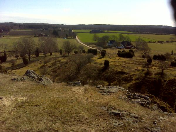
Swedish: Billebjer är ett bergsparti med vidunderlig utsikt från toppen. Namnet Billebjer kommer från att bergets form liknar en bila eller plogbill och det danska ordet för berg, bjer. Berget består av flera ryggar som höjer sig över det öppna landskapet. Runt urbergsryggen växer lövskog och på branterna kan man bl.a. hitta backsippor.
För att logga denna earthcache ska du göra följande:
1. Svara på frågan: När planterades lövskogen som idag växer i delar av reservatet?
Svaret finner ni på en av de många informationstavlorna runt området.
2. Mät upp höjden över havet från den givna parkeringsplatsen, t ex med er GPS. Gå sedan upp till koordinaterna för earthcachen och mät hur högt över havet ni är nu. Räkna ut höjdskillnaden mellan de 2 punkterna.
Skicka svaren på de 2 frågorna i ett email till mig.
Valfritt: Ta en bild från cache-koordinaterna i valfri riktning med er och/eller er GPS på bild och posta den tillsammans med er logg.
Ni behöver inte vänta på att få godkännande på mail innan ni loggar, jag hör av mig om det skulle vara något problem.
English: Billebjer is a hill with a fantastic view from the top. The name Billebjer comes from the shape of the rock that resembles a broad-axe (bila in Swedish) and the Danish word for mountain, bjer. The rock consist of several ridges that raises above the open landscape. Around the primary rock ridge grows deciduous forest and on the steeps you can find, among others, pasqueflowers.
To log this earthcache you will have to do the following things:
1. Answer the question: When was the deciduous forest, that now grows in parts of the reserve, planted?
You will find the answer on one of the many information boards around the area.
2. Measure the height over the sea from the given parkingplace, for example with you GPS. Then go to the coordinates for the earthcache and measure how high above the sea you are now. Calculate the height difference between the 2 points.
Send the answers to the 2 questions in an email to me.
Optional: Take a picture from the cache-coordinates in a direction of your choice with you and/or your GPS in the picture and post it together with your log.
You don't have to wait for an approval-mail before you log the cache, I will get in touch if there should be any problems.