|
TOMANOWOS AND THE GREAT MISSOULA
FLOODS
|
| |
|
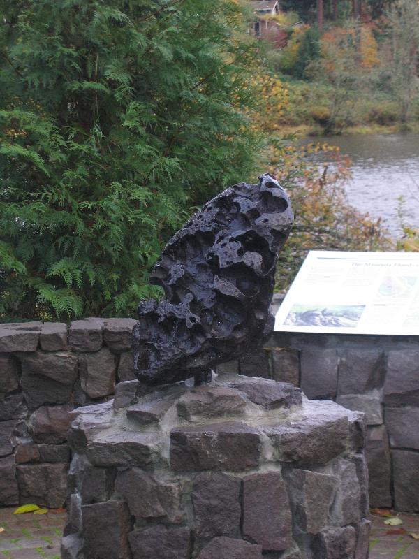
| Discovered by the Clackamas Tribe of the Willamette Valley,
the Willamette Meteorite is the largest meteorite ever found in the
United States. Scientists believe the meteorite, composed of iron
and nickel, is the iron core of a planet that collided with another
planet or asteroid billions of years ago when our solar system was
just forming. After orbiting our solar system, a subsequent
collision in space thousands of years ago sent the fragment
plummeting to the Earth’s surface, landing in the Cordilleran
Ice Sheet somewhere along what is now western Montana, Idaho and
the Canadian border.
So, if this foreign and mysterious rock
impacted Earth in the area of Montana, how did a Native American
tribe of Oregon discover it on a hillside along the Willamette
River? The answer to that question is the story of Tomanowos
and the Great Missoula Floods.
|
| The
Cordilleran Ice Sheet and other glacial ice sheets covered much of
the Northern Hemisphere during most of the Pleistocene Epoch. As
the Ice Age was ending, one section of the ice sheet broke off,
moved south into present-day Idaho, and formed an ice dam blocking
the Clark Fork River. This dam continued to grow, causing water to
back up into Montana forming glacial Lake Missoula. This
immense lake grew to 3000 square miles holding 530 cubic miles of
water, as big as Great Lakes Ontario and Erie combined. Eventually
the ice dam failed catastrophically, emptying the lake at about 17
million gallons per second and creating a massive flood that poured
across Idaho, Washington, and dumping into the Columbia
River.
In the years following the flood, the glacial
ice to the north continued to move southward, again blocking the
Clark Fork River and again creating and building another massive
ice dam. Eventually, the dam failed again and the floods
washed over the area again. The cycles continued, with the Great
Missoula Floods continually moving over the vast flat lands at
speeds up to 60 miles per hour. The water sculpted and scoured the
land, creating the Channeled Scablands in Eastern Washington and
the Columbia River Gorge. The soils picked up by the flood waters
were carried downstream into the flooded river valleys it passed
along the way to the Pacific Ocean. These soils created the rich
agricultural areas such as the Willamette and Yakima Valleys.
Some scientists believe these floods occurred up to 100 times
during the waning 2000-3000 years of the last ice age.
|
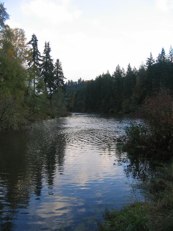 |
| It
was most likely during one of these massive floods that the
Willamette Meteorite made its way to the Willamette Valley.
As the icebergs and flood waters rushed across Washington and
through the Columbia River Gorge, they carried rocks and boulders
trapped in the ice. The flood waters reached the Portland
Basin and began to spread out; with the waters slowing, sand and
gravel fell out of the stream creating the sandbar on which most of
Portland is currently built.
Some of the flood waters made their way up
the Willamette and Tualatin valleys as far south as present-day
Eugene, with the last of the icebergs still floating on top. As the
waters slowed and the icebergs melted, they began to drop the large
rocks, gravel, sand and silt brought down the flood waters with
them. Those large rocks left behind, not matching any of the
rocks in the surrounding areas, are called erratics and can be
found throughout the Pacific Northwest. The iceberg holding
the Willamette Meteorite melted or settled on a hillside in the
area that eventually became the town of Willamette.
Visit these other erratic Earthcaches in the
Pacific Northwest:
| GC14JT5: |
Glacial
Erratic Rock by Mr. & Mrs. Kensquach |
| GC1KHFB: |
Red Bridge
Erratics by K2D2 and djbach |
| GC1B1JN: |
Wedgwood
Erratic by Sassy&Gordy |
| GC23XAK: |
Heavy rocks
float? That's erratic! by Lotus72 |
| GC1F6X1: |
Glacial
Erratics by Celtic-Heart |
| GCQGJD: |
Willow
Springs Road Erratic by Mr. Gadget #2 |
|
| When discovered by the Clackamas
Tribe, the large rock fragment was immediately recognized as
special and named Tomanowos by the tribe. |
 |
According to the stories passed down by the
descendents of the Clackamas (now a part of the Confederated Tribes
of the Grand Ronde), Tomanowos has empowered and healed people in
the area surrounding the Willamette Valley since the dawn of time.
The Clackamas thought that Tomanowos came to the valley as a
representative of the Sky People; they believed that by resting on
the ground and collecting rainwater in its basins, Tomanowos caused
a great union between the sky, the earth, and water. The rainwater
served as a powerful purifying, cleansing, and healing source for
the tribe and their friends. Tribal hunters would dip their
arrowheads in the water collected in the Meteorite's crevices to
bring them power.
These traditions and the spiritual link with
Tomanowos are preserved today through the ceremonies and songs of
the descendants of the Clackamas. Beginning in the 1850s, the
Clackamas, along with more than 20 other tribes and bands from
western Oregon and northern California, were relocated to the Grand
Ronde Reservation in Oregon.
Today, under an agreement struck in June,
2000, Tomanowos continues to be displayed at the American Museum of
Natural History in New York City where it has been since
1906. Under this agreement, the Clackamas tribe members visit
Tomanowos annually for ceremonial purposes.
|
In
order to log this Earthcache, you will need to read this page,
visit all three waypoints for this cache and take a picture or two.
Then, you must answer the following questions in an email to the
cache owner:
| 1. What does Tomanowos
represent to the Clackamas Tribe? |
| 2. How did Tomanowos end up in
the Willamette Valley? |
| 3. How many times did Lake
Missoula flood the area? |
| 4. What does the word
"Tomanowos" mean? |
| 5. How many different crops are
grown in the rich, fertile soils brought by the floods to the
Willamette Valley? |
| 6. Which two geologists first
put together the geological puzzle pieces of the Missoula
Floods? |
And lastly, please post your favorite photo
taken from the areas of this Earthcache.
|
| |
|
|
References:
In
Search of Ancient Oregon by Ellen Morris
Bishop
American
Museum of Natural History: http://www.amnh.org/
Idaho Museum of Natural History: http://imnh.isu.edu/
Reader Boards at Fields Bridge Park by West Linn Parks and
Recreation
|