Knivsås-Borelund
Hurvida Knivsås fått namnet av sin form är inte
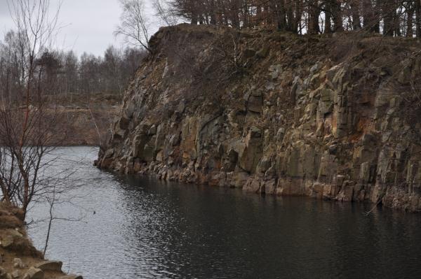
säkert men troligt: den långsmala grusåsen har en smal kam över
sina åt båda håll branta sluttningar och man balanserar om inte på
en egg så i alla fall en getrygg. Knivsås kan sägas vara något av
den mönstergilla rullstensåsen, väl synlig på håll från Dalby mot
Veberöd. Åsarna bildades som steniga grussträngar i issprickor
under den senaste istiden. Uppe från åsen har man god utsikt åt
ömse håll, inte minst norrut mot Hällestad där hela det system av
rullstensåsar, som Knivsås tillhör, böljar vidare, längre än ögat
når. Knivsås står inte bara som förnämlig exponent ute i det fria
utan fortsätter också västerut in i skogen och kan följas i
bokarnas skugga. För att få annat perspektiv på åsen kan man gå ett
stycke på Skåneleden, som löper hela vägen nedanför. För att logga
cachen som funnen måste du svara på följande frågor:
1. Mät vattentemperaturen?
2. Mät med t.ex. din GPS höjden över havet vid
utsiktsplatsen N 55 39.576 E 013 24.149.Ta dig sedan till
earthcache koordinaten och gör en liknande mätning, räkna ut
skillnaden mellan dessa 2 punkter i hela meter?
Skicka svaren på frågorna i ett email till
mig.
Valfritt: Ta ett foto på dig/er och/eller GPSén
Ni behöver inte vänta på att få godkännande på mail innan ni
loggar, jag hör av mig om det skulle vara något problem.
[Eng]
Whether Knivsås derives its name from
its shape is not certain but probable: the long, narrow gravel
ridge has a narrow ridge on its both ways and steep slopes to
balance if not on an edge, then at least one goat ridge. Knivsås
can be said to be one of the exemplary boulder ridge, visible in
the distance from Dalby to Veberöd. The ridges formed by rocky
gravel strings in icecracks during the last ice age. Obvious from
the ridge has good views to both sides, not least Hällestad north
towards where the whole system of ridges, which belongs Knivsås,
billows on, longer than the eye can see. Knivsås stands not only as
a premier exponent in the open but also continues westward into the
woods and can be followed in beech tree’s shadow. To get
another perspective on the ridge you can walk on a piece of
Skåneleden, which runs all the way below. To log the cache as
found, you must answer the following questions:
1st Take the
watertemperature?
2nd Measure with such GPS altitude
outlook at N 55 39 576 E 013 24 149. Getting to the earth since the
cache coordinate and make a similar measurement, calculate the
difference between these two points, and answer in whole
meters?
Send the answers for the questions
in an email to me. Optional: Take a photo of you and/or
GPSén
You need not wait for the approval
of the email before you sign, I'll be in touch if there would be
any problem.