Nečekejte žádný Karlštejn, tohle byl opravdu jen malý hrádek a moc toho z něj nezbylo. Dnes se uvádí pod jménem Hrádek, dříve se nazýval Jevín. Hrad byl postavený na ostrožně (skalním výběžku) nad vsí Jevíněves. Převýšení mezi vsí a hradem je 60 m. Je to také jedno z míst, kde by prý mohl být pohřbený praotec Cech - k Řípu je to odtud jen 6 km.

První písemná zmínka o obci Jevineves (visit link) pochází z doby vlády Karla IV. (*1316 †1378). Tehdy byl majitelem vsi a hradu pan Pešek z Válovic. Posledními šlechtickými majiteli byli Chotkové. Dnes pozemek s hradem patří státu a hospodaří na něm Lesy České republiky s.p. V blízkosti hradu vedla v minulosti obchodní cesta Praha - Dráždany, tzv. Lužická cesta (visit link) . Dnes tudy vede červená turistická značka "Dvořákova cesta" vedoucí z Kralup nad Vltavou přes Nelahozeves a Jevíněves na horu Říp.
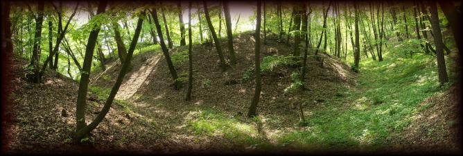
Roku 1330 se Karel IV. ješte jako markrabe moravský snažil zbavit Cechy loupeživých rytíru prepadajících kupce a poutníky. Loupežníci se premnožili zejména v dobe vlády Karlova otce, Jana Lucemburského. Práve jako sídlo loupeživého rytíre byl nekdy kolem výše uvedeného roku dobyt a poboren zdejší hrad Jevín. Bylo to pomerne mohutné sídlo, i když rozlohou nevelké. Zdi mel asi 180 centimetru široké, príkopy až 30 metru široké a 8 metru hluboké, chránící hrad ze snadno prístupné strany.
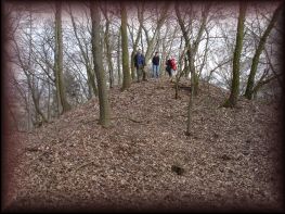
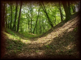
Tenhle hrádek nebyl nikdy moc významný, nezanechal v historii žádnou výraznejší stopu. Ješte pomerne nedávno tu bylo lecos k videní. Místní pametníci vypravují, že jako deti prolézali na Hrádku sklepy, ty jsou dnes už bohužel zasypané. Dnes uvidíte jen hradište obklopené príkopy a valy a nepatrné zbytky kamenného zdiva. Ta hromada vlevo je zbytek veže, vpravo je centrum hradu s viditelným obrysem hradního paláce a malého nádvorí.
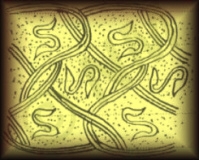 Hrad byl už kdysi archeology prozkoumán, nalezené veci - nádoby a zbrane jsou uloženy v Národním muzeu v Praze a v muzeu v Litomericích. V on-line katalogu Národního muzea je uveden nález bronzového pozlaceného knoflíku (visit link) . Na fotce je nákres zdobení tohoto knoflíku.
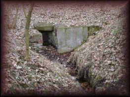
Základní problém každého hradu (zvlášt pri obléhání) bylo zásobování vodou. Na Jevíne prý nekde byla hluboká studna dnes už zasypaná. Dodnes jsou blízko hradu dva prameny. Ten úplne nahore, na náhorní plošine je zakreslený na turistických mapách . Dnes je dost zanedbaný, voda není pitná, zrejme se do vody splavují hnojiva a postriky z okolních polí. Druhý pramen je kousek pod hradem ve svahu nad vsí a voda je odtud vedená do kašny v Jevinevsi. Na kašne je tabulka že voda není pitná.
Kudy a jak na kešku:
Ke hradu je možné přijít různými cestami. Díky aktuální neschůdnosti červené turistické značky z Jevíněvsi doporučuji zaparkovat na N50°19.216 E014°21.813 nad obcí a vydat se horní cestou. Na N50°19.214 E014°21.806 odbočit vlevo stezku vedoucí k hradu.
Těsně u hradu na N50°20.710 E14°20.066 se lze kochat výhledem po kraji.
Po odlovu se stejnou cestou můžete vrátit k vozu. Nebo se vraťte zpět na lesní cestu a pokračujte po ní v původním směru chůze. Na N50 20.591 E14 20.050 je další vyhlídka po krajině. Opět se kousek vraťte na cestu, tentokráte už luční a celou procházku dokončete pravotočivě. Projdete kolem rekreačních chatek a pak po kraji pole zpět k vozu. Polní cestou opačným směrem lze alternativně dojít k myslivecké studánce (GCNAHR)
Prameny informací:
stránky obce Jevineves (visit link)
turistické stránky (visit link)
teta Wiki (visit link)
stránky Národního muzea (visit link)
Ledcické novinky (pdf.) (visit link)
hint (visit link)
This cache will lead you to the place where once stood a small castle.
Do not expect any real castle like Karlstejn. Nowadays just ruins are here. The name is Hradek, or Jevin. The castle was built on a small rock approx. 60 m above the village Jevíněves. It is also supposed Grandfather Čech was buried here - the Říp hill is just 6 km away.
The first written record of the village Jevineves (visit link) is from the king Charles IV. period (* 1316 † 1378). The castle was held by Pešek of Valovice. The last noble owners were Chotek´s family. Today the land is owned by Czech republic. Trade route led near by - Prague - Dresden (visit link). Today a red tourist trail "Dvorak´s way" passes the castle, the trail starts in Kralupy nad Vltavou and over Nelahozeves and Jevineves leads to the Říp hill.
In 1330 Karel IV. Margrave of Moravia as still trying to clean Bohemia from robber baron, who rob the buyers and pilgrims. Robbers were many especially when Charles's father, John of Luxembourg reign. At the time when robber knight sat here, was the conquered and destroyed the local castle Jevin. It was quite powerful castle, even though the small size. The walls had about 180 centimeters wide trenches up to 30 meters wide and 8 meters deep, protecting the castle from an easily accessible side.
This castle was never very significant in the history had left no noticeable trace. Even relatively recently, there was more to see. Local eyewitnesses tell that as children visit the castle cellars, they are now unfortunately land up. Today you see a castle surrounded by moats and ramparts and remains of small stone walls. The heap left is the rest of the tower, on the right is the center of the castle with the visible outline of a small palace.
 The castle was once archaeologists have explored, discovered things - utensils and weapons are stored at the National Museum in Prague and the Museum in Litomerice. The on-line catalog of the National Museum is given a bronze award gilded knob (visit link) . The picture is a drawing of the decoration button.
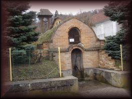
The basic problem of the castle (especially during the siege), the water supply. On the Jevin somewhere was the deep well, now buried. Remain, two sources close to the castle. The very top, the plateau is covered by the tourist maps. Today it is quite neglected, the water is not drinkable, probably into the water wash down fertilizers and spraying of nearby fields. The second source is just below the castle on the slope above the village and the water is then led into the fountain in Jevinevsi. On the fountain is a notice that water is not drinkable.
How to the Cache:
There are many ways to the castle.
The red trail from Jevíněves village is not accesible now. Park your car above the village at N50°19.216 E014°21.813 and followe red trail from here. On N50°19.214 E014°21.806 turn left to the castle.
There is a viewpoint near by - N50°20.710 E14°20.066.
After then you can go bach to your car. Or, get bach to the red trail and continue to next viewpoint - N50 20.591 E14 20.050. Get back to the forest path and finish your hike clockwise.
Sources of information:
(visit link)
(visit link)
(visit link)
(visit link)
(visit link)
hint (visit link)