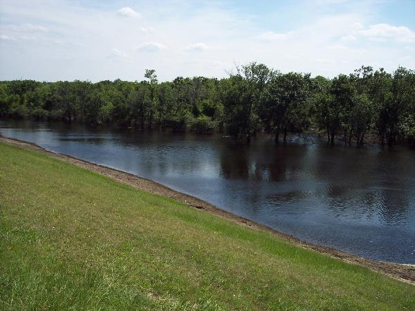
From the Parking area walk to the North West and climb bank to the top of the levee. At the top of the levee, look to the west. Everything you see to the west is part of the Barker Reservior watershed. Everything you see to the east is the Buffalo Bayou watershed.
WATERSHEDS
A watershed is the geographic area that contributes water runoff into a stream. How is this geologically important, you ask? A watershed, a.k.a. drainage basin, is the primary transportation system of water carried sediment. It also provides nutrients for vegetation and wildlife that live here, which may also affect the local geology. An example is rainstorms: When it rains, the water naturally flows downhill, until something blocks its path. This "something" can be land, vegetation, man-made structures, debris, and even more water. As more rains falls, the water flows into the drainage basin and out towards downtown Houston. If something is blocking the path, downstream, then the water starts to back up and may cause flooding. In the greater Houston area, there are 22 watersheds that drain into 22 major waterways. Back when the Allen Brothers first established Houston at the confluence of Buffalo Bayou and White Oak Bayou, it flooded often. For the first 100 years , Houston experienced 16 major floods.
BARKER RESERVOIR
Let's start with the Barker Reservoir watershed. The drainage area for this water shed is about 126 square miles, and includes Upper Buffalo Bayou and Mason Creek. Starting in the 1940's, the Army corps of Engineers built the Barker Dam to act as flood control and protect downtown Houston, about 15 miles to the east. Since the construction of this reservoir and a similar one to the northeast (the Addicks Reservoir), Harris County has suffered only 1 major regional flood. In June of 2001, Tropical Storm Allison, dumped almost 40 inches of rainfall in the East Texas area. Needless to say, the flood control of the area was overwhelmed. A large part of this watershed has been converted to a recreational area, know as George Bush park.
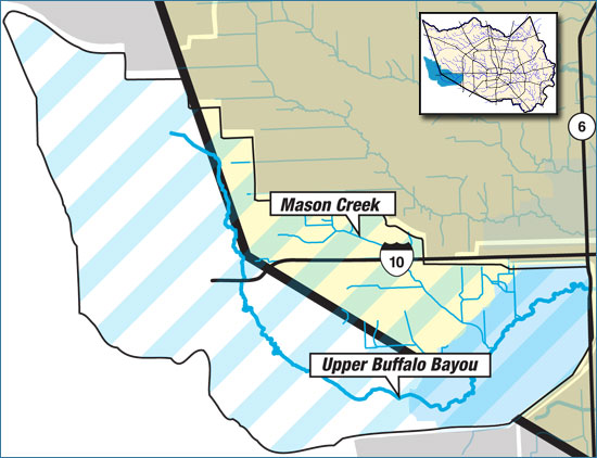
Barker Reservoir Watershed
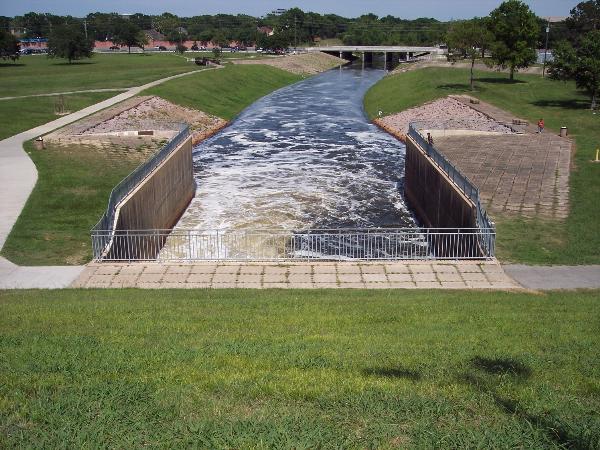
BUFFALO BAYOU
For The Buffalo Bayou watershed, the drainage area is 103 square miles and has 47 miles of open streams. Buffalo Bayou is the largest primary stream within the watershed and also the sole outlet for the Addicks and Barker reservoirs. The bayou flows into the Houston Ship Channel after combining with White Oak Bayou and passing through downtown Houston. Buffalo Bayou becomes the Houston Ship Channel at the Turning Basin.
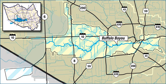
Buffalo Bayou Watershed
QUESTIONS
To receive credit for this Earth Cache, answer these questions in an email to the cache owners. Please do not post the answers in your online log.
1. Why do you think the Army Corp of Engineers control the flow of water exiting the Barker Reservoir watershed into the Buffalo Bayou watershed?
2. Is there standing water in the Barker Reservoir(west), or is most of it confined to the bayou channel?
3. What happened here in late August / early September of 2017 ?
4. What is your estimate of the height of the levee, from the base to the top. Why do you think it is so high?
5. Photo( if desired): Post a picture from the top of the levee, looking towards the Barker Reservoir. Your face and the watershed should be visible in the picture.