Romualdo Cave / Romualdo Höhle / Romualdova spilja
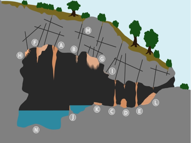
The formation of a dripstone cave / Der Aufbau einer Tropfsteinhöhle - Die schematische Schnittzeichnung stammt aus Wikipedia von Chriskl
EN:
No other cave in Croatia has such a history like the Romualdo Cave at the Limfjord.
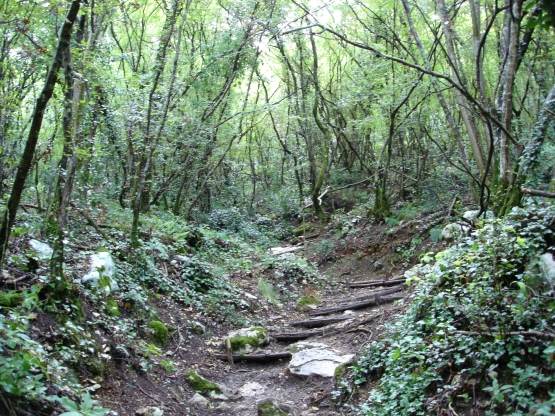
In the 120 meters above sea level, the cave is accessible only on foot. From the entrance of the hiking trail to the cave entrance is a well-trodden, about 360 meters long road is very steep uphill.
At the end of the Limfjord is the ascent to the cave Romualdo. The Limfjord is an extraordinary natural phenomenon, it is still a flooded, karst valley.
Here are the Lim Draga, whose ends move runners over Dvigrad and Tinjan until Pazin. In the gorge of the Pazin Pazincica seeps underground and flows on to the Limfjord, where he emerges as an underwater source again.
--> GC23180
When it is possible, you can visit the cave for money. Adults 30 kn - Children 15 kn
DE:
Keine andere Höhle in Kroatien hat eine solche Geschichte wie die Romualdo Höhle am Limfjord.
Die in 120 Metern über dem Meeresspiegel liegende Höhle ist nur zu Fuß zu erreichen. Vom Eingangsbereich des Wanderweges bis zum Höhleneingang geht ein ausgetretener, ca. 360 Meter langer Weg sehr steil bergauf.
Am Ende des Limfjord befindet sich der Aufstieg zur Romualdo Höhle. Der Limfjord stellt eine außergewöhnliche Naturerscheinung dar, handelt es sich doch um ein überflutetes, karstiges Tal. Hier endet die Limski Draga, dessen Ausläufer sich über Dvigrad und Tinjan bis nach Pazin ziehen. In der Paziner Schlucht versickert der Fluss Pazincica und fließt unterirdisch weiter bis zum Limfjord, wo er als Unterwasserquelle wieder austritt.
--> GC23180
Führungen sind möglich aber nicht Bedingung: Erwachsene 30 Kuna, Kinder 15 Kuna
IMPORTANT!
EN: To log this earthcache, send an email to ec.hr.en@gmail.com with the answers of the following questions and post a photo (optional) of yourself and your GPS near the ENTRANCE
I. Measure the height of the entrance (look at the picture)
II. How long is this cave in meters?
III. Stalactites and stalagmites can also form a column together. How is it called?
To log this cache wait till you get the log permission. Logs without this will be deleted!
WICHTIG!
DE: Um diesen Earthcache loggen zu dürfen, musst du folgenden Fragen beantworten und sie mir per Mail zusenden. Schicke dazu eine Email an ec.hr.de@gmail.com .Wenn du Lust dazu hast, lade ein Foto von Dir mit deinem GPS beim HÖHLENEINGANG mit deinem Log hoch
1. Messe die Höhe des Einganges (Foto)
2. Wie lange ist die Höhle in Meter?
3. Stalaktiten und Stalagmiten wachsen manchmal zusammen. Wie nennt man sie dann?
Logs ohne Logerlaubnis werden kommentarlos von mir gelöscht!