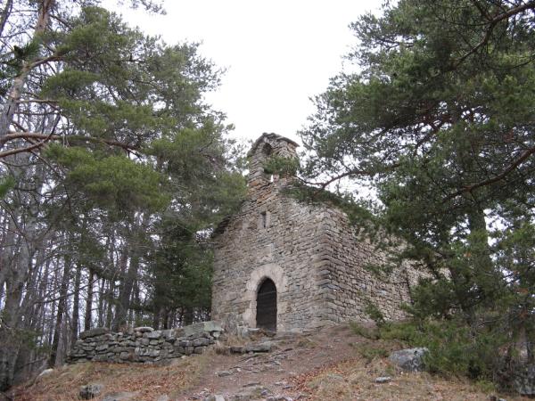
Au XIIème siècle, les Templiers étaient installés au col entre
les vallées de la Blanche et de l'Ubaye, appelé Col Saint Jean car
l'accueil des voyageurs a plus tard été repris par l'Ordre des
Hospitaliers de Saint Jean de Jérusalem. A cette époque a été
construite une petite chapelle romane dédiée à Saint Léger qui
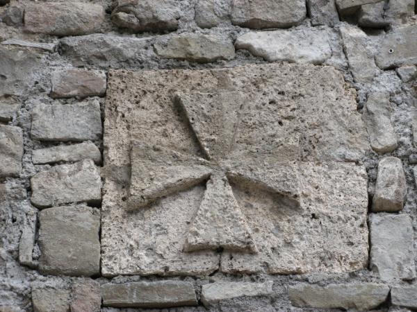
subsiste encore de nos jours : la chapelle est ornée maintenant
d'une croix de Malte comme celle qui marquaient les bornes
délimitant les possessions des moines (une telle borne est exposée
à l'Office de Tourisme de la
station de Saint Jean-Montclar).
La cache se trouve à proximité immédiate de la chapelle. Même si
une petite route mène jusqu'à 200m de la cache, l'itinéraire
conseillé part du col Saint Jean ou de la station et emprunte un
sentier touristique permettant de découvrir quelques curiosités des
environs et de se promener dans des paysages où nature et activité
humaine font toujours bon ménage (balisage jaune, descriptif
disponible à l'Office de Tourisme). Un itinéraire plus long permet
d'enchaîner avec la cache
"Au sommet de la colline (GC3183)" en passant par la chapelle
de la Salette et en revenant par le village de Montclar (balisage
jaune, compter une dizaine de kilomètre et 300m de dénivelé).
In the XIIth century, the Knights Templars was guarding the
pass between the valleys of the Blanche and of the Ubaye. This pass
is now called "Col Saint Jean" because the Templars were later
replaced by warrior monks from the Hospitaller Order of Saint John
(Jean in French) of Jerusalem. At that time, a small roman chapel
dedicated to Saint Léger was built in the woods and it survived
both religion wars and revolution until today. The chapel is
decorated with a Malta Cross like the one that used to mark the
limits of the monks' possessions (such a land mark can be seen in
the Tourist Office
of the Saint Jean-Montclar resort.
The cache is located not far from the chapel. Although a
small road ends 200m from it, the recommended way is to park at the
Saint Jean pass or the resort and follow a touristic trail that
helps discover some points of interest in landscapes where nature
and human activities keep a good balance (yellow marks, English
description of the trail available at the Tourism Office). A longer
way is to follow a trail up to the Salette Chapel and its geocache
"On top of the hill" (GC3183) and come back through the
Montclar village (yellow marks, 10kms long, 300m climb).
|